- Maße
-
Höhe: 10 cm, Breite: 11
- Kontext
-
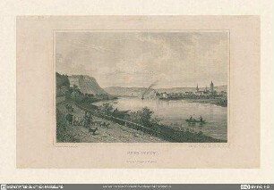
RW Karten >> 6. Siedlungen >> 6.1. Stadtpläne >> 6.1.11. Düsseldorf
- Bestand
-
RW Karten
- Laufzeit
-
[Vor 1780]
- Weitere Objektseiten
- Provenienz
-
Diverse Registraturbildner
- Geliefert über
- Letzte Aktualisierung
-
05.11.2025, 16:22 MEZ
Datenpartner
Dieses Objekt wird bereitgestellt von:
Landesarchiv Nordrhein-Westfalen. Abteilung Rheinland. Bei Fragen zum Objekt wenden Sie sich bitte an den Datenpartner.
Landesarchiv Nordrhein-Westfalen. Abteilung Rheinland. Bei Fragen zum Objekt wenden Sie sich bitte an den Datenpartner.
Objekttyp
- Karten / Pläne
Entstanden
- [Vor 1780]
Ähnliche Objekte (12)

Plan der Carlstadt
Carlstadt

Carlstadt

Carlstadt
Carlstadt

Plan von Düsseldorf mit der neu erbauten Carlstadt

Rheinwerft Carlstadt, Düsseldorf, BRD, 1982

Düsseldorf-Carlstadt, Mariensäule, errichtet 1873

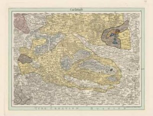
Plan von Carlstadt in Croatien
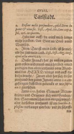
CVIII. Carlstadt.

Carlstadt, Andreas

Die Carlstadt
Plan der Carlstadt
Carlstadt
Carlstadt
Carlstadt
Carlstadt
Plan von Düsseldorf mit der neu erbauten Carlstadt
Rheinwerft Carlstadt, Düsseldorf, BRD, 1982
Düsseldorf-Carlstadt, Mariensäule, errichtet 1873
Plan von Carlstadt in Croatien
CVIII. Carlstadt.
Carlstadt, Andreas
Die Carlstadt
Plan der Carlstadt
Carlstadt
Carlstadt
Carlstadt
Carlstadt
Plan von Düsseldorf mit der neu erbauten Carlstadt
Rheinwerft Carlstadt, Düsseldorf, BRD, 1982
Düsseldorf-Carlstadt, Mariensäule, errichtet 1873
Plan von Carlstadt in Croatien
CVIII. Carlstadt.
Carlstadt, Andreas