- Alternative title
-
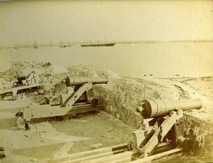
PLAN / DE LA VILLE ET DE LA CITADELLE / D'ALEXANDRIE / D'APRÈS LES PROJETS DU GAL. CHASSELOUP DE LAUBAT,
- Location
-
Deutsches Historisches Museum, Berlin
- Inventory number
-
Do 2006/827
- Measurements
-
Höhe x Breite: 42,3 x 54,7 cm (Blatt)
Höhe x Breite: 36,3 x 46 cm (Karte)
Höhe x Breite: 39,4 x 49 cm (Platte)
- Material/Technique
-
Papier, Kupferstich
- Classification
-
Kartografie (Gattung)
- Subject (what)
-
Alessandria
Italien
- Event
-
Herstellung
- (who)
-
Kartograf, Stecher: Ambroise Tardieu
- (where)
-
Paris, Frankreich
- (when)
-
1822
- Rights
-
Deutsches Historisches Museum
- Last update
-
24.03.2023, 9:30 AM CET
Data provider
This object is provided by:
Stiftung Deutsches Historisches Museum. If you have any questions about the object, please contact the data provider.
Stiftung Deutsches Historisches Museum. If you have any questions about the object, please contact the data provider.
Object type
- Fortifikationsplan
Associated
- Kartograf, Stecher: Ambroise Tardieu
Time of origin
- 1822
Other Objects (12)
![624 [Rezension] Philon d'Alexandrie, Les Oeuvres de Philon d'Alexandrie](https://iiif.deutsche-digitale-bibliothek.de/image/2/d07e520a-51d0-43a3-8528-33ae5d765727/full/!306,450/0/default.jpg)
624 [Rezension] Philon d'Alexandrie, Les Oeuvres de Philon d'Alexandrie
La Guerre D'Alexandrie, Par Hirtius
Mémoire sur la ville d'Alexandrie
Mémoire sur la ville d'Alexandrie
![372-374 [Rezension] Philon d'Alexandrie, les oeuvres de Philon d'Alexandrie](https://iiif.deutsche-digitale-bibliothek.de/image/2/eeb48a45-c6e8-4af4-8a3b-463504165feb/full/!306,450/0/default.jpg)
372-374 [Rezension] Philon d'Alexandrie, les oeuvres de Philon d'Alexandrie
![44-46 [Rezension] Philon d'Alexandrie, Les Oeuvres de Philon d'Alexandrie](https://iiif.deutsche-digitale-bibliothek.de/image/2/309be73a-77a3-40a2-89a6-e9f20c9871fd/full/!306,450/0/default.jpg)
44-46 [Rezension] Philon d'Alexandrie, Les Oeuvres de Philon d'Alexandrie
![297-298 [Rezension] Philon d'Alexandrie, Les Oeuvres de Philon d'Alexandrie](https://iiif.deutsche-digitale-bibliothek.de/image/2/44f5c5db-f8b1-4069-a7e0-90313294d8bc/full/!306,450/0/default.jpg)
297-298 [Rezension] Philon d'Alexandrie, Les Oeuvres de Philon d'Alexandrie
![134-136 [Rezension] Philon d'Alexandrie, Les Oeuvres de Philon d'Alexandrie](https://iiif.deutsche-digitale-bibliothek.de/image/2/02da2299-6ce2-4c5b-9e11-219be66b7d6d/full/!306,450/0/default.jpg)
134-136 [Rezension] Philon d'Alexandrie, Les Oeuvres de Philon d'Alexandrie

Plan d'Alexandrie
Monumens d'Alexandrie
Port d’Alexandrie
Vray Portraict de la Ville d'Alexandrie en Egypte
624 [Rezension] Philon d'Alexandrie, Les Oeuvres de Philon d'Alexandrie
La Guerre D'Alexandrie, Par Hirtius
Mémoire sur la ville d'Alexandrie
Mémoire sur la ville d'Alexandrie
372-374 [Rezension] Philon d'Alexandrie, les oeuvres de Philon d'Alexandrie
44-46 [Rezension] Philon d'Alexandrie, Les Oeuvres de Philon d'Alexandrie
297-298 [Rezension] Philon d'Alexandrie, Les Oeuvres de Philon d'Alexandrie
134-136 [Rezension] Philon d'Alexandrie, Les Oeuvres de Philon d'Alexandrie
Plan d'Alexandrie
Monumens d'Alexandrie
Port d’Alexandrie