- Alternative title
-
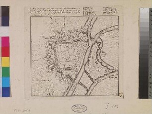
CALAIS, Ville Forte de Picardie, a 51. Degrez 1. Minute de Latidude, et 23. degrez 2. Minute de Longitude Port de Mer ...
- Location
-
Deutsches Historisches Museum, Berlin
- Inventory number
-
Do 94/218
- Measurements
-
Höhe x Breite: 22,7 x 31,5 cm (Blatt), Höhe x Breite: 20,1 x 28 cm (Platte)
- Material/Technique
-
Druckfarbe, Papier, Radierung
- Classification
-
Kartografie (Gattung)
- Subject (what)
-
England
Frankreich
- Event
-
Herstellung
- (who)
-
Geograph, Kartograf: Fer (Antoine) de
Stecher: H. van Loon
- (when)
-
um 1650
- Rights
-
Deutsches Historisches Museum
- Last update
-
24.03.2023, 9:31 AM CET
Data provider
This object is provided by:
Stiftung Deutsches Historisches Museum. If you have any questions about the object, please contact the data provider.
Stiftung Deutsches Historisches Museum. If you have any questions about the object, please contact the data provider.
Object type
- Stadtplan
Associated
- Geograph, Kartograf: Fer (Antoine) de
- Stecher: H. van Loon
Time of origin
- um 1650
Other Objects (12)

Berlin im Kartenbild : zur Entwicklung d. Stadt, 1650 - 1950 ; Ausstellung d. Staatsbibliothek Preuss. Kulturbesitz Berlin, 20. Mai 1981 - 22. August 1981
Karte von Stettin
Karte von Schleswig-Holstein und drei Städten
![Stadtplan und Ansicht von Kassel, ca. 1:5 000, Kupferst., 1742 : Plan der Hochfürstl. Residenz- und Haubt-Stadt Cassel in Nieder-Hessen : nebst dem Hochfürstl. Lust-Garten auf der Aue = Plan de la Ville Capitale de Cassel en basse Hesse / herausgeben von Homaennischen Erben. Revidirt von Leopold. - Rev.. - [Ca. 1:5 000]. - [Nürnberg] : Homaennischen Erben , 1742. - 1 Kt. + 1 Ansicht auf 1 Bl. : kolor. Kupferst. ; Gesamtgr. 56 x 50 cm](https://iiif.deutsche-digitale-bibliothek.de/image/2/b83bff86-49f8-49f5-8622-3b0444dc4c77/full/!306,450/0/default.jpg)
Stadtplan und Ansicht von Kassel, ca. 1:5 000, Kupferst., 1742 : Plan der Hochfürstl. Residenz- und Haubt-Stadt Cassel in Nieder-Hessen : nebst dem Hochfürstl. Lust-Garten auf der Aue = Plan de la Ville Capitale de Cassel en basse Hesse / herausgeben von Homaennischen Erben. Revidirt von Leopold. - Rev.. - [Ca. 1:5 000]. - [Nürnberg] : Homaennischen Erben , 1742. - 1 Kt. + 1 Ansicht auf 1 Bl. : kolor. Kupferst. ; Gesamtgr. 56 x 50 cm
Pharus-Plan Stuttgart und Cannstatt : [Mit 1 Nebenkt.]

Athen, Nordabhang der Akropolis
Städteatlas Grossraum Stuttgart, Mittlerer Neckar : 1:20.000 ; mit Postleitzahlen ; 190 Städte und Gemeinden im Grossraum Stuttgart ; von Neckarsulm bis Reutlingen - von Pforzheim bis Göppingen ; Ausflugskarten: Nordschwarzwald, Schwäbische Alb
Russischer Stadtplan von Sankt Petersburg mit den Stadtteilen Wassilij Ostrow, Peterburgskij Ostrow und Admiralitätsteil
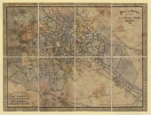
Plan von Berlin...
Pharus-Plan Frankfurt a. M.
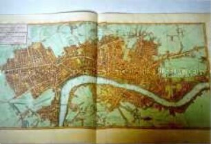
Faden, William: A NEW POCKET PLAN OF THE CITIES OF LONDON / WESTMINSTER: WITH THE BOROUGH OF SOUTHWARK: Comprehending the New Buildings and other Alterations to the YEAR 1790. London (1790)
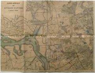
Sechsteilige topografische Karte von Antwerpen und Umgebung vom Beginn des Ersten Weltkrieges
Berlin im Kartenbild : zur Entwicklung d. Stadt, 1650 - 1950 ; Ausstellung d. Staatsbibliothek Preuss. Kulturbesitz Berlin, 20. Mai 1981 - 22. August 1981
Karte von Stettin
Karte von Schleswig-Holstein und drei Städten
Stadtplan und Ansicht von Kassel, ca. 1:5 000, Kupferst., 1742 : Plan der Hochfürstl. Residenz- und Haubt-Stadt Cassel in Nieder-Hessen : nebst dem Hochfürstl. Lust-Garten auf der Aue = Plan de la Ville Capitale de Cassel en basse Hesse / herausgeben von Homaennischen Erben. Revidirt von Leopold. - Rev.. - [Ca. 1:5 000]. - [Nürnberg] : Homaennischen Erben , 1742. - 1 Kt. + 1 Ansicht auf 1 Bl. : kolor. Kupferst. ; Gesamtgr. 56 x 50 cm
Pharus-Plan Stuttgart und Cannstatt : [Mit 1 Nebenkt.]
Athen, Nordabhang der Akropolis
Städteatlas Grossraum Stuttgart, Mittlerer Neckar : 1:20.000 ; mit Postleitzahlen ; 190 Städte und Gemeinden im Grossraum Stuttgart ; von Neckarsulm bis Reutlingen - von Pforzheim bis Göppingen ; Ausflugskarten: Nordschwarzwald, Schwäbische Alb
Russischer Stadtplan von Sankt Petersburg mit den Stadtteilen Wassilij Ostrow, Peterburgskij Ostrow und Admiralitätsteil
Plan von Berlin...
Pharus-Plan Frankfurt a. M.
Faden, William: A NEW POCKET PLAN OF THE CITIES OF LONDON / WESTMINSTER: WITH THE BOROUGH OF SOUTHWARK: Comprehending the New Buildings and other Alterations to the YEAR 1790. London (1790)