- Alternativer Titel
-
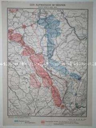
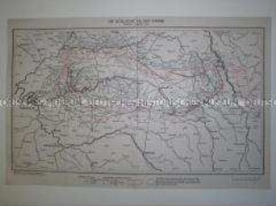
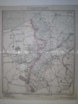
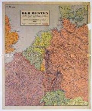
Der Stellungskrieg im Westen
- Standort
-
Deutsches Historisches Museum, Berlin
- Inventarnummer
-
Do2 95/1286
- Maße
-
Höhe x Breite: 32,7 x 23,3 cm
- Material/Technik
-
Papier, gedruckt
- Klassifikation
-
Kartografie (Gattung)
- Bezug (was)
-
Krieg
Militär
Geographie
- Ereignis
-
Herstellung
- (wer)
-
Entwerfer: Hermann Stegemann
Zeichner: Geographisches Institut Kümmerly und Frey
- (wo)
-
Bern, Schweiz
- (wann)
-
1918
- Rechteinformation
-
Deutsches Historisches Museum
- Letzte Aktualisierung
-
24.03.2023, 09:30 MEZ
Datenpartner
Dieses Objekt wird bereitgestellt von:
Stiftung Deutsches Historisches Museum. Bei Fragen zum Objekt wenden Sie sich bitte an den Datenpartner.
Stiftung Deutsches Historisches Museum. Bei Fragen zum Objekt wenden Sie sich bitte an den Datenpartner.
Objekttyp
- Militärgeographische Karte
Beteiligte
- Entwerfer: Hermann Stegemann
- Zeichner: Geographisches Institut Kümmerly und Frey
Entstanden
- 1918
Ähnliche Objekte (12)
Kriegskarte von der Westfront im August 1914
Kriegskarte von der Westfront im September 1914
Kriegskarte von der Westfront im November 1914

1. An der Westfront 1914/15

6. Champagne-Winter 1914/15

Stellungskampf im Winter 1914/15

Vorlesungen im Winter 1914/15
Kriegskarte von der Westfront im Frühjahr 1940

Tagebücher, Einsatz an der Westfront 1914/15: Bd. 2
Tagebücher, Einsatz an der Westfront 1914/15: Bd. 1
Deutsche Kriegskarte 1914
Deutsche Kriegskarte 1914
Kriegskarte von der Westfront im August 1914
Kriegskarte von der Westfront im September 1914
Kriegskarte von der Westfront im November 1914
1. An der Westfront 1914/15
6. Champagne-Winter 1914/15
Stellungskampf im Winter 1914/15
Vorlesungen im Winter 1914/15
Kriegskarte von der Westfront im Frühjahr 1940
Tagebücher, Einsatz an der Westfront 1914/15: Bd. 2
Tagebücher, Einsatz an der Westfront 1914/15: Bd. 1
Deutsche Kriegskarte 1914