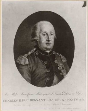
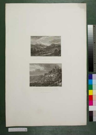
Grafik
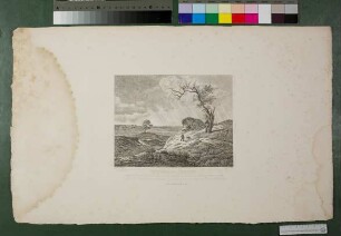
Gegend um Zweibrücken
Titel in Rocaille-Kartusche: GEOMETRISCHE KARTE Über DAS OBER AMT ZWEYBRÜCKEN nebst dem dazu Gehörigen AMT HOMBURG. Verfertiget von Johann Theobald Fritsch, Fürstlich Pfalz Zweybrücken Geometra. Anno 1774. Signiert: Gravée A Paris par J. Dezauche, rue St. Severin, la porte Cochère en face de la rue de la Harpe.
- Standort
-
Universitätsbibliothek Heidelberg
- Sammlung
-
UB Graphische Sammlung
- Inventarnummer
-
Graph. Slg. A_0578
- Maße
-
B 63 cm, H 54,4 cm (Blatt), B 60,3 cm, H 51,4 cm (Platte),
- Material/Technik
-
Kupferstich
- Verwandtes Objekt und Literatur
-
in Beziehung zu: Charta Palatina 1774-1776
- Klassifikation
-
Karte (Gattung)
Batt'sche Sammlung (Lokale Systematik)
- Bezug (was)
-
Historische Karte
Karte
Rocaille
- Ereignis
-
Herstellung
- (wann)
-
1774
- Letzte Aktualisierung
-
05.03.2025, 16:23 MEZ
Datenpartner
Dieses Objekt wird bereitgestellt von:
Ruprecht-Karls-Universität Heidelberg. Universitätsbibliothek. Bei Fragen zum Objekt wenden Sie sich bitte an den Datenpartner.
Ruprecht-Karls-Universität Heidelberg. Universitätsbibliothek. Bei Fragen zum Objekt wenden Sie sich bitte an den Datenpartner.
Objekttyp
- Grafik
Entstanden
- 1774
Ähnliche Objekte (12)
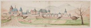
Ansicht der Stadt Zweibrücken
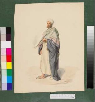
Mann aus der Gegend um Kairo
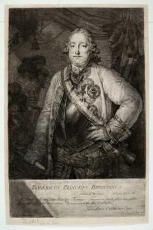
Friedrich Wilhelm von Pfalz-Zweibrücken-Birkenfeld
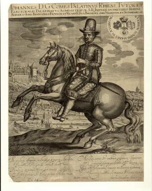
Pfalzgraf Johann II. von Pfalz-Zweibrücken
Karl August Christian von Pfalz-Zweibrücken
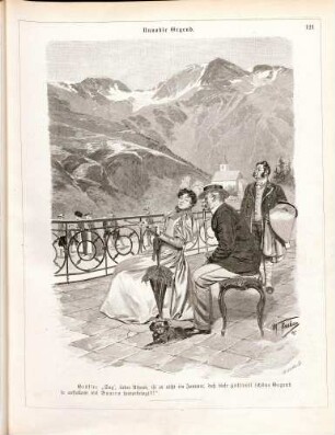
Nordische Gegend
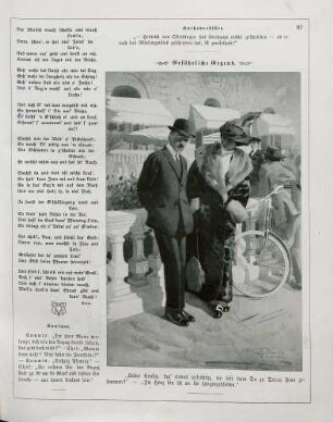
"Unnoble Gegend"
"Unsichere Gegend"
"Gefährliche Gegend"
"Miese Gegend"
"Harmlose Gegend"
Gegend bei Wimpfen, Leipziger Gegend, Schreckenstein bei Aussig
Ansicht der Stadt Zweibrücken
Mann aus der Gegend um Kairo
Friedrich Wilhelm von Pfalz-Zweibrücken-Birkenfeld
Pfalzgraf Johann II. von Pfalz-Zweibrücken
Karl August Christian von Pfalz-Zweibrücken
Nordische Gegend
"Unnoble Gegend"
"Unsichere Gegend"
"Gefährliche Gegend"
"Miese Gegend"
"Harmlose Gegend"