
- Alternative title
-
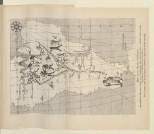
Plano Del Puerto Del Callao De Lima
Plano Del Sitio De La Angostura
- Extent
-
1 Kt. auf 8 Bl, [Ca. 1:4.200.000]
- Language
-
Spanisch
- Notes
-
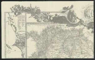
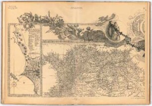
Orig.-Vorlage: handkolor. Kupferst. - Maßstab in graph. Form (Leguas de España, Leguas comunes de España). - Nullmeridian: Tenerife, Madrid, Londres, Paris, Hierro. - Mit 2 Nebenkt.: Plano Del Puerto Del Callao De Lima. Plano Del Sitio De La Angostura. - Mit Erl. auf dem Kt.-Feld
- Bibliographic citation
-
Cartografía hispano colonial de Chile
- Series
-
Altkarten-Projekt des IAI
- Contributor
-
Cruz Cano y Olmedilla, Juan
Ricarte, Hipolito
- Published
-
1924
- PURL
- Last update
-
09.05.2025, 3:02 PM CEST
Data provider
This object is provided by:
Ibero-Amerikanisches Institut - Stiftung Preußischer Kulturbesitz. If you have any questions about the object, please contact the data provider.
Ibero-Amerikanisches Institut - Stiftung Preußischer Kulturbesitz. If you have any questions about the object, please contact the data provider.
Object type
- Beigefügtes oder enthaltenes Werk
Associated
- Cruz Cano y Olmedilla, Juan
- Ricarte, Hipolito
Time of origin
- 1924
Other Objects (12)
Mapa Geográfico De America Meridional
Mapa Geográfico De America Meridional
Mapa Geográfico De America Meridional

Mapa geográfico de América meridional : porción que comprende a Venezuela
Mapa de la América Meridional

Mapa general de la América Meridional

Mapa Geográfico Del Partido De Carrion

Mapa Geográfico Del Partido De Carrion

Mapa Geográfico Del Partido De Toro

Mapa Geográfico Del Partido De Toro
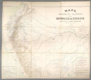
Mapa Geográfico-Histórico de la República del Ecuador

Mapa geográfico y corogracigo de la república de bolivia
Mapa Geográfico De America Meridional
Mapa Geográfico De America Meridional
Mapa Geográfico De America Meridional
Mapa geográfico de América meridional : porción que comprende a Venezuela
Mapa de la América Meridional
Mapa general de la América Meridional
Mapa Geográfico Del Partido De Carrion
Mapa Geográfico Del Partido De Carrion
Mapa Geográfico Del Partido De Toro
Mapa Geográfico Del Partido De Toro
Mapa Geográfico-Histórico de la República del Ecuador