Karte
C. Plan of Cuttack shewing the flow of the Mahanuddy and Kajooree Rivers and the project for controlling the volume at the head of the Kajooree River

- Language
-
Englisch
- Bibliographic citation
-
Harris, John C.. - Maps and plans illustrative of a report upon the extraordinary flood of A. D. 1855 as affecting the city of Cuttack
- Published
-
1857
- Last update
-
22.04.2025, 2:10 PM CEST
Data provider
This object is provided by:
Staatsbibliothek zu Berlin - Preußischer Kulturbesitz. If you have any questions about the object, please contact the data provider.
Staatsbibliothek zu Berlin - Preußischer Kulturbesitz. If you have any questions about the object, please contact the data provider.
Object type
- Karte
Time of origin
- 1857
Other Objects (12)
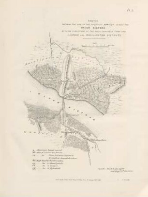
Pl. 2. Sketch shewing the site of the proposed annicut across the river Kistnah ...
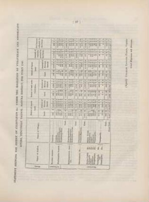
Statement shewing the extent of cultivation &c. unter the irrigation of Vyravenaur and Shoorlyaur rivers, ...
Appendix L. The River Thames shewing all the Docks of London with the Extensions now in Progress
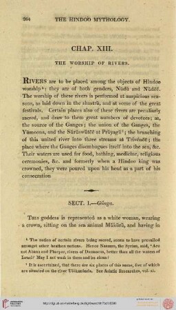
The Worship of Rivers

Rivers of the world
The eagre of the Tsien-Tang River : on the Eagre of the Tsien-Tang River
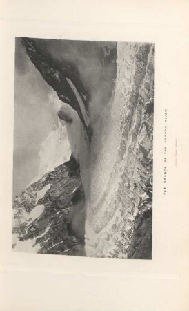
The source of the Teesta River

In the Middle of the River

In the Middle of the River
The king of the golden river

In the Middle of the River

In the Middle of the River
Pl. 2. Sketch shewing the site of the proposed annicut across the river Kistnah ...
Statement shewing the extent of cultivation &c. unter the irrigation of Vyravenaur and Shoorlyaur rivers, ...
Appendix L. The River Thames shewing all the Docks of London with the Extensions now in Progress
The Worship of Rivers
Rivers of the world
The eagre of the Tsien-Tang River : on the Eagre of the Tsien-Tang River
The source of the Teesta River
In the Middle of the River
In the Middle of the River
The king of the golden river
In the Middle of the River
In the Middle of the River
Pl. 2. Sketch shewing the site of the proposed annicut across the river Kistnah ...
Statement shewing the extent of cultivation &c. unter the irrigation of Vyravenaur and Shoorlyaur rivers, ...
Appendix L. The River Thames shewing all the Docks of London with the Extensions now in Progress
The Worship of Rivers
Rivers of the world
The eagre of the Tsien-Tang River : on the Eagre of the Tsien-Tang River
The source of the Teesta River
In the Middle of the River
In the Middle of the River
The king of the golden river
In the Middle of the River