Karten und Pläne
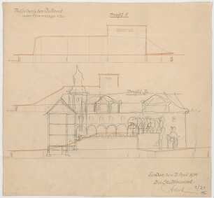
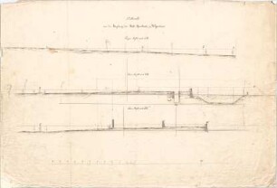
Gestaltung des Uhland-Platzes; Längenprofile und Querprofile der Akazien- und Bahnhofallee
- Reference number
-
D 30/K 2226/10
- Former reference number
-
prefix: D 30/K
- Dimensions
-
88 x 60 cm
- Material
-
Papier
- Notes
-
Hochwasserstand 1851 (nach der Wahrnehmung des Herrn Baurat Schlierholz) ist eingezeichnet
- Further information
-
Ausführung: Tusche, koloriert
Maßstab: 1:600 Längen; 1:60 Höhen
Druck / Verlag: Leins
- Context
-
D 30 Karten- und Plansammlung >> Anlagen und Straßen >> Denkmäler
- Holding
-
D 30 Karten- und Plansammlung
- Indexbegriff subject
-
Hochwasserstand 1851
- Indexentry place
-
Tübingen, Akazienallee
- Date of creation
-
ca. 1865
- Other object pages
- Last update
-
29.04.2025, 8:35 AM CEST
Data provider
This object is provided by:
Stadtarchiv Tübingen. If you have any questions about the object, please contact the data provider.
Stadtarchiv Tübingen. If you have any questions about the object, please contact the data provider.
Object type
- Karte und Plan
Time of origin
- ca. 1865
Other Objects (12)

Gestaltung des Uhland-Platzes, Längenprofile der Akazien- und der Bahnhofallee
Gestaltung des Uhland-Platzes; Querprofile
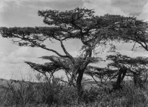
Akazie : Akazien in Tansania
Akazie
Götendeich, Niedermörmter, Lageplan, Längenprofile und Querprofile, Längennivellement
Fischer, Theodor; Landau; Schule - Längenprofile, Querprofile; Schnitt
Voit, August von; Weißenhorn; Pfarrkirche - Längenprofile, Querprofile
Gestaltung des Uhland-Platzes; Profile zur Auffüllung und Erbreiterung der Akazien- und eines Teils der Bahnhofallee zu Tübingen
Grundrisse, Längenprofile und Querprofile der Staatseisenbahn Bautzen - Königswartha
Grundrisse, Längenprofile und Querprofile der Staatseisenbahn Weißenberg - Radibor
Grundrisse, Längenprofile und Querprofile der Staatseisenbahn Großpostwitz - Cunewalde
Grundrisse, Längenprofile und Querprofile der Staatseisenbahn Wilthen - Bautzen
Gestaltung des Uhland-Platzes, Längenprofile der Akazien- und der Bahnhofallee
Gestaltung des Uhland-Platzes; Querprofile
Akazie : Akazien in Tansania
Akazie
Götendeich, Niedermörmter, Lageplan, Längenprofile und Querprofile, Längennivellement
Fischer, Theodor; Landau; Schule - Längenprofile, Querprofile; Schnitt
Voit, August von; Weißenhorn; Pfarrkirche - Längenprofile, Querprofile
Gestaltung des Uhland-Platzes; Profile zur Auffüllung und Erbreiterung der Akazien- und eines Teils der Bahnhofallee zu Tübingen
Grundrisse, Längenprofile und Querprofile der Staatseisenbahn Bautzen - Königswartha
Grundrisse, Längenprofile und Querprofile der Staatseisenbahn Weißenberg - Radibor
Grundrisse, Längenprofile und Querprofile der Staatseisenbahn Großpostwitz - Cunewalde