
- Alternative title
-
Übersichtsblatt zu G.D. Reymann's topographischer Special-Karte von Central Europa
- Location
-
Universitäts- und Landesbibliothek Sachsen-Anhalt -- Altkt E IV 1 [1] 1
- Extent
-
1 Karte; 23 x 34 cm, Kupferstich
- Language
-
Deutsch
- Notes
-
Maßstab in grafischer Form (Kilometer, geogr. Meile)
Gez. durch C.v.O., Böhm und W. Hammer. Gest. v. August Heimburger
Karte
- Bibliographic citation
-
[G.D. Reymann's topographische Special-Karte von Central Europa]
- Contributor
- Published
-
[Glogau] : [Carl Flemming] , 1868
- Sponsorship
-
Deutsche Forschungsgemeinschaft
- DOI
-
doi:10.25673/111979
- URN
-
urn:nbn:de:gbv:3:3-1192015415-1870862945-14
- Last update
-
03.06.2025, 7:51 AM CEST
Data provider
This object is provided by:
Martin-Luther-Universität Halle-Wittenberg, Universitäts- und Landesbibliothek Sachsen-Anhalt. If you have any questions about the object, please contact the data provider.
Martin-Luther-Universität Halle-Wittenberg, Universitäts- und Landesbibliothek Sachsen-Anhalt. If you have any questions about the object, please contact the data provider.
Object type
- Band
Associated
Time of origin
- [Glogau] : [Carl Flemming] , 1868
Other Objects (12)

Netz (Übersichtsblatt) und Arcona
Netz (Übersichtsblatt) und Arcona
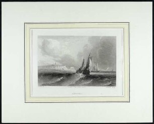
Arcona.
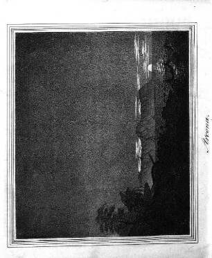
Arcona
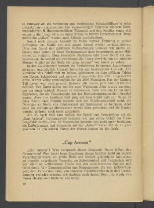
"Cap Arcona"
Schleppdampfer "Arcona"
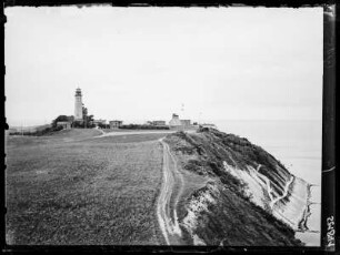
Rügen, Arcona
Kahn "Arcona"
Kap Arcona

2: Das trigonometrische Netz 1. Ordnung
![2: Übersichtsblatt, Arcona, 1868 : 2 : Netz u. Arcona. - 1:200 000. - Glogau : Flemming , [1868]. - 1 Kt. : mehrfarb. - Mit Übersichtsblatt der Kartenserie](https://iiif.deutsche-digitale-bibliothek.de/image/2/7fb5cf6c-78cf-43a5-804c-ae24c4003412/full/!306,450/0/default.jpg)
2: Übersichtsblatt, Arcona, 1868 : 2 : Netz u. Arcona. - 1:200 000. - Glogau : Flemming , [1868]. - 1 Kt. : mehrfarb. - Mit Übersichtsblatt der Kartenserie
![2: Übersichtsblatt, Arcona, 1868 : 2 : Netz u. Arcona. - 1:200 000. - Glogau : Flemming , [1868]. - 1 Kt. : mehrfarb. - Mit Übersichtsblatt der Kartenserie](https://iiif.deutsche-digitale-bibliothek.de/image/2/499846f1-1205-4e43-a681-81e9ce5c2ff6/full/!306,450/0/default.jpg)
2: Übersichtsblatt, Arcona, 1868 : 2 : Netz u. Arcona. - 1:200 000. - Glogau : Flemming , [1868]. - 1 Kt. : mehrfarb. - Mit Übersichtsblatt der Kartenserie
Netz (Übersichtsblatt) und Arcona
Netz (Übersichtsblatt) und Arcona
Arcona.
Arcona
"Cap Arcona"
Schleppdampfer "Arcona"
Rügen, Arcona
Kahn "Arcona"
Kap Arcona
2: Das trigonometrische Netz 1. Ordnung
2: Übersichtsblatt, Arcona, 1868 : 2 : Netz u. Arcona. - 1:200 000. - Glogau : Flemming , [1868]. - 1 Kt. : mehrfarb. - Mit Übersichtsblatt der Kartenserie
2: Übersichtsblatt, Arcona, 1868 : 2 : Netz u. Arcona. - 1:200 000. - Glogau : Flemming , [1868]. - 1 Kt. : mehrfarb. - Mit Übersichtsblatt der Kartenserie
Netz (Übersichtsblatt) und Arcona
Netz (Übersichtsblatt) und Arcona
Arcona.
Arcona
"Cap Arcona"
Schleppdampfer "Arcona"
Rügen, Arcona
Kahn "Arcona"
Kap Arcona
2: Das trigonometrische Netz 1. Ordnung
2: Übersichtsblatt, Arcona, 1868 : 2 : Netz u. Arcona. - 1:200 000. - Glogau : Flemming , [1868]. - 1 Kt. : mehrfarb. - Mit Übersichtsblatt der Kartenserie