- Location
-
Herzog August Bibliothek, Wolfenbüttel
- Inventory number
-
5.2 Geogr. (49)
- Measurements
-
Höhe: 144 mm (Platte)
Breite: 194 mm
Höhe: 204 mm (Blatt)
Breite: 266 mm
- Material/Technique
-
Kupferstich
- Inscription/Labeling
-
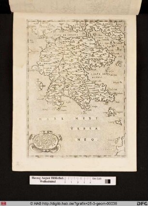
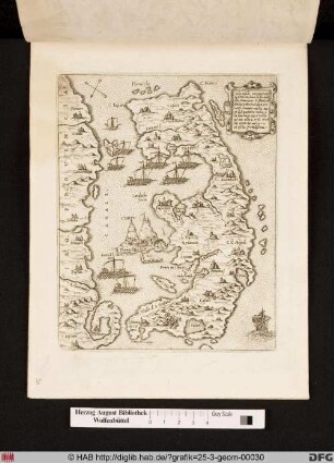
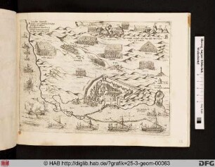
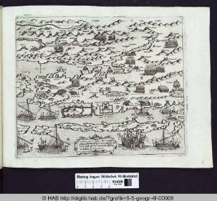
Inschrift: Morea peninsula prouinc.a principale della Grecia posta su l'mare Mediter.o uerso Mezo giorno et Occidente et uerso Settentrione, cofina con il Golfo di Lepanto da Leuante con il Mare di Candia, sottoposta al Turco quale tiene di sircuito da miglia 600, fertile di ogni cosa
- Classification
-
Druckgraphik (Gattung)
- Subject (what)
-
Krieg
Schiff
Stadt
Topographie
Seeschlacht
Insel
Windrose
Landkarte
Griechenland
Militär
Venedig
Kartusche
Mittelmeer
ICONCLASS: Kompassrose
- Subject (where)
-
Morea/Peloponnes
- Cultural attribution
-
Italienisch
- Event
-
Herstellung
- (who)
-
Camocio, Gio. Franco (Verleger)
Unbekannt (Stecher)
- (when)
-
1571-1574
- Delivered via
- Last update
- 13.06.2023, 2:16 PM CEST
Data provider
This object is provided by:
Herzog August Bibliothek Wolfenbüttel. If you have any questions about the object, please contact the data provider.
Herzog August Bibliothek Wolfenbüttel. If you have any questions about the object, please contact the data provider.
Object type
- Druckgraphik
Associated
- Camocio, Gio. Franco (Verleger)
- Unbekannt (Stecher)
Time of origin
- 1571-1574
Other Objects (12)

Landkarte von Morea/Peloponnes und Umgebung.
Landkarte von Morea/Peloponnes und Umgebung.
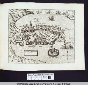
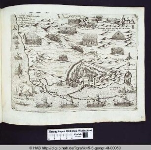
Die Stadt Neapel in der Provinz Morea.
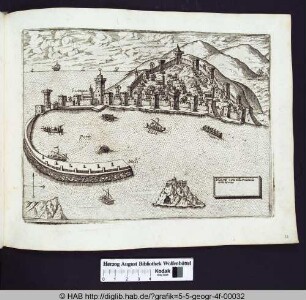
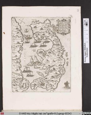
Die Stadt Modon in der Provinz Morea.
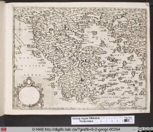
Landkarte von Griechenland.
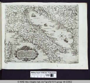
Landkarte von Italien.
Landkarte von Corfu und Umgebung.
Landkarte mit Stadtansicht von Famagosta.
Landkarte von Corfu und Umgebung.
Landkarte mit Stadtansicht von Famagosta.
Landkarte von Zadar und Umgebung.
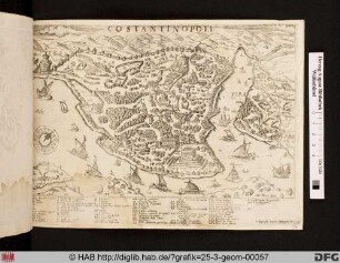
Landkarte mit Stadtansicht von Costantinopoli.
Landkarte von Morea/Peloponnes und Umgebung.
Landkarte von Morea/Peloponnes und Umgebung.
Die Stadt Neapel in der Provinz Morea.
Die Stadt Modon in der Provinz Morea.
Landkarte von Griechenland.
Landkarte von Italien.
Landkarte von Corfu und Umgebung.
Landkarte mit Stadtansicht von Famagosta.
Landkarte von Corfu und Umgebung.
Landkarte mit Stadtansicht von Famagosta.
Landkarte von Zadar und Umgebung.