Verzeichnung
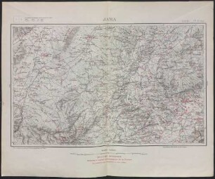
Topographische Karte von Ostfriesland mit den Ostfriesischen Inseln Zeichnung von NN. Papier Format 87,0x84,5 M 1:100.000
- Reference number
-
NLA HA, Rep. 244, C Nr. 1759
- Former reference number
-
Rep. 244, 6957 C
Rep. 244 C 6957
- Context
-
Kartensammlung >> 5 Regierungsbezirk Weser-Ems >> 19 Kreisübergreifende Gebiete >> 3 größere Gebietsteile
- Holding
-
Rep. 244 Kartensammlung
- Indexentry place
-
Ostfriesland, topographische Karte
- Date of creation
-
- 1920
- Other object pages
- Last update
-
16.06.2025, 1:30 PM CEST
Data provider
This object is provided by:
Niedersächsisches Landesarchiv. If you have any questions about the object, please contact the data provider.
Niedersächsisches Landesarchiv. If you have any questions about the object, please contact the data provider.
Object type
- Verzeichnung
Time of origin
- - 1920
Other Objects (12)

Lage der Ostfriesischen Inseln Zeichnung von NN. Papier Format 107,0x50,0 M 1:100.000
Lage der Ostfriesischen Inseln Zeichnung von NN. Papier Format 117,0x58,5 M 1:100.000
Karte von Ostfriesland Kolorierte Zeichnung von NN. Papier Format 106,0x86,5 M 1:100.000
Bohrkarten 1:100.000
Wehrwirtschaft (1:100000)
Tunisie <1:100000>
Umgebungskarte (1:100.000)
Umgebungskarte (1:100.000)
Die Nordsee zwischen den Ostfriesischen Inseln und Ostfriesland sowie zwischen Delfzyl und Emden mit der Ostfriesischen Küste und hydrographischen Eintragungen Kolorierte Zeichnung von NN. Papier Format 64,6x52,8 M 1:100.000
Die Nordsee zwischen den Ostfriesischen Inseln und Ostfriesland sowie zwischen Delfzyl und Emden mit der Ostfriesischen Küste und hydrographischen Eintragungen Kolorierte Zeichnung von NN. Papier Format 64,6x52,8 M 1:100.000
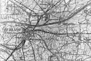
Ruhland. Karte, 1:100.000
Spessart-Wanderkarte, 1:100.000
Lage der Ostfriesischen Inseln Zeichnung von NN. Papier Format 107,0x50,0 M 1:100.000
Lage der Ostfriesischen Inseln Zeichnung von NN. Papier Format 117,0x58,5 M 1:100.000
Karte von Ostfriesland Kolorierte Zeichnung von NN. Papier Format 106,0x86,5 M 1:100.000
Bohrkarten 1:100.000
Wehrwirtschaft (1:100000)
Tunisie <1:100000>
Umgebungskarte (1:100.000)
Umgebungskarte (1:100.000)
Die Nordsee zwischen den Ostfriesischen Inseln und Ostfriesland sowie zwischen Delfzyl und Emden mit der Ostfriesischen Küste und hydrographischen Eintragungen Kolorierte Zeichnung von NN. Papier Format 64,6x52,8 M 1:100.000
Die Nordsee zwischen den Ostfriesischen Inseln und Ostfriesland sowie zwischen Delfzyl und Emden mit der Ostfriesischen Küste und hydrographischen Eintragungen Kolorierte Zeichnung von NN. Papier Format 64,6x52,8 M 1:100.000
Ruhland. Karte, 1:100.000