Regionalkarte
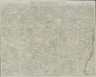
Grand Atlas . Bl. 57 (Elsass, Lothringen, Salm): Contenant le Margraviat de l'Alsace, une Partie du Duché de Lorraine, et le Principauté de Salm.
- Alternative title
-
CARTE TOPOGRAPHIQUE D'ALLEMAGNE / Contenant le MARGRAVIAT de l'ALSACE, une Partie du DUCHÉ de LORRAINE, et le PRINCIPAUTÉ de SALM.
- Location
-
Deutsches Historisches Museum, Berlin
- Inventory number
-
Do 2006/1059.57
- Measurements
-
Höhe x Breite: 56,5 x 78 cm, Höhe: 56,5 cm, Breite: 78 cm, Tiefe: 3 cm (Atlas)
Höhe x Breite: 56,5 x 78 cm (Blatt)
Höhe x Breite: 52 x 68 cm (Platte)
Höhe x Breite: 46 x 59 cm (Karte)
- Material/Technique
-
Papier, Kupferstich, koloriert, gebunden |Fadenheftung
- Classification
-
Kartografie (Gattung)
- Subject (what)
-
Deutschland
- Event
-
Herstellung
- (who)
-
Verleger, Militärkartograph: Johann Wilhelm Abraham Jaeger
- (where)
-
Frankfurt (Main) [historisch: Frankfurt, Reichsstadt], Deutschland
- (when)
-
um 1787
- Rights
-
Deutsches Historisches Museum
- Last update
-
24.03.2023, 9:27 AM CET
Data provider
This object is provided by:
Stiftung Deutsches Historisches Museum. If you have any questions about the object, please contact the data provider.
Stiftung Deutsches Historisches Museum. If you have any questions about the object, please contact the data provider.
Object type
- Regionalkarte
Associated
- Verleger, Militärkartograph: Johann Wilhelm Abraham Jaeger
Time of origin
- um 1787
Other Objects (12)
57: Carte topographique d'Allemagne contenant le Margraviat de l'Alsace, une partie du Duché de Lorraine et le Principauté de Salm

Ordonnance da Prince de Salm Salm, portant Reglement sur la regie et distribution des sets dans la principaute de Salm de 20. Juni 1772

Mémoire pour le rhingrave de Salm
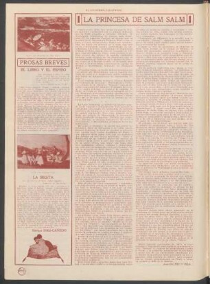
La princesa de Salm Salm
Le Gauleiter Wagner : le bourreau de l'Alsace
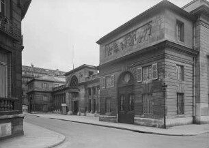
Hôtel de Salm

Monsieur Le Rhingrave Frédéric De Salm, Innocent Ou Coupable
Salm - Salm
Salm - Salm
Salm - Salm
Salm - Salm
Salm - Salm
57: Carte topographique d'Allemagne contenant le Margraviat de l'Alsace, une partie du Duché de Lorraine et le Principauté de Salm
Ordonnance da Prince de Salm Salm, portant Reglement sur la regie et distribution des sets dans la principaute de Salm de 20. Juni 1772
Mémoire pour le rhingrave de Salm
La princesa de Salm Salm
Le Gauleiter Wagner : le bourreau de l'Alsace
Hôtel de Salm
Monsieur Le Rhingrave Frédéric De Salm, Innocent Ou Coupable
Salm - Salm
Salm - Salm
Salm - Salm
Salm - Salm