- Dimensions
-
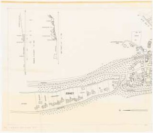
Maßstab: 1:500, 1:1000
- Context
-
Landesamt für Agrarordnung - Karten K-R >> 5. Kall (K. 96/ 1802) >> 5.3. Schätzungsrisse
- Holding
-
BR 0142 Landesamt für Agrarordnung - Karten K-R
- Date of creation
-
1937
- Other object pages
- Provenance
-
Bezirksregierung Münster, Flurbereinigungsarchiv
- Delivered via
- Last update
-
17.09.2025, 3:01 PM CEST
Data provider
This object is provided by:
Landesarchiv Nordrhein-Westfalen. Abteilung Rheinland. If you have any questions about the object, please contact the data provider.
Landesarchiv Nordrhein-Westfalen. Abteilung Rheinland. If you have any questions about the object, please contact the data provider.
Object type
- Karten / Pläne
Time of origin
- 1937
Other Objects (12)

Gemarkung Teveren Planblatt 10 : 1:1000 Planblatt 13 : 1:1000 Planblatt 15 : 1:2000
Gemarkung Oedt Planblatt 7 : 1:2500; Planblatt 12 : 1:1000
Gemarkung Wünschheim Planblatt 2 (1:2000) und Planblatt 6 (1:1000)
Planblatt 20 : 1:1000; Flur 24 : 1:2000
Flurkartenausschnitte 1:500 und 1:1000
Teil I (Hauptgebiet) der Umlegung Rossenbach (1:500) Brenzirigen (1:500) Hoff (1:500) Homburgerhaan (1:1000) Ziegenhardt (1:1000)
Gemarkung Höhenscheid Planblatt 11 (1:1000) u. Flur 8 (1:2500)
Flur 22 : 1:1000; Flur 11 : 1:500
Landschaftsaufbauplanung Bellingen: Grundriss 1:1000, Schnitte 1:500
Planblatt 1 (gestrichen), Planblatt 5
Planblatt 1 (gestrichen) - Planblatt 2
Planblatt
Gemarkung Teveren Planblatt 10 : 1:1000 Planblatt 13 : 1:1000 Planblatt 15 : 1:2000
Gemarkung Oedt Planblatt 7 : 1:2500; Planblatt 12 : 1:1000
Gemarkung Wünschheim Planblatt 2 (1:2000) und Planblatt 6 (1:1000)
Planblatt 20 : 1:1000; Flur 24 : 1:2000
Flurkartenausschnitte 1:500 und 1:1000
Teil I (Hauptgebiet) der Umlegung Rossenbach (1:500) Brenzirigen (1:500) Hoff (1:500) Homburgerhaan (1:1000) Ziegenhardt (1:1000)
Gemarkung Höhenscheid Planblatt 11 (1:1000) u. Flur 8 (1:2500)
Flur 22 : 1:1000; Flur 11 : 1:500
Landschaftsaufbauplanung Bellingen: Grundriss 1:1000, Schnitte 1:500
Planblatt 1 (gestrichen), Planblatt 5
Planblatt 1 (gestrichen) - Planblatt 2