Monografie
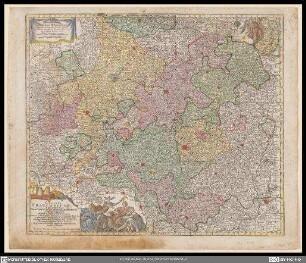
Delineatio Geographica Ditionis Martisburgensis hodie regiis et electoralibus auspiciis florentis

- Standort
-
Universitäts- und Landesbibliothek Sachsen-Anhalt -- Altkt D II 7 [3] 9
- Umfang
-
1 Karte; 47 x 55 cm, Kupferstich
- Sprache
-
Latein, Deutsch
- Anmerkungen
-
"Cum Privilegio S. Reg. Maj. Poloniæ Elect. Sax."
Maßstab in grafischer Form (Meilen, Poleicey Meile)
Titelkartusche mit allegorischer Darstellung unten links. - Maßstab oben Mitte links und Mitte rechts. - Verleger unter Titelkartusche. - Stecher unten rechts auf Kartenrand
Mit Windrose und Bergzeichnung
edita à Matth. Seutt. S.C.M. Geogr. Aug. Vindel. ; Tob. Conr. Lotter sculps.
Altkarte
- Beteiligte Personen und Organisationen
- Erschienen
-
In Augsburg : Anjezo im Verlag beÿ Tobias Conrad Lotter, Geogr. , 1757
- Förderung
-
Die Digitalisierung wurde gefördert durch die Deutsche Digitale Bibliothek aus Mitteln des Programms „Neustart Kultur“ der Beauftragten der Bundesregierung für Kultur und Medien.
- DOI
-
doi:10.25673/39107
- URN
-
urn:nbn:de:gbv:3:3-1192015415-236879200-18
- Letzte Aktualisierung
-
03.06.2025, 07:51 MESZ
Datenpartner
Dieses Objekt wird bereitgestellt von:
Martin-Luther-Universität Halle-Wittenberg, Universitäts- und Landesbibliothek Sachsen-Anhalt. Bei Fragen zum Objekt wenden Sie sich bitte an den Datenpartner.
Martin-Luther-Universität Halle-Wittenberg, Universitäts- und Landesbibliothek Sachsen-Anhalt. Bei Fragen zum Objekt wenden Sie sich bitte an den Datenpartner.
Objekttyp
- Monografie
Beteiligte
Entstanden
- In Augsburg : Anjezo im Verlag beÿ Tobias Conrad Lotter, Geogr. , 1757
Ähnliche Objekte (12)

Delineatio Geographica Ditionis Martisburgensis hodie regiis et electoratibus auspiciis florentis : Cum Privilegio S. Reg. Maj. Poloniae Elect. Sax.

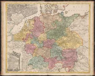
Nova Et Exacta Mappa Geographica exhibens Circulum Westphalicum
Circulus Franconicus
Mappa Geographica exhibens Postas omnes tam vehiculares quam veredarias Totius Germaniæ : cum earum accurata distantia

Helvetiae, Rhaetia, Valesiae und Partis Sabaudiae Tabula

Ducatus Wurtembergici cum Territoriis conterminis

Superioris atque inferioris Alsatiae

Geographia Silesiae, 0

Topographia Sedis Imperatoriae Moscovitarum Petropolis : anno 1744 designata iam publici iuris facta ; Cum Grat. et Privil. S. R. I. Vicariatus, in part. Rheni, Sveviae, et Iur. Franc. = Plan der Kayserlichen Residentz-Stadt Sankt Petersburg
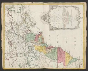
Carte Nouvelle de l'Amerique Angloise : contenant tout ce que les Anglois possedent sur le Continent de l'Amerique Septentrionale Savoir le Canada, la Nouvelle Ecosse ou Acadie, les treize Provinces unies qui sont: les quatres Colonies de la Nouvelle Angleterre 1. New Hampshire, 2. Massachusetsbaye, 3. Rhode-Island, & 4. Conecticut, 5. la Nouvelle York, 6. Nouvelle Jersey, 7. Pensilvanie, 8. les Comtés de Newcastle Kent et Sussex sur la Delaware, 9. Mariland, 10. Virginie, 11. la Caroline Septentrionale, 12. la Caroline Meridionale et 13. Georgie: avec la Floride
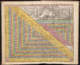
Germaniae Aliorumque Quorundam Loco-rum Europae Poliometria

Tabula Synoptica Totius Fluminis Danubii A Fontibus Usque Ad Ostia - R 18 : in qua omnes regiones, quas perfluit et amnes, quos recipit, Imprimis Integrum Hungariae Regnum, Principat. Transilvaniae, Moldaviae, Walachiae, Archiducatus Austriae, Regna Et Ducat. Styriae, Carinthiae, Carniolae, Croatiae, Dalmatiae, Sclavoniae, Bosniae, Bessarabiae, Bulgariae, Romaniae, Cum Magna Parte Turciae Et Tartariae &c. &c. Nec Non Mare Adriaticum Et Pontus Euxinus Oculis Sistuntur; Cum Gratia et Privil. S. R. I. Vicariatus, in partibus Rheni, Sueviae, et Iuris Franconicii
Delineatio Geographica Ditionis Martisburgensis hodie regiis et electoratibus auspiciis florentis : Cum Privilegio S. Reg. Maj. Poloniae Elect. Sax.
Nova Et Exacta Mappa Geographica exhibens Circulum Westphalicum
Circulus Franconicus
Mappa Geographica exhibens Postas omnes tam vehiculares quam veredarias Totius Germaniæ : cum earum accurata distantia
Helvetiae, Rhaetia, Valesiae und Partis Sabaudiae Tabula
Ducatus Wurtembergici cum Territoriis conterminis
Superioris atque inferioris Alsatiae
Geographia Silesiae, 0
Topographia Sedis Imperatoriae Moscovitarum Petropolis : anno 1744 designata iam publici iuris facta ; Cum Grat. et Privil. S. R. I. Vicariatus, in part. Rheni, Sveviae, et Iur. Franc. = Plan der Kayserlichen Residentz-Stadt Sankt Petersburg
Carte Nouvelle de l'Amerique Angloise : contenant tout ce que les Anglois possedent sur le Continent de l'Amerique Septentrionale Savoir le Canada, la Nouvelle Ecosse ou Acadie, les treize Provinces unies qui sont: les quatres Colonies de la Nouvelle Angleterre 1. New Hampshire, 2. Massachusetsbaye, 3. Rhode-Island, & 4. Conecticut, 5. la Nouvelle York, 6. Nouvelle Jersey, 7. Pensilvanie, 8. les Comtés de Newcastle Kent et Sussex sur la Delaware, 9. Mariland, 10. Virginie, 11. la Caroline Septentrionale, 12. la Caroline Meridionale et 13. Georgie: avec la Floride
Germaniae Aliorumque Quorundam Loco-rum Europae Poliometria