Karten und Pläne
Forstwirtschaftskarte Forstamt Rosenheim, Betriebsverband Hohenaschau (mit Flächenübersicht und Altersklassendarstellung)
- Reference number
-
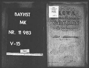
StAM, Plansammlung 8554
- Dimensions
-
128,00 x 107,00
- Formal description
-
Papier auf Leinwand; 1:10.000
- Language of the material
-
deutsch
- Context
-
Plansammlung >> Plansammlung >> 2. Plansammlung ab Nr. 4192 (nach Provenienzen) >> 2.5. Forstbehörden (Forstkarten und -pläne) >> 2.5.2. Forstbehörden nach 1803 >> 2.5.2.15. Forstamt Rosenheim
- Holding
-
StAM, Plansammlung Plansammlung
- Indexbegriff subject
-
Forstwirtschaftskarte
- Indexentry place
-
Hohenaschau (Gde. Aschau im Chiemgau, Lkr. Rosenheim), Forstbetriebsverband
- Date of creation
-
1935
- Other object pages
- Provenance
-
Forstamt Rosenheim
- Last update
-
22.04.2025, 1:54 PM CEST
Data provider
This object is provided by:
Staatsarchiv München. If you have any questions about the object, please contact the data provider.
Staatsarchiv München. If you have any questions about the object, please contact the data provider.
Object type
- Karten und Pläne
Time of origin
- 1935
Other Objects (12)

Flächenübersicht
Flächenübersicht
Forstamt Mühldorf Betriebsverband Pürten
Hohenaschau (LK Rosenheim). Grundriß des Schlosses Hohenaschau
Hohenaschau (Bezirksamt Rosenheim), Schule
Landrat Rosenheim, Bieraufschlag, Hohenaschau
Grundbuchauszüge - Flächenübersicht
Statistische Flächenübersicht
Hohenaschau (Lk Rosenheim). Pläne vom Brauhaus in Hohenaschau
Hohenaschau (Lk Rosenheim). Pläne vom Brauhaus in Hohenaschau
Hohenaschau (Lk Rosenheim). Pläne vom Brauhaus in Hohenaschau
Hohenaschau (LK Rosenheim). Plan vom Waisenhaus in Hohenaschau
Flächenübersicht
Flächenübersicht
Forstamt Mühldorf Betriebsverband Pürten
Hohenaschau (LK Rosenheim). Grundriß des Schlosses Hohenaschau
Hohenaschau (Bezirksamt Rosenheim), Schule
Landrat Rosenheim, Bieraufschlag, Hohenaschau
Grundbuchauszüge - Flächenübersicht
Statistische Flächenübersicht
Hohenaschau (Lk Rosenheim). Pläne vom Brauhaus in Hohenaschau
Hohenaschau (Lk Rosenheim). Pläne vom Brauhaus in Hohenaschau
Hohenaschau (Lk Rosenheim). Pläne vom Brauhaus in Hohenaschau