Verzeichnung
Längenprofil des Tiefs von WITTMUND bis Carolinensiel und zur Einmündung in die See mit dem Teilabschnitt Carolinengrode bis zum Watt Kolorierte Zeichnung von F. Lüning Papier Format 142,6x28,7 M 1:4.880/1:85
- Reference number
-
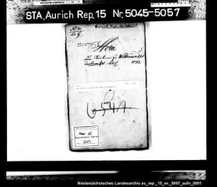
NLA HA, Rep. 244, C Nr. 49
- Former reference number
-
Rep. 244, 285 C
Rep. 244 C 285
- Further information
-
Ergänzungen: Klassifikation TeilB: Wittmund
- Context
-
Kartensammlung >> 5 Regierungsbezirk Weser-Ems >> 18 Kreis Wittmund >> 9 Gleisanlagen, Straßen und Wege
- Holding
-
Rep. 244 Kartensammlung
- Indexentry person
-
Lüning, F.
- Indexentry place
-
Carolinengrode, Tief, Profil
Carolinensiel/Wittmund, Tief, Profil
Wittmund/Carolinensiel, Tief, Profil
- Date of creation
-
- 1836
- Other object pages
- Last update
-
16.06.2025, 1:30 PM CEST
Data provider
This object is provided by:
Niedersächsisches Landesarchiv. If you have any questions about the object, please contact the data provider.
Niedersächsisches Landesarchiv. If you have any questions about the object, please contact the data provider.
Object type
- Verzeichnung
Time of origin
- - 1836
Other Objects (12)

Wittmund-Carolinensiel

Wittmund-Carolinensiel

Längenprofil des Tiefs von WITTMUND bis Carolinensiel und zur Einmündung in die See mit dem Teilabschnitt Ihnkeburg bis Charlottengroden Kolorierte Zeichnung von F. Lüning Papier Format 192,2x28,2 M 1:4.880/1:85
Längenprofil des Tiefs von WITTMUND bis Carolinensiel und zur Einmündung in die See mit dem Teilabschnitt Mosewarfen bis Algershausen Kolorierte Zeichnung von F. Lüning Papier Format 192,2x28,2 M 1:4.880/1:85
Carolinensiel, Harlesiel und Wittmund - meine Urlaubsorte
Die Seiler in Wittmund und Carolinensiel
Carolinensiel, Harlesiel und Wittmund : meine Urlaubsorte
Carolinensiel, Harlesiel und Wittmund, meine Urlaubsorte
Der Bau der Landstraße von Wittmund nach Carolinensiel
4880
Die dem Johann Eiben aus Wittmund gestattete Manufakturwarenhandlung in Carolinensiel
Louis Israel Levy. geb. 12.10.1871 in Carolinensiel, Krs. Wittmund. Kaufmann
Wittmund-Carolinensiel
Wittmund-Carolinensiel
Längenprofil des Tiefs von WITTMUND bis Carolinensiel und zur Einmündung in die See mit dem Teilabschnitt Ihnkeburg bis Charlottengroden Kolorierte Zeichnung von F. Lüning Papier Format 192,2x28,2 M 1:4.880/1:85
Längenprofil des Tiefs von WITTMUND bis Carolinensiel und zur Einmündung in die See mit dem Teilabschnitt Mosewarfen bis Algershausen Kolorierte Zeichnung von F. Lüning Papier Format 192,2x28,2 M 1:4.880/1:85
Carolinensiel, Harlesiel und Wittmund - meine Urlaubsorte
Die Seiler in Wittmund und Carolinensiel
Carolinensiel, Harlesiel und Wittmund : meine Urlaubsorte
Carolinensiel, Harlesiel und Wittmund, meine Urlaubsorte
Der Bau der Landstraße von Wittmund nach Carolinensiel
4880
Die dem Johann Eiben aus Wittmund gestattete Manufakturwarenhandlung in Carolinensiel