- Alternative title
-
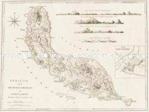
MARTINICO, / Done / from ACTUAL SURVEYS and OBSERVATIONS, / made by ENGLISH ENGINEERS
- Location
-
Deutsches Historisches Museum, Berlin
- Inventory number
-
Do 2006/40
- Measurements
-
Höhe x Breite: 53,5 x 69,2 cm (Blatt)
Höhe x Breite: 44,2 x 59,3 cm (Karte)
Höhe x Breite: 48,6 x 64,6 cm (Platte)
- Material/Technique
-
Druckfarbe, Papier, Kupferstich, grenzkoloriert
- Classification
-
Kartografie (Gattung)
- Subject (what)
-
Kleine Antillen
Martinique
Westindische Inseln
- Event
-
Herstellung
- (who)
-
Kartograf, Geograph, Stecher, Verleger: Thomas Jefferys (1695)
Verleger: Robert Sayer
- (where)
-
London, Großbritannien und Nordirland
- (when)
-
1775
- Rights
-
Deutsches Historisches Museum
- Last update
-
24.03.2023, 9:29 AM CET
Data provider
This object is provided by:
Stiftung Deutsches Historisches Museum. If you have any questions about the object, please contact the data provider.
Stiftung Deutsches Historisches Museum. If you have any questions about the object, please contact the data provider.
Object type
- Küstenkarte
Associated
- Kartograf, Geograph, Stecher, Verleger: Thomas Jefferys (1695)
- Verleger: Robert Sayer
Time of origin
- 1775
Other Objects (12)
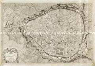
Plan routier de la Ville de Bruxelles
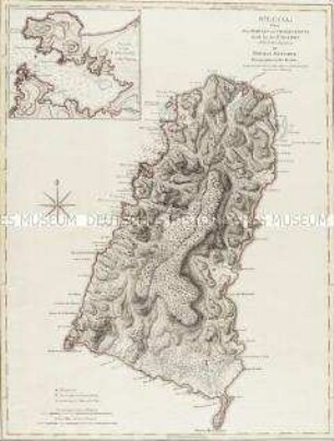
St. Lucia. Mit einer Nebenkarte: Plan of the Carenage

Hochzeitslager
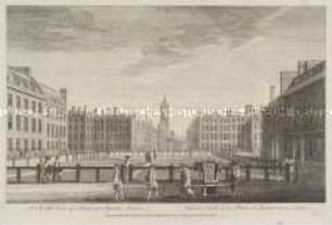
London, Hanover Square - aus einer Folge
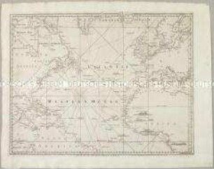
A Chart of the Atlantic Ocean I. Sheet. Mit vier Ansichten
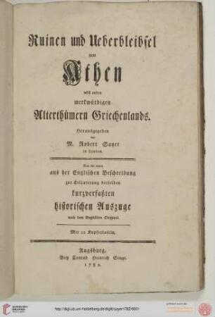
Ruinen und Ueberbleibsel von Athen nebst andern merkwuerdigen Alterthuemern Griechenlands
Curaçao. Mit vier Profilen/ Küstenansichten und einer Nebenkarte: Plan of Fort Amsterdam

Jamaica. Mit zwei Nebenkarten: The Harbour of Bluefields; The Harbours of Kingston and Port Royal
![Plan von Brüssel, 1:4 500, Kupferstich, 1783 : Plan Routier De La Ville De Bruxelles. - [Ca. 1:4 500]. - London : R. Sayer ; Berlin : S. Schropp , 1783. - 1 Kt. : Kupferst. ; 74 x 50 cm ; W oben](https://iiif.deutsche-digitale-bibliothek.de/image/2/4b09c2bb-96ab-4949-83da-2a27d75e58b1/full/!306,450/0/default.jpg)
Plan von Brüssel, 1:4 500, Kupferstich, 1783 : Plan Routier De La Ville De Bruxelles. - [Ca. 1:4 500]. - London : R. Sayer ; Berlin : S. Schropp , 1783. - 1 Kt. : Kupferst. ; 74 x 50 cm ; W oben

The Russian discoveries
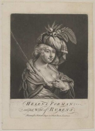
Bildnis der Helena Forman
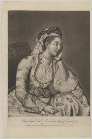
Bildnis der Maria Coventry
Plan routier de la Ville de Bruxelles
St. Lucia. Mit einer Nebenkarte: Plan of the Carenage
Hochzeitslager
London, Hanover Square - aus einer Folge
A Chart of the Atlantic Ocean I. Sheet. Mit vier Ansichten
Ruinen und Ueberbleibsel von Athen nebst andern merkwuerdigen Alterthuemern Griechenlands
Curaçao. Mit vier Profilen/ Küstenansichten und einer Nebenkarte: Plan of Fort Amsterdam
Jamaica. Mit zwei Nebenkarten: The Harbour of Bluefields; The Harbours of Kingston and Port Royal
Plan von Brüssel, 1:4 500, Kupferstich, 1783 : Plan Routier De La Ville De Bruxelles. - [Ca. 1:4 500]. - London : R. Sayer ; Berlin : S. Schropp , 1783. - 1 Kt. : Kupferst. ; 74 x 50 cm ; W oben
The Russian discoveries
Bildnis der Helena Forman