- Standort
-
Herzog August Bibliothek, Wolfenbüttel
- Inventarnummer
-
25.3 Geom. (1-47)
- Maße
-
Höhe: 150 mm (Platte)
Breite: 200 mm
Höhe: 195 mm (Blatt)
Breite: 257 mm
- Material/Technik
-
Kupferstich
- Inschrift/Beschriftung
-
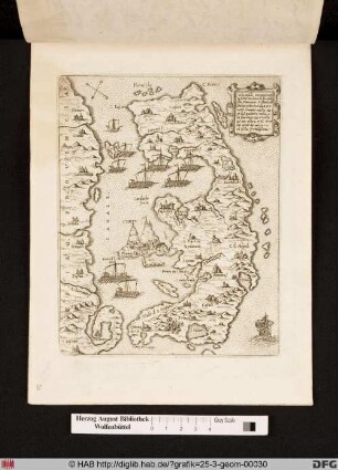
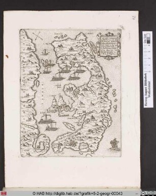
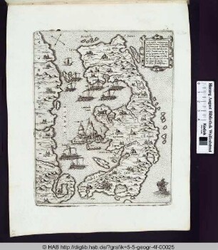
Inschrift: Milo insula posta nel mare dello Arcipelago longi dalla Morea milia 80 insula fertile, et tiene di circuito da milia 70 sottoposta al Turcho.
- Klassifikation
-
Druckgraphik (Gattung)
- Bezug (was)
-
Krieg
Stadt
Topographie
Seeschlacht
Insel
Windrose
Landkarte
Griechenland
Militär
Venedig
Kartusche
Mittelmeer
Stadtansicht
ICONCLASS: Insel
ICONCLASS: geographische Bezeichnungen von Ländern, Regionen, Bergen, Flüssen, etc. (ausgenommen Städte und Dörfer) (MILOS)
- Bezug (wo)
-
Milo/Milos
- Kulturelle Zuschreibung
-
Italienisch
- Ereignis
-
Herstellung
- (wer)
-
Camocio, Gio. Franco (Verleger)
Unbekannt (Stecher)
- (wann)
-
1568-1571
- Geliefert über
- Letzte Aktualisierung
- 13.06.2023, 12:16 UTC
Datenpartner
Dieses Objekt wird bereitgestellt von:
Herzog August Bibliothek Wolfenbüttel. Bei Fragen zum Objekt wenden Sie sich bitte an den Datenpartner.
Herzog August Bibliothek Wolfenbüttel. Bei Fragen zum Objekt wenden Sie sich bitte an den Datenpartner.
Objekttyp
- Druckgraphik
Beteiligte
- Camocio, Gio. Franco (Verleger)
- Unbekannt (Stecher)
Entstanden
- 1568-1571
Ähnliche Objekte (12)
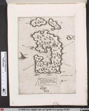
Landkarte von Milo/Milos und Umgebung.
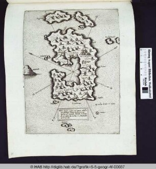
Landkarte von Milos/Milo und Umgebung.
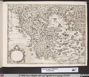
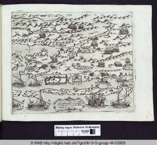
Landkarte von Griechenland.
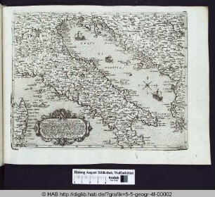
Landkarte von Italien.
Landkarte von Corfu und Umgebung.
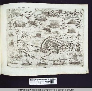
Landkarte mit Stadtansicht von Famagosta.
Landkarte von Corfu und Umgebung.
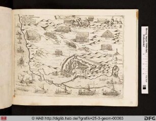
Landkarte mit Stadtansicht von Famagosta.
Landkarte von Zadar und Umgebung.
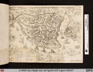
Landkarte mit Stadtansicht von Costantinopoli.
Landkarte von Corfu und Umgebung.
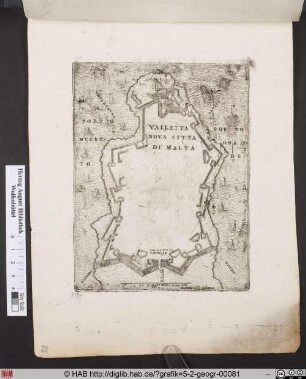
Landkarte mit Stadtansicht von Valletta.
Landkarte von Milo/Milos und Umgebung.
Landkarte von Milos/Milo und Umgebung.
Landkarte von Griechenland.
Landkarte von Italien.
Landkarte von Corfu und Umgebung.
Landkarte mit Stadtansicht von Famagosta.
Landkarte von Corfu und Umgebung.
Landkarte mit Stadtansicht von Famagosta.
Landkarte von Zadar und Umgebung.
Landkarte mit Stadtansicht von Costantinopoli.
Landkarte von Corfu und Umgebung.