Landkarte
Ducatus Slesvicensis in omnes eiusdem Generales et Particulares Praefecturas exacte divisi
Maßstab 1:310.000 Maßstab in geogr. Form (Milliaria Germanica communia) ohne Kt-Netz Die Karte zeigt das Herzogtum Schleswig und seine Ämter.
- Location
-
Schleswig-Holsteinische Landesbibliothek - Landesgeschichtliche Sammlung
- Collection
-
Karten
- Inventory number
-
II 140
- Other number(s)
-
B 804 (alte Inventarnummer)
- Measurements
-
Blattmaß: Höhe: 51,2 cm; Breite: 60,3 cm Plattenmaß: Höhe: 49,5 cm; Breite: 57,4 cm Bildmaß: Höhe: 46,8 cm; Breite: 54,8 cm
- Material/Technique
-
Papier; Kupferstich (koloriert)
- Inscription/Labeling
-
Signatur: betitelt Wo: u. l. Was: Ducatus Slesvicensis in omnes eiusdem Generales et Particulares Praefecturas exacte divisi
Signatur: bezeichnet Wo: u. l. Was: Nova tabula edita à Ioh. Baptista Homanno
- Related object and literature
-
Dokumentiert in: IKAR Landkartendrucke vor 1850.
- Classification
-
Rechts- und Verwaltungskarten (Sachgruppe)
- Subject (what)
-
Ikonographie: Landkarten verschiedener Länder und Regionen
- Subject (where)
-
Schleswig-Holstein (Herzogtum Schleswig)
- Event
-
Herstellung
- (who)
-
Homann, Johann Baptista (Künstler)
- (when)
-
1782
- Delivered via
- Last update
-
29.04.2025, 11:17 AM CEST
Data provider
This object is provided by:
Schleswig-Holsteinische Landesbibliothek - Landesgeschichtliche Sammlung. If you have any questions about the object, please contact the data provider.
Schleswig-Holsteinische Landesbibliothek - Landesgeschichtliche Sammlung. If you have any questions about the object, please contact the data provider.
Object type
- Landkarte
Associated
- Homann, Johann Baptista (Künstler)
Time of origin
- 1782
Other Objects (12)
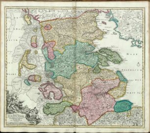
Ducatus Slesvicensis in omnes eiusdem Generales et Particulares Praefecturas exacte divisi Nova Tabula
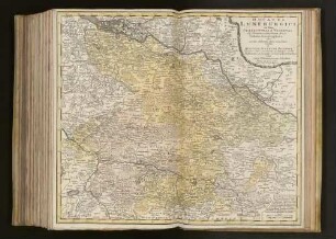
Ducatus Luneburgici in suas Præfecturas et Vogteyas ad Statum recentissimum divisi Tabula Geographica
![Karte von Schleswig, ca. 1:310 000, Kupferstich, nach 1715 : Ducatûs Slesvicensis in omnes eiusdem Generales et Particulares Praefecturas exactè divisi Nova Tabula / edita à Ioh. Baptista Homanno. - [Ca. 1:310 000]. - Norimbergae , [nach 1715]. - 1 Kt. : kolor. Kupferst. ; 55 x 47 cm](https://iiif.deutsche-digitale-bibliothek.de/image/2/4ebd8b2e-83fd-490c-8b3c-e528eb1d3a4f/full/!306,450/0/default.jpg)
Karte von Schleswig, ca. 1:310 000, Kupferstich, nach 1715 : Ducatûs Slesvicensis in omnes eiusdem Generales et Particulares Praefecturas exactè divisi Nova Tabula / edita à Ioh. Baptista Homanno. - [Ca. 1:310 000]. - Norimbergae , [nach 1715]. - 1 Kt. : kolor. Kupferst. ; 55 x 47 cm

Ducatus Slesvicensis in omnes ejusdem Generales et Particulares ...

DUCATUS SLESVICENSIS : in omnes suas PRAEFECTURAS CIRCULOS et PROVINCIAS Distinté divisus
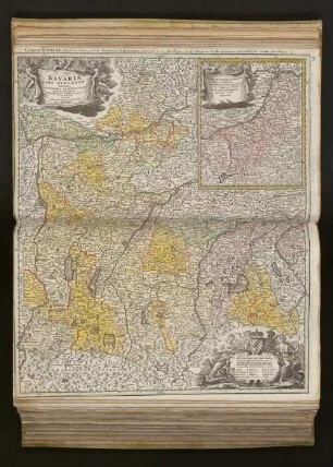
Bavariæ Pars Superior : tam in sua Regimina Principaliora quàm in eorundem Præfecturas Particulares accuratè divisa
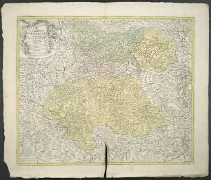
Archiducatus Austriae Superioris in suas Quadrantes Ditiones exacte divisi accuratißima Tabula
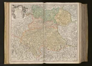
Archiducatus Austriae Superioris in suas Quadrantes Ditiones exacte divisi accuratissima Tabula
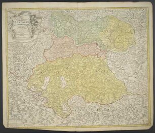
Archiducatus Austriae Superioris in suas Quadrantes Ditiones exacte divisi accuratißima Tabula
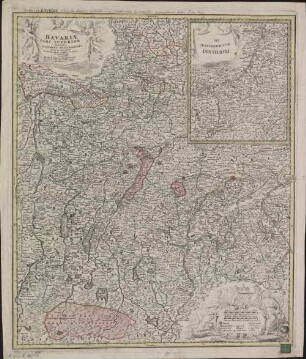
Bavariae Pars Superior : tam in sua Regimina Principalioria quam in eorundem Praefecturas Particulares accurate divisa = La Haute Baviere
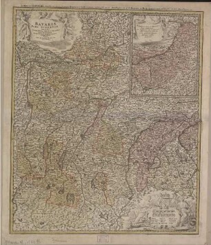
Bavariae Pars Superior : tam in sua Regimina Principaliora quam in eorundem Praefecturas Particulares accurate divisa = La Haute Baviere
![Nova Territorii Erfordien[sis] In Suas Præfecturas accurate divisi descriptio : cui accedit Erfordiæ Urbis exterior Facies et Prospectus](https://iiif.deutsche-digitale-bibliothek.de/image/2/1a1c820f-5504-4ead-84a6-6e5aad984fa8/full/!306,450/0/default.jpg)
Nova Territorii Erfordien[sis] In Suas Præfecturas accurate divisi descriptio : cui accedit Erfordiæ Urbis exterior Facies et Prospectus
Ducatus Slesvicensis in omnes eiusdem Generales et Particulares Praefecturas exacte divisi Nova Tabula
Ducatus Luneburgici in suas Præfecturas et Vogteyas ad Statum recentissimum divisi Tabula Geographica
Karte von Schleswig, ca. 1:310 000, Kupferstich, nach 1715 : Ducatûs Slesvicensis in omnes eiusdem Generales et Particulares Praefecturas exactè divisi Nova Tabula / edita à Ioh. Baptista Homanno. - [Ca. 1:310 000]. - Norimbergae , [nach 1715]. - 1 Kt. : kolor. Kupferst. ; 55 x 47 cm
Ducatus Slesvicensis in omnes ejusdem Generales et Particulares ...
DUCATUS SLESVICENSIS : in omnes suas PRAEFECTURAS CIRCULOS et PROVINCIAS Distinté divisus
Bavariæ Pars Superior : tam in sua Regimina Principaliora quàm in eorundem Præfecturas Particulares accuratè divisa
Archiducatus Austriae Superioris in suas Quadrantes Ditiones exacte divisi accuratißima Tabula
Archiducatus Austriae Superioris in suas Quadrantes Ditiones exacte divisi accuratissima Tabula
Archiducatus Austriae Superioris in suas Quadrantes Ditiones exacte divisi accuratißima Tabula
Bavariae Pars Superior : tam in sua Regimina Principalioria quam in eorundem Praefecturas Particulares accurate divisa = La Haute Baviere
Bavariae Pars Superior : tam in sua Regimina Principaliora quam in eorundem Praefecturas Particulares accurate divisa = La Haute Baviere