Grafik | Landkarte
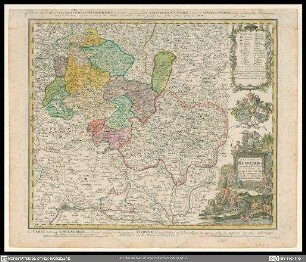
Sancti Romani Imperii Principatus Fuldensis in Buchonia
Historische Landkarte von Fulda und Umgebung mit Titelkartusche unten rechts und kleine Legende in Kartusche unten links
- Alternative title
-
cum adjacentibus quibusdam regionibus adumbratus
- Collection
-
Pictothek
- Identifier
-
36/A 1.8
- Source
-
Universitätsbibliothek Würzburg
- Extent
-
505 mm x 731 mm
- Language
-
Latein
- Subject
-
Altkarte
- Subject (where)
-
Fulda
Rhön
- URN
-
urn:nbn:de:bvb:20-36a18term73233776-4
- Last update
-
06.03.2025, 3:26 PM CET
Data provider
This object is provided by:
Universitätsbibliothek Würzburg. If you have any questions about the object, please contact the data provider.
Universitätsbibliothek Würzburg. If you have any questions about the object, please contact the data provider.
Object type
- Grafik
- Landkarte
Associated
Time of origin
- Ca. 1715
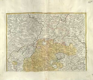
Other Objects (12)

Principatus Fuldensis in Buchonia

"S.R.I. PRINCIPATUS FULDENSIS IN BUCHONIA ..."
Sancti Romani Imperii Comitatus Henneberg
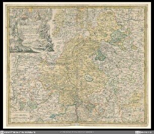
Sacri Romani Imperii principatus et episcopatus Bambergensis nova tabula geographica
Ordines Sancti Romani Imperii Romano-Germanici
S.R.I. Principatus Fuldensis in Buchonia ; cum adjacentibus quibusdam Regionibus a dumbratus
Monarchia S[ancti] Romani Imperii, T. 3.
Monarchia S[ancti] Romani Imperii, T. 2.
Monarchia S[ancti] Romani Imperii, T. 1.

Reverendissimo et celsissimo Sacri Romani Imperii Principi ac Domino D. Henrico, cathedralis ecclesiae Fuldensis ...

S. R. I. Principatus Fuldensis In Buchonia cum adjacentibus quibusdam Regionibus adumbratus
Romani Imperii
Principatus Fuldensis in Buchonia
"S.R.I. PRINCIPATUS FULDENSIS IN BUCHONIA ..."
Sancti Romani Imperii Comitatus Henneberg
Sacri Romani Imperii principatus et episcopatus Bambergensis nova tabula geographica
Ordines Sancti Romani Imperii Romano-Germanici
S.R.I. Principatus Fuldensis in Buchonia ; cum adjacentibus quibusdam Regionibus a dumbratus
Monarchia S[ancti] Romani Imperii, T. 3.
Monarchia S[ancti] Romani Imperii, T. 2.
Monarchia S[ancti] Romani Imperii, T. 1.
Reverendissimo et celsissimo Sacri Romani Imperii Principi ac Domino D. Henrico, cathedralis ecclesiae Fuldensis ...
S. R. I. Principatus Fuldensis In Buchonia cum adjacentibus quibusdam Regionibus adumbratus