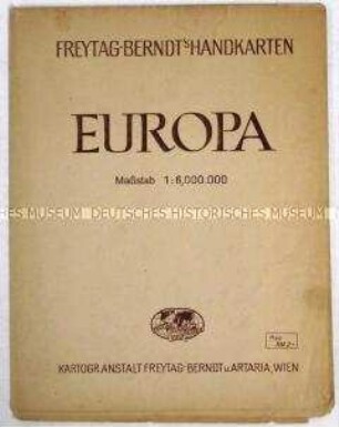
- Alternative title
-
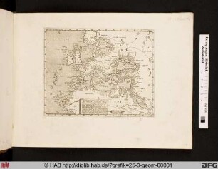
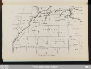
Der europäische Raum
- Location
-
Deutsches Historisches Museum, Berlin
- Inventory number
-
Do2 94/3501
- Measurements
-
Höhe x Breite: 92 x 118 cm
- Material/Technique
-
Papier, gedruckt
- Classification
-
Kartografie (Gattung)
- Subject (what)
-
Weltkrieg, 2.
Geographie
- Event
-
Herstellung
- (who)
-
Herausgeber: Richard Schwarz Landkartenhandlung und Geografischer Verlag
- (where)
-
Berlin, Deutschland
- (when)
-
1944
- Rights
-
Deutsches Historisches Museum
- Last update
-
24.03.2023, 9:28 AM CET
Data provider
This object is provided by:
Stiftung Deutsches Historisches Museum. If you have any questions about the object, please contact the data provider.
Stiftung Deutsches Historisches Museum. If you have any questions about the object, please contact the data provider.
Object type
- Politisch-geographische Karte
Associated
- Herausgeber: Richard Schwarz Landkartenhandlung und Geografischer Verlag
Time of origin
- 1944
Other Objects (12)
Politisch-administrative Karte von Europa und Nordafrika
![[Europa und Nordafrika]](https://iiif.deutsche-digitale-bibliothek.de/image/2/5a60b283-daea-41cc-ab26-b436f9bf0115/full/!306,450/0/default.jpg)
[Europa und Nordafrika]
Landkarte von Europa und Nordafrika.

Politisch-geografische Karte von Europa und Nordafrika ("Tornisterschrift der Wehrmacht")
Dreiecksnetze in Europa und Nordafrika
Vögel Europas, Nordafrikas und Vorderasiens
Politische Karte von Nordafrika
Geografische Schulwandkarte von Europa und Nordafrika
Reiseberichte von Vertretern aus Europa und Nordafrika
Reiseberichte von Vertretern aus Europa und Nordafrika
Sonderdruck von Mehnerts Aufsatz "Nordafrika-Kalifornien Europas"
Nachschubführung von Europa nach Nordafrika, insbes. Schiffslagemeldungen
Politisch-administrative Karte von Europa und Nordafrika
[Europa und Nordafrika]
Landkarte von Europa und Nordafrika.
Politisch-geografische Karte von Europa und Nordafrika ("Tornisterschrift der Wehrmacht")
Dreiecksnetze in Europa und Nordafrika
Vögel Europas, Nordafrikas und Vorderasiens
Politische Karte von Nordafrika
Geografische Schulwandkarte von Europa und Nordafrika
Reiseberichte von Vertretern aus Europa und Nordafrika
Reiseberichte von Vertretern aus Europa und Nordafrika
Sonderdruck von Mehnerts Aufsatz "Nordafrika-Kalifornien Europas"