Archivale
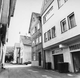
Plan über den Ausbau der verl. Ottostraße von der Querstraße bis Ewaldistraße
Längenprofil und Lageplan.
- Archivaliensignatur
-
Slg-KUP, A 134,6,11
- Maße
-
Bl. 49,7 x 20,9
- Formalbeschreibung
-
Papier leicht eingerissen.
- Sonstige Erschließungsangaben
-
Ausführung: Pause
Maßstab: 1:100, 1:1250
- Kontext
-
Karten und Pläne >> 01. Stadtdarstellungen >> 01.04. Straßen und Plätze
- Bestand
-
Slg-KUP Karten und Pläne
- Indexbegriff Ort
-
Ottostraße
- Laufzeit
-
1911, 06.
- Weitere Objektseiten
- Provenienz
-
. Stadtbauverwaltung
- Geliefert über
- Letzte Aktualisierung
- 09.01.2026, 11:13 MEZ
Datenpartner
Dieses Objekt wird bereitgestellt von:
Stadtarchiv Münster. Bei Fragen zum Objekt wenden Sie sich bitte an den Datenpartner.
Stadtarchiv Münster. Bei Fragen zum Objekt wenden Sie sich bitte an den Datenpartner.
Objekttyp
- Archivale
Entstanden
- 1911, 06.
Ähnliche Objekte (12)

Ottostraße und Querstraße
Plan über den Ausbau der verl. Ottostraße
Plan zum Ausbau der Querstraße
Plan über den Ausbau der Querstraße
Ausbau der Ottostraße (Hamborn)
Ausbau der Herrnacker-Querstraße
Querstraße (mit Plänen)
Herborn, Ottostraße 4, Ottostraße 6, Ottostraße
Pläne Querstraße Jahnstraße-Kirchheimerstraße
Herborn, Ottostraße 3, Ottostraße 5
Herborn, Ottostraße 10, Ottostraße 8
Ottostraße
Ottostraße und Querstraße
Plan über den Ausbau der verl. Ottostraße
Plan zum Ausbau der Querstraße
Plan über den Ausbau der Querstraße
Ausbau der Ottostraße (Hamborn)
Ausbau der Herrnacker-Querstraße
Querstraße (mit Plänen)
Herborn, Ottostraße 4, Ottostraße 6, Ottostraße
Pläne Querstraße Jahnstraße-Kirchheimerstraße
Herborn, Ottostraße 3, Ottostraße 5
Herborn, Ottostraße 10, Ottostraße 8