Kreiskarte
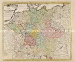
Charte welche das Deutsche Reich nach seinen Kreisen und Staaten vorstellet
- Alternative title
-
CHARTE / welche das / DEUTSCHE REICH / nach seinen Kreisen und Staaten
- Location
-
Deutsches Historisches Museum, Berlin
- Inventory number
-
Do 2006/1090
- Measurements
-
Höhe x Breite: 58,5 x 69 cm (Blatt)
Höhe x Breite: 44,5 x 52 cm (Karte)
Höhe x Breite: 49 x 56,5 cm (Platte)
- Material/Technique
-
Papier, Kupferstich, koloriert
- Classification
-
Kartografie (Gattung)
- Subject (what)
-
Deutschland
- Event
-
Herstellung
- (who)
-
Kartograf, Geograph, Kupferstecher, Verleger: Johann Baptist Homann
Stecher: Johann Jakob Schatz
Verlag: Homannsche Erben
- (where)
-
Nürnberg, Deutschland
- (when)
-
um 1740
- Rights
-
Deutsches Historisches Museum
- Last update
-
24.03.2023, 9:27 AM CET
Data provider
This object is provided by:
Stiftung Deutsches Historisches Museum. If you have any questions about the object, please contact the data provider.
Stiftung Deutsches Historisches Museum. If you have any questions about the object, please contact the data provider.
Object type
- Kreiskarte
Associated
- Kartograf, Geograph, Kupferstecher, Verleger: Johann Baptist Homann
- Stecher: Johann Jakob Schatz
- Verlag: Homannsche Erben
Time of origin
- um 1740
Other Objects (12)
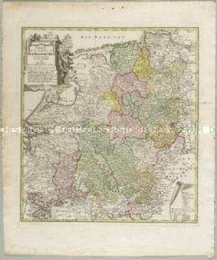
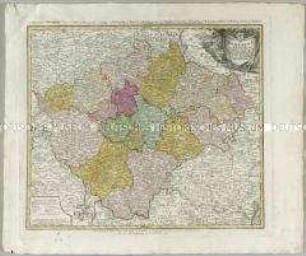
Charte das Deutsche Reich nach seinen Kreisen und deren Unterabtheilungen vorstellend

Charte von dem Königreich Preussen
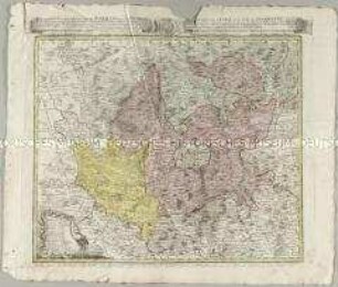
Charte über die saemtlichen zum Westphaelischen Kreis gehörige Laender
Atlas Regni Bohemiae: Repraesentatio Geographica Circuli Egerani, nec non Elnbogensis / Carte du Territoire d'Egra, & du Cercle d'Elnbogue
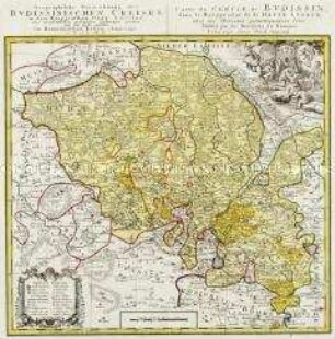
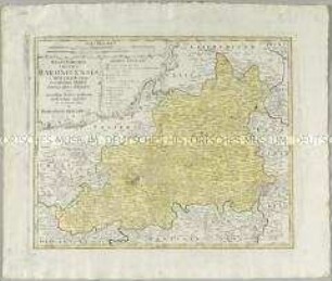
Geographische Verzeichnung des Budissinischen Creises in dem Marggrafthum Ober Lausitz
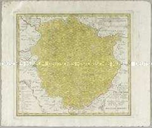
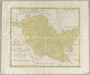
Atlas Regni Bohemiae: Regni Bohemiae Circulus Pilsnensis
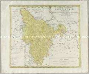
Atlas Regni Bohemiae: Regni Bohemiae Circulus Kaurzimensis
Atlas regni Bohemiae: Bohemiae Regnum in XII. Circulos divisum
Atlas Regni Bohemiae: Regni Bohemiae Circulus Rakonicensis
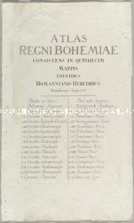
Atlas Regni Bohemiae
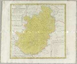
Atlas Regni Bohemiae: Regni Bohemiae Circulus Chrudimensis
Atlas Regni Bohemiae: Regni Bohemiae Circulus Boleslaviensis
Charte das Deutsche Reich nach seinen Kreisen und deren Unterabtheilungen vorstellend
Charte von dem Königreich Preussen
Charte über die saemtlichen zum Westphaelischen Kreis gehörige Laender
Atlas Regni Bohemiae: Repraesentatio Geographica Circuli Egerani, nec non Elnbogensis / Carte du Territoire d'Egra, & du Cercle d'Elnbogue
Geographische Verzeichnung des Budissinischen Creises in dem Marggrafthum Ober Lausitz
Atlas Regni Bohemiae: Regni Bohemiae Circulus Pilsnensis
Atlas Regni Bohemiae: Regni Bohemiae Circulus Kaurzimensis
Atlas regni Bohemiae: Bohemiae Regnum in XII. Circulos divisum
Atlas Regni Bohemiae: Regni Bohemiae Circulus Rakonicensis
Atlas Regni Bohemiae
Atlas Regni Bohemiae: Regni Bohemiae Circulus Chrudimensis