- Alternative title
-
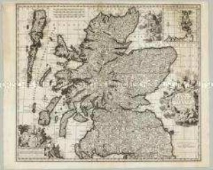
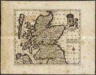
EXTIMA SCOTIAE / SEPTENTRIONALIS ORA, / ubi Provinciae sunt / ROSSIA, SVTHERLANDIA, CATHENESIA,
- Location
-
Deutsches Historisches Museum, Berlin
- Inventory number
-
Do 2006/283
- Measurements
-
Höhe x Breite: 50,5 x 61 cm (Blatt)
Höhe x Breite: 39 x 49,8 cm (Karte)
Höhe x Breite: 42 x 52,5 cm (Platte)
- Material/Technique
-
Druckfarbe, Papier, Kupferstich
- Classification
-
Kartografie (Gattung)
- Subject (what)
-
Schottland
- Event
-
Herstellung
- (who)
-
Geograph, Landvermesser: Robert Gordon
Verleger, Kartograf: Joan Blaeu
- (where)
-
Schottland ?
- (when)
-
um zwischen 1654 und 1662
- Rights
-
Deutsches Historisches Museum
- Last update
- 24.03.2023, 9:30 AM CET
Data provider
This object is provided by:
Stiftung Deutsches Historisches Museum. If you have any questions about the object, please contact the data provider.
Stiftung Deutsches Historisches Museum. If you have any questions about the object, please contact the data provider.
Object type
- Regionalkarte
Associated
- Geograph, Landvermesser: Robert Gordon
- Verleger, Kartograf: Joan Blaeu
Time of origin
- um zwischen 1654 und 1662
Other Objects (12)
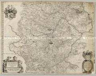
Thuringia Landgraviatus
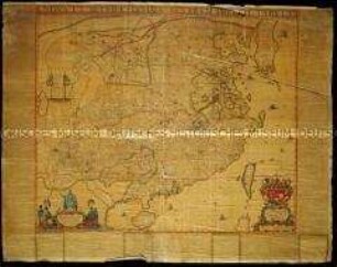
Nova et Accuratissima Sinarum Imperii Tabula. Karte erschienen in Blaeu, Joan: Atlas Maior. Lateinische Ausgabe
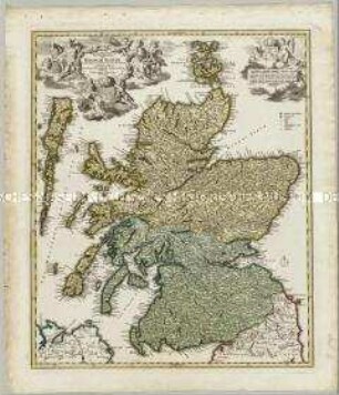
Novissima Regni Scotiae Septentrionalis et Meridionalis Tabula. Mit einer Nebenkarte: Orcades Insulae
Magnae Britanniae Pars Septentrionalis qua Regnum Scotiae in Suas Partes et subjacentes Insulas divisum Accurata Tabula

America Septentrionalis
Scotiae Regnum / Königreich Schottland.
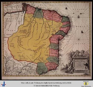
Novae et accuratae Brasiliae tabula.
![Karte von Großbritannien, ca. 1:2 500 000, Kupferstich, ab 1645 : Britannia prout divisa fuit temporibus Anglo-Saxonvm, præsertim durante illorum Heptarchia. - circa 1:2 500 000 (W 007 58 -E 001 59 /N 058 44 -N 049 46). - [Amsterdam] : [Jean Blaeu] , [ab 1645]. - 1 Karte : Kupferstich ; Bildgröße 40 x 30 cm, Blattgröße 42 x 54 cm // Ohne Maßstab. - Ohne Kartennetz. - Titelkartusche mit allegorischer Darstellung und Krone oben rechts. - Mit 9 Gebietswappen im Kartenbild. - Mit zahlreichen Illustrationen zur angelsächsischen Geschichte links und rechts am Kartenrand. - Mit Text auf Rückseite](https://iiif.deutsche-digitale-bibliothek.de/image/2/0badfd66-8e60-4e52-be07-492993cba399/full/!306,450/0/default.jpg)
Karte von Großbritannien, ca. 1:2 500 000, Kupferstich, ab 1645 : Britannia prout divisa fuit temporibus Anglo-Saxonvm, præsertim durante illorum Heptarchia. - circa 1:2 500 000 (W 007 58 -E 001 59 /N 058 44 -N 049 46). - [Amsterdam] : [Jean Blaeu] , [ab 1645]. - 1 Karte : Kupferstich ; Bildgröße 40 x 30 cm, Blattgröße 42 x 54 cm // Ohne Maßstab. - Ohne Kartennetz. - Titelkartusche mit allegorischer Darstellung und Krone oben rechts. - Mit 9 Gebietswappen im Kartenbild. - Mit zahlreichen Illustrationen zur angelsächsischen Geschichte links und rechts am Kartenrand. - Mit Text auf Rückseite
![Stadtplan von Mecheln in Belgien 1 : 5 200, kolorierter Kupferstich, 1649 : Machlinia, [ca. 1:5.200] / [Amsterdam] : [Joan Blaeu], [1649]. - 1 Plan : Kupferst. ; 48,4 x 38,0 cm - Vermutl. aus: Novum Ac Magnum Theatrum Urbium Belgicae Foederatae. [Teil 2] : Ad praesentis temporis faciem expressum / a Ioanne Blaeu, Amstelaedamensi](https://iiif.deutsche-digitale-bibliothek.de/image/2/4db6de1a-677d-4ba6-8253-c4798b0b13b0/full/!306,450/0/default.jpg)
Stadtplan von Mecheln in Belgien 1 : 5 200, kolorierter Kupferstich, 1649 : Machlinia, [ca. 1:5.200] / [Amsterdam] : [Joan Blaeu], [1649]. - 1 Plan : Kupferst. ; 48,4 x 38,0 cm - Vermutl. aus: Novum Ac Magnum Theatrum Urbium Belgicae Foederatae. [Teil 2] : Ad praesentis temporis faciem expressum / a Ioanne Blaeu, Amstelaedamensi
![Stadtplan von Purmerend in den Niederlande, 1 : 2 000, kolorierter Kupferstich, 1650 : Purmerenda Vulgo Purmer-Eynd : [Stadtpl.] ; Ampliß. Prudentiß. Dominis D. Praetori Consulibus Scabinis Et Senatui Urbis Purmerendae / Tabulam hanc D. D. D. J. Blaeu , [ca. 1:2.000] / [Amsterdam] : [Joan Blaeu], 1650? - 1 Plan : Kupferst. ; 50,1 x 39,0 cm - NO oben. - Maßstab in graph. Form (Maete van 30 Roeden). - Titelkartusche oben Mitte, Maßstabskartusche unten links, Wappendarst. oben links u. oben rechts - Mit Gebäudeverz. - (Kein Nordpfeil über dem Maßstab in graphischer Form wie bei Frederick de Wit.)](https://iiif.deutsche-digitale-bibliothek.de/image/2/4be3d176-1bfa-4b6f-9dae-cdeb6b1d12c6/full/!306,450/0/default.jpg)
Stadtplan von Purmerend in den Niederlande, 1 : 2 000, kolorierter Kupferstich, 1650 : Purmerenda Vulgo Purmer-Eynd : [Stadtpl.] ; Ampliß. Prudentiß. Dominis D. Praetori Consulibus Scabinis Et Senatui Urbis Purmerendae / Tabulam hanc D. D. D. J. Blaeu , [ca. 1:2.000] / [Amsterdam] : [Joan Blaeu], 1650? - 1 Plan : Kupferst. ; 50,1 x 39,0 cm - NO oben. - Maßstab in graph. Form (Maete van 30 Roeden). - Titelkartusche oben Mitte, Maßstabskartusche unten links, Wappendarst. oben links u. oben rechts - Mit Gebäudeverz. - (Kein Nordpfeil über dem Maßstab in graphischer Form wie bei Frederick de Wit.)
![Stadtplan von Namur in Belgien 1 : 3 300, kolorierter Kupferstich, 1649 : Namurcum, [ca. 1:3.300] / [Amsterdam] : [Joan Blaeu], [1649]. - 1 Plan : Kupferst. ; 49,8 x 37,7 cm - Mit 1 wappen . - Mit Gebäudeverz. - Vermutl. aus: Novum Ac Magnum Theatrum Urbium Belgicae Foederatae. [Teil 2] : Ad praesentis temporis faciem expressum / a Ioanne Blaeu, Amstelaedamensi](https://iiif.deutsche-digitale-bibliothek.de/image/2/0e2e5618-44e7-4b97-8e00-46fc9307c426/full/!306,450/0/default.jpg)
Stadtplan von Namur in Belgien 1 : 3 300, kolorierter Kupferstich, 1649 : Namurcum, [ca. 1:3.300] / [Amsterdam] : [Joan Blaeu], [1649]. - 1 Plan : Kupferst. ; 49,8 x 37,7 cm - Mit 1 wappen . - Mit Gebäudeverz. - Vermutl. aus: Novum Ac Magnum Theatrum Urbium Belgicae Foederatae. [Teil 2] : Ad praesentis temporis faciem expressum / a Ioanne Blaeu, Amstelaedamensi
![Ansicht des Real Sitio de San Lorenzo de El Escorial und Rückseite des Blattes, Spanien, Kupferstich, 1665 : Scenographia Fabricae S. Lavrentii in Escvriali. - [Amsterdam] : [Blaeu] , [1665]. - 1 Ansicht : Kupferst. ; 75 x 47 cm](https://iiif.deutsche-digitale-bibliothek.de/image/2/bb12ea91-4f44-44c6-b00e-7ccc1df0c5e7/full/!306,450/0/default.jpg)
Ansicht des Real Sitio de San Lorenzo de El Escorial und Rückseite des Blattes, Spanien, Kupferstich, 1665 : Scenographia Fabricae S. Lavrentii in Escvriali. - [Amsterdam] : [Blaeu] , [1665]. - 1 Ansicht : Kupferst. ; 75 x 47 cm
Thuringia Landgraviatus
Nova et Accuratissima Sinarum Imperii Tabula. Karte erschienen in Blaeu, Joan: Atlas Maior. Lateinische Ausgabe
Novissima Regni Scotiae Septentrionalis et Meridionalis Tabula. Mit einer Nebenkarte: Orcades Insulae
Magnae Britanniae Pars Septentrionalis qua Regnum Scotiae in Suas Partes et subjacentes Insulas divisum Accurata Tabula
America Septentrionalis
Scotiae Regnum / Königreich Schottland.
Novae et accuratae Brasiliae tabula.
Karte von Großbritannien, ca. 1:2 500 000, Kupferstich, ab 1645 : Britannia prout divisa fuit temporibus Anglo-Saxonvm, præsertim durante illorum Heptarchia. - circa 1:2 500 000 (W 007 58 -E 001 59 /N 058 44 -N 049 46). - [Amsterdam] : [Jean Blaeu] , [ab 1645]. - 1 Karte : Kupferstich ; Bildgröße 40 x 30 cm, Blattgröße 42 x 54 cm // Ohne Maßstab. - Ohne Kartennetz. - Titelkartusche mit allegorischer Darstellung und Krone oben rechts. - Mit 9 Gebietswappen im Kartenbild. - Mit zahlreichen Illustrationen zur angelsächsischen Geschichte links und rechts am Kartenrand. - Mit Text auf Rückseite
Stadtplan von Mecheln in Belgien 1 : 5 200, kolorierter Kupferstich, 1649 : Machlinia, [ca. 1:5.200] / [Amsterdam] : [Joan Blaeu], [1649]. - 1 Plan : Kupferst. ; 48,4 x 38,0 cm - Vermutl. aus: Novum Ac Magnum Theatrum Urbium Belgicae Foederatae. [Teil 2] : Ad praesentis temporis faciem expressum / a Ioanne Blaeu, Amstelaedamensi
Stadtplan von Purmerend in den Niederlande, 1 : 2 000, kolorierter Kupferstich, 1650 : Purmerenda Vulgo Purmer-Eynd : [Stadtpl.] ; Ampliß. Prudentiß. Dominis D. Praetori Consulibus Scabinis Et Senatui Urbis Purmerendae / Tabulam hanc D. D. D. J. Blaeu , [ca. 1:2.000] / [Amsterdam] : [Joan Blaeu], 1650? - 1 Plan : Kupferst. ; 50,1 x 39,0 cm - NO oben. - Maßstab in graph. Form (Maete van 30 Roeden). - Titelkartusche oben Mitte, Maßstabskartusche unten links, Wappendarst. oben links u. oben rechts - Mit Gebäudeverz. - (Kein Nordpfeil über dem Maßstab in graphischer Form wie bei Frederick de Wit.)
Stadtplan von Namur in Belgien 1 : 3 300, kolorierter Kupferstich, 1649 : Namurcum, [ca. 1:3.300] / [Amsterdam] : [Joan Blaeu], [1649]. - 1 Plan : Kupferst. ; 49,8 x 37,7 cm - Mit 1 wappen . - Mit Gebäudeverz. - Vermutl. aus: Novum Ac Magnum Theatrum Urbium Belgicae Foederatae. [Teil 2] : Ad praesentis temporis faciem expressum / a Ioanne Blaeu, Amstelaedamensi