Seekarte
Carte réduite de la mer Baltique. Mit drei Nebenkarten: Carte du port de Dantzick; Carte du Sund; Plan de Gothenbourg
- Alternative title
-
CARTE RÉDUITE / DE LA / MER BALTIQUE / 1785
- Location
-
Deutsches Historisches Museum, Berlin
- Inventory number
-
Do 2006/1034.1-2
- Measurements
-
Höhe x Breite: 99 x 67 cm (Blatt 1)
Höhe x Breite: 74 x 59,5 cm (Karte 1)
Höhe x Breite: 99 x 67,3 cm (Blatt 2)
Höhe x Breite: 74 x 59,5 cm (Karte 2)
- Material/Technique
-
Papier, Kupferstich
- Classification
-
Kartografie (Gattung)
- Subject (what)
-
Ostsee
- Event
-
Herstellung
- (who)
-
Stecher: Louis André Dupuis
Stecher: Ph. Macquet
- (where)
-
Frankreich ?
- (when)
-
1785
- Rights
-
Deutsches Historisches Museum
- Last update
-
24.03.2023, 9:29 AM CET
Data provider
This object is provided by:
Stiftung Deutsches Historisches Museum. If you have any questions about the object, please contact the data provider.
Stiftung Deutsches Historisches Museum. If you have any questions about the object, please contact the data provider.
Object type
- Seekarte
Associated
- Stecher: Louis André Dupuis
- Stecher: Ph. Macquet
Time of origin
- 1785
Other Objects (12)
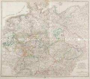
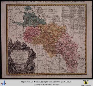
Carte réduite de la Carte Génerale d'Allemagne
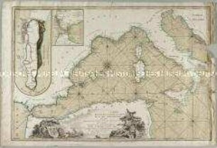
Carte Reduite de la Partie Occidentiale de la Mer Mediterranée. Mit zwei Nebenkarten: Plan de Gibraltar; Plan du Detroit de Gibraltar

Carte Réduite de la Route d'Acapulco à Mexico
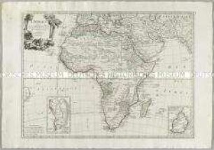
L'Afrique. Mit zwei Nebenkarten: Carte particuliere du Cap de Bonne Esperance; Carte particuliere de l'Isle de France
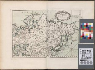
Carte Réduite De La Moscovie, Siberie, Tartarie et Pais Voisins
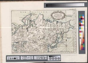
Carte Réduite De La Moscovie, Siberie, Tartarie et Pais Voisins
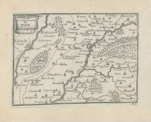
Carte du Gouvernement de Dole
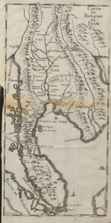
Carte du Royaume de Siam
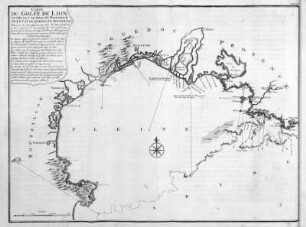
Carte du Golfe de Lion
Carte du diocese de Breslau
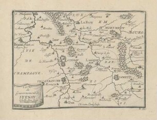
Carte du Gouvernement de Stenay
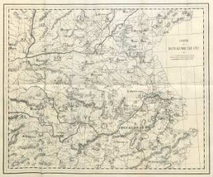
Carte du royaume de Ou
Carte réduite de la Carte Génerale d'Allemagne
Carte Reduite de la Partie Occidentiale de la Mer Mediterranée. Mit zwei Nebenkarten: Plan de Gibraltar; Plan du Detroit de Gibraltar
Carte Réduite de la Route d'Acapulco à Mexico
L'Afrique. Mit zwei Nebenkarten: Carte particuliere du Cap de Bonne Esperance; Carte particuliere de l'Isle de France
Carte Réduite De La Moscovie, Siberie, Tartarie et Pais Voisins
Carte Réduite De La Moscovie, Siberie, Tartarie et Pais Voisins
Carte du Gouvernement de Dole
Carte du Royaume de Siam
Carte du Golfe de Lion
Carte du diocese de Breslau
Carte du Gouvernement de Stenay