- Reference number
-
D 30/K 1277
- Former reference number
-
prefix: D 30/K
- Dimensions
-
41 x 47 cm
- Material
-
Papier
- Further information
-
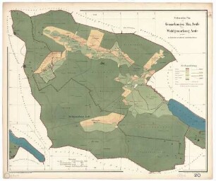
Ausführung: Lichtpause, koloriert, mit Einzeichnungen
Maßstab: 1:1000
Druck / Verlag: Fischer, Oberamtsgeometer
- Context
-
D 30 Karten- und Plansammlung >> Stadtteile >> Lustnau
- Holding
-
D 30 Karten- und Plansammlung
- Indexbegriff subject
-
Äule, Gemeindepachtflächen
- Indexentry place
-
Lustnau, Gemeindepachtstücke
- Date of creation
-
1922
- Other object pages
- Last update
-
29.04.2025, 8:35 AM CEST
Data provider
This object is provided by:
Stadtarchiv Tübingen. If you have any questions about the object, please contact the data provider.
Stadtarchiv Tübingen. If you have any questions about the object, please contact the data provider.
Object type
- Karte und Plan
Time of origin
- 1922
Other Objects (12)

Pachtflächen der Gemeinde Lustnau auf dem Äule, Lageplan
Plan zur Erbauung eines Zweifamilienhauses in Lustnau auf dem Äule für die Gemeinde Lustnau; Grundrisse, Aufriß, Ansichten
Pachtstücke an der Schlachthausstraße
Pachtstücke bei der ehemaligen Sägemühle
Pläne der Domäne Molmerswende und Asseburger Pachtstücke
Aha (Schluchsee FR) und Äule
Luftbild Lustnau, im Vordergrund Äule und äußere Gartenstraße
Sonstige Pachtstücke
Ausdehnung der Schwemmkanalisation, Kanal Mühlstraße-Gartenstraße-Äule; Verhandlungen mit Lustnau
Längenprofil des Schmutzwasserkanals zur Kläranlage von der Keplerstraße - Äule
Oberamt Tübingen, Markung Lustnau; Ortsbauplan Lustnau
Waldsteuer Gemarkung Äule
Pachtflächen der Gemeinde Lustnau auf dem Äule, Lageplan
Plan zur Erbauung eines Zweifamilienhauses in Lustnau auf dem Äule für die Gemeinde Lustnau; Grundrisse, Aufriß, Ansichten
Pachtstücke an der Schlachthausstraße
Pachtstücke bei der ehemaligen Sägemühle
Pläne der Domäne Molmerswende und Asseburger Pachtstücke
Aha (Schluchsee FR) und Äule
Luftbild Lustnau, im Vordergrund Äule und äußere Gartenstraße
Sonstige Pachtstücke
Ausdehnung der Schwemmkanalisation, Kanal Mühlstraße-Gartenstraße-Äule; Verhandlungen mit Lustnau
Längenprofil des Schmutzwasserkanals zur Kläranlage von der Keplerstraße - Äule
Oberamt Tübingen, Markung Lustnau; Ortsbauplan Lustnau