Karten und Pläne
Bayern. Historische Karte von Bayern zur Übersicht der territoriale Entwicklung von 1180 bis jetzt.. Bearbeiter: M. Kirmaier, Kartograph
- Reference number
-
StAM, Kartensammlung 1791
- Former reference number
-
K 280
- Dimensions
-
62 cm x 44,5 cm
- Formal description
-
1 : 1000 000; Farblithographie
- Language of the material
-
deutsch
- Context
-
Kartensammlung >> Kartensammlung >> 1. Kartensammlung Bd. 1-4 (retrokonvertiert)
- Holding
-
Kartensammlung
- Date of creation
-
München 1883
- Other object pages
- Last update
-
22.04.2025, 1:57 PM CEST
Data provider
This object is provided by:
Staatsarchiv München. If you have any questions about the object, please contact the data provider.
Staatsarchiv München. If you have any questions about the object, please contact the data provider.
Object type
- Karten und Pläne
Time of origin
- München 1883
Other Objects (12)

Historische Karte von Bayern : zur Übersicht der territorialen Entwicklung von 1180 bis jetzt
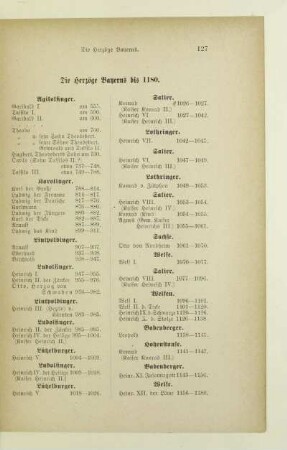
Die Herzöge Bayerns bis 1180
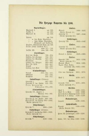
Die Herzoge Bayerns bis 1180

Territoriale Vergrößerung Bayerns
I. Bayern ein Herzogtum 1180 - 1623

Regesten der Herzöge von Bayern : 1180 - 1231

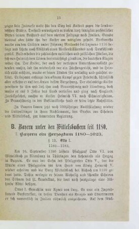
B. Bayern unter den Wittelsbachern seit 1180
Bayern. Einteilungskarte des Königreichs Bayern nach Landwehrbezirkskommandos. Bearbeiter: General-Quartiermeisterstab
Bayern. Einteilungskarte des Königreichs Bayern nach Landwehrbezirkskommandos. Bearbeiter: General-Quartiermeisterstab

Zweiter Teil. Bayern unter den Wittelsbachern (1180 - 1906).
Bayern (BY).- Vorschlagslisten: Bd. 5: Nr. 1141-1180
Der Territorial- und Successionsstreit mit Bayern.
Historische Karte von Bayern : zur Übersicht der territorialen Entwicklung von 1180 bis jetzt
Die Herzöge Bayerns bis 1180
Die Herzoge Bayerns bis 1180
Territoriale Vergrößerung Bayerns
I. Bayern ein Herzogtum 1180 - 1623
Regesten der Herzöge von Bayern : 1180 - 1231
B. Bayern unter den Wittelsbachern seit 1180
Bayern. Einteilungskarte des Königreichs Bayern nach Landwehrbezirkskommandos. Bearbeiter: General-Quartiermeisterstab
Bayern. Einteilungskarte des Königreichs Bayern nach Landwehrbezirkskommandos. Bearbeiter: General-Quartiermeisterstab
Zweiter Teil. Bayern unter den Wittelsbachern (1180 - 1906).
Bayern (BY).- Vorschlagslisten: Bd. 5: Nr. 1141-1180