Archivale
Pausfähiger Plan, Fluchtlinienplan der Verbandsgrünfläche 2 Neuer Friedhof. 1:2500
- Reference number
-
59, 617.65
- Context
-
Karten des Vermessungs- und Katasteramtes >> 6. Fluchtlinienpläne, Bebauungspläne, Höhenpläne, Verbandsstraßen, Verbandsgrünflächen, Nord-Südstraße >> 617. Verbandsgrünflächen
- Holding
-
59 Karten des Vermessungs- und Katasteramtes
- Date of creation
-
ohne Datum
- Other object pages
- Delivered via
- Last update
-
17.09.2025, 3:09 PM CEST
Data provider
This object is provided by:
Stadtarchiv Duisburg. If you have any questions about the object, please contact the data provider.
Stadtarchiv Duisburg. If you have any questions about the object, please contact the data provider.
Object type
- Archivale
Time of origin
- ohne Datum
Other Objects (12)

Fluchtlinienplan der Verbandsgrünfläche Duisburg Nr. 2. 1:2500
Fluchtlinienplan der Verbandsgrünfläche Duisburg Nr. 2. 1:2500
Pausfähiger Plan, Fluchtlinienplan der Verbandsgrünfläche 15 Gemeinde Huckingen Flur 11. 1:2500
Fluchtlinienplan der Verbandsgrünfläche Duisburg Nr. 15 mit Anliegerverzeichnis. 1:2500
Fluchtlinienplan der Verbandsgrünfläche Duisburg Nr. 2 mit Anliegerverzeichnis. 1:2500

Friedhof, Hannover-Stöcken: Grundriss 1:2500
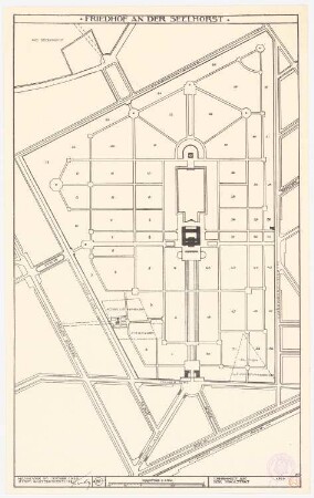
Friedhof am Seelhorst, Hannover: Grundriss 1:2500
Lageplan 1:2500
Lageplan (1:2.500)
Lageplan 1:2500
Lageplan 1:2500
Lageplan 1:2500
Fluchtlinienplan der Verbandsgrünfläche Duisburg Nr. 2. 1:2500
Fluchtlinienplan der Verbandsgrünfläche Duisburg Nr. 2. 1:2500
Pausfähiger Plan, Fluchtlinienplan der Verbandsgrünfläche 15 Gemeinde Huckingen Flur 11. 1:2500
Fluchtlinienplan der Verbandsgrünfläche Duisburg Nr. 15 mit Anliegerverzeichnis. 1:2500
Fluchtlinienplan der Verbandsgrünfläche Duisburg Nr. 2 mit Anliegerverzeichnis. 1:2500
Friedhof, Hannover-Stöcken: Grundriss 1:2500
Friedhof am Seelhorst, Hannover: Grundriss 1:2500
Lageplan 1:2500
Lageplan (1:2.500)
Lageplan 1:2500
Lageplan 1:2500