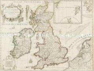
Regionalkarte
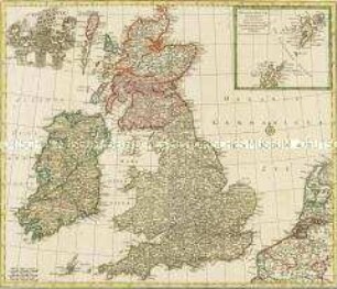
Regnorum Magnae Britanniae Et Hiberniae Mappa Geographica. Mit einer Nebenkarte: Insulae Schetlandiae
- Alternative title
-
REGNORUM / MAGNAE / BRITANNIAE / ET HIBERNIAE
- Location
-
Deutsches Historisches Museum, Berlin
- Inventory number
-
Do 2006/115
- Measurements
-
Höhe x Breite: 57,8 x 69 cm (Blatt)
Höhe x Breite: 45,2 x 52,4 cm (Karte)
Höhe x Breite: 51 x 57,5 cm (Platte)
- Material/Technique
-
Druckfarbe, Papier, Kupferstich, koloriert
- Classification
-
Kartografie (Gattung)
- Subject (what)
-
England
Schottland
Irland
Großbritannien
Britische Inseln
- Event
-
Herstellung
- (who)
-
Geograph: Johann Tobias Mayer
Verlag: Homannsche Erben
- (where)
-
Nürnberg, Deutschland
- (when)
-
1749
- Rights
-
Deutsches Historisches Museum
- Last update
-
24.03.2023, 9:26 AM CET
Data provider
This object is provided by:
Stiftung Deutsches Historisches Museum. If you have any questions about the object, please contact the data provider.
Stiftung Deutsches Historisches Museum. If you have any questions about the object, please contact the data provider.
Object type
- Regionalkarte
Associated
- Geograph: Johann Tobias Mayer
- Verlag: Homannsche Erben
Time of origin
- 1749
Other Objects (12)
Nova Totius Angliae Scotiae Et Hiberniae. Mit einer Nebenkarte: Orcades Insulae borealiores
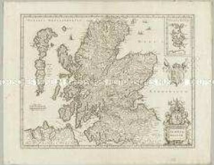
Scotia Regnum. Mit einer Nebenkarte: Orcades Insulae.
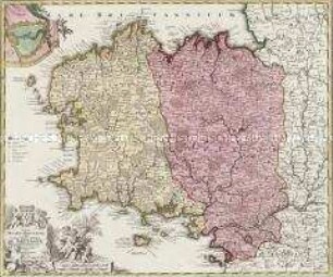
Tabula Ducatus Britanniae. Mit einer Nebenkarte: BREST
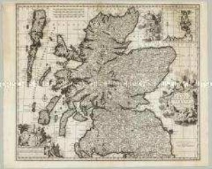
Novissima Regni Scotiae Septentrionalis et Meridionalis Tabula. Mit einer Nebenkarte: Orcades Insulae
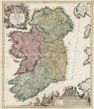
Hiberniae Regnum

Insulae et Principatus Rugiae
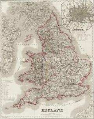
England. Mit einer Nebenkarte: London
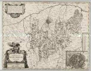
Territorium Norimbergense. Mit einer Nebenkarte: Nurnberg
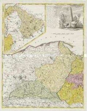
Borussiae Occidentalis Tabula. Mit einer Nebenkarte: Ermland
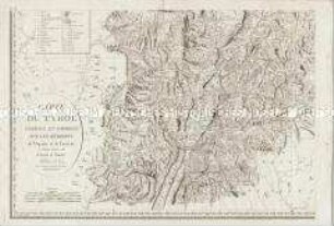
Carte du Tyrol. Mit einer Nebenkarte: Carte Générale
Les Isles Britanniques. Mit einer Nebenkarte: Orkney- und Shetlandinseln
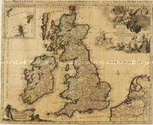
Les Isles Britanniques. Mit einer Nebenkarte: Orkney- und Shetlandinseln
Nova Totius Angliae Scotiae Et Hiberniae. Mit einer Nebenkarte: Orcades Insulae borealiores
Scotia Regnum. Mit einer Nebenkarte: Orcades Insulae.
Tabula Ducatus Britanniae. Mit einer Nebenkarte: BREST
Novissima Regni Scotiae Septentrionalis et Meridionalis Tabula. Mit einer Nebenkarte: Orcades Insulae
Hiberniae Regnum
Insulae et Principatus Rugiae
England. Mit einer Nebenkarte: London
Territorium Norimbergense. Mit einer Nebenkarte: Nurnberg
Borussiae Occidentalis Tabula. Mit einer Nebenkarte: Ermland
Carte du Tyrol. Mit einer Nebenkarte: Carte Générale
Les Isles Britanniques. Mit einer Nebenkarte: Orkney- und Shetlandinseln
Les Isles Britanniques. Mit einer Nebenkarte: Orkney- und Shetlandinseln
Nova Totius Angliae Scotiae Et Hiberniae. Mit einer Nebenkarte: Orcades Insulae borealiores
Scotia Regnum. Mit einer Nebenkarte: Orcades Insulae.
Tabula Ducatus Britanniae. Mit einer Nebenkarte: BREST
Novissima Regni Scotiae Septentrionalis et Meridionalis Tabula. Mit einer Nebenkarte: Orcades Insulae
Hiberniae Regnum
Insulae et Principatus Rugiae
England. Mit einer Nebenkarte: London
Territorium Norimbergense. Mit einer Nebenkarte: Nurnberg
Borussiae Occidentalis Tabula. Mit einer Nebenkarte: Ermland
Carte du Tyrol. Mit einer Nebenkarte: Carte Générale
Les Isles Britanniques. Mit einer Nebenkarte: Orkney- und Shetlandinseln