- Alternative title
-
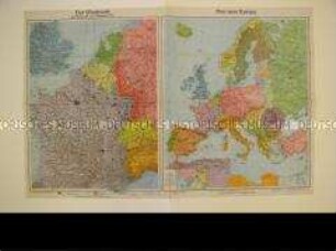
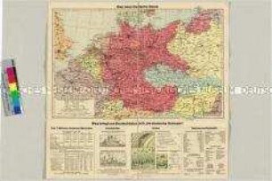
Übersichtskarte von Europa
- Location
-
Deutsches Historisches Museum, Berlin
- Inventory number
-
Do 72/46II
- Measurements
-
Höhe x Breite: 25 x 16 cm (gefaltet), Höhe x Breite: 51 x 64 cm (aufgeschlagen)
- Material/Technique
-
Papier, gedruckt
- Classification
-
Kartografie (Gattung)
- Subject (what)
-
Geographie
- Event
-
Herstellung
- (who)
-
Verlag: Brockhaus-Verlag
- (where)
-
Leipzig, Deutschland [historisch: Deutsches Reich]
- (when)
-
1940
- Rights
-
Deutsches Historisches Museum
- Last update
- 24.03.2023, 9:30 AM CET
Data provider
This object is provided by:
Stiftung Deutsches Historisches Museum. If you have any questions about the object, please contact the data provider.
Stiftung Deutsches Historisches Museum. If you have any questions about the object, please contact the data provider.
Object type
- Geografische Karten
Associated
- Verlag: Brockhaus-Verlag
Time of origin
- 1940
Other Objects (12)
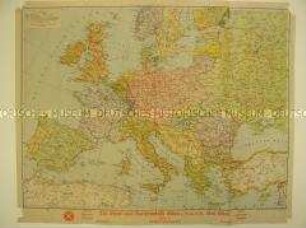
Politisch-administrative Landkarte von Europa
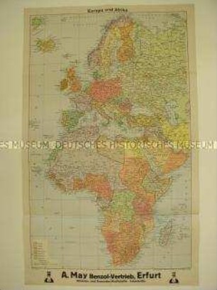
Politisch-administrative Landkarte von Europa und Afrika

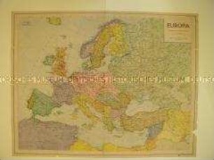
Politisch-administrative Karte von Europa
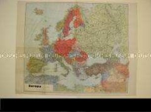
Politisch-administrative Karte von Europa
Politisch-Administrative Karte von Europa
Politisch-administrative Karten von Europa
Politisch-administrative Karte von Europa und Nordafrika
Politisch-administrative Karten von Europa und Frankreich
Administrative Landkarte der Provinz Brandenburg einschließlich Sonderkarte mit der Kreiseinteilung
Landkarte von Europa und Nordafrika.
Politisch-administrative Karte von Europa nach dem "Anschluß" Österreichs
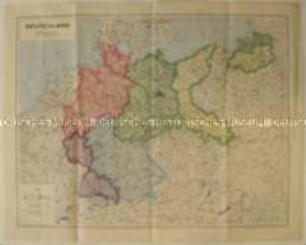
Politsch-administrative Landkarte Deutschlands mit den Besatzungszonen nach dem 2. Weltkrieg
Politisch-administrative Landkarte von Europa
Politisch-administrative Landkarte von Europa und Afrika
Politisch-administrative Karte von Europa
Politisch-administrative Karte von Europa
Politisch-Administrative Karte von Europa
Politisch-administrative Karten von Europa
Politisch-administrative Karte von Europa und Nordafrika
Politisch-administrative Karten von Europa und Frankreich
Administrative Landkarte der Provinz Brandenburg einschließlich Sonderkarte mit der Kreiseinteilung
Landkarte von Europa und Nordafrika.
Politisch-administrative Karte von Europa nach dem "Anschluß" Österreichs