Band
4: Vollständige und gründliche Anweisung zur Verzeichnung der Land- See- und Himmelscharten und der Netze zu Coniglobien und Kugeln ..

- Location
-
Sächsische Landesbibliothek - Staats- und Universitätsbibliothek Dresden -- Geodaes.135-4
- Extent
-
[1] Bl., XVI, 652 S., 8 gef. Bl.
- Edition
-
Zweyte verbesserte und vermehrte Auflage
- Language
-
Deutsch
- Bibliographic citation
-
Mayer, Johann Tobias. - Gründlicher und ausführlicher Unterricht zur praktischen Geometrie
- Series
-
Technikgeschichte
Projekt: Quellen zur Technikgeschichte 19. Jh.
- Creator
-
Mayer, Tobias (Verfasser*in)
- Contributor
-
SLUB Dresden (Besitzer*in)
- Published
-
Erlangen : Palm , 1804
- Sponsorship
-
Deutsche Forschungsgemeinschaft
- URN
-
urn:nbn:de:bsz:14-db-id3351072145
- PURL
- Last update
-
09.10.2025, 2:14 PM CEST
Data provider
This object is provided by:
Sächsische Landesbibliothek - Staats- und Universitätsbibliothek Dresden. If you have any questions about the object, please contact the data provider.
Sächsische Landesbibliothek - Staats- und Universitätsbibliothek Dresden. If you have any questions about the object, please contact the data provider.
Object type
- Band
Associated
- Mayer, Tobias (Verfasser*in)
- SLUB Dresden (Besitzer*in)
Time of origin
- Erlangen : Palm , 1804
Other Objects (12)
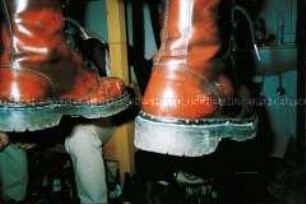
Herabhängende rote Stiefel vor einem Etagenbett mit darauf sitzender Person, einem Waschbecken und Bierdosen (Altersgruppe 14-17)
![Karte von Polen und Litauen, 1:2 900 000, Kupferstich, 1773. - Aus: Atlas mapparum geographicarum generalium & specialium Centum Foliis compositum et quotidianis usibus accommodatum - Norimbergae, 1791 : Mappa Geographica Regni Poloniae : C. P. S. C. M. = Carte des Etats de la Couronne de Pologne / ex novissimis quotquot sunt mappis specialibus composita et ad LL. stereographica proiectionis revocata a Tob. Mayero, S. C. S. Luci publicae tradita per Homannianos Heredes. - [Ca. 1:2.900.000]. - Norimb.//Nürnberg, 1773. - 1 Kt : Kupferst ; 50 x 43 cm. - Maßstab in graph. Form (Milliaria Germanica, Leucae Gallicae). - Nullmeridian: Ferro](https://iiif.deutsche-digitale-bibliothek.de/image/2/f9fec02e-60be-4683-8544-99a33c6ef7e8/full/!306,450/0/default.jpg)
Karte von Polen und Litauen, 1:2 900 000, Kupferstich, 1773. - Aus: Atlas mapparum geographicarum generalium & specialium Centum Foliis compositum et quotidianis usibus accommodatum - Norimbergae, 1791 : Mappa Geographica Regni Poloniae : C. P. S. C. M. = Carte des Etats de la Couronne de Pologne / ex novissimis quotquot sunt mappis specialibus composita et ad LL. stereographica proiectionis revocata a Tob. Mayero, S. C. S. Luci publicae tradita per Homannianos Heredes. - [Ca. 1:2.900.000]. - Norimb.//Nürnberg, 1773. - 1 Kt : Kupferst ; 50 x 43 cm. - Maßstab in graph. Form (Milliaria Germanica, Leucae Gallicae). - Nullmeridian: Ferro
![Karte von Polen und Litauen, 1:2 900 000, Kupferstich, 1773. - Aus: Atlas mapparum geographicarum generalium & specialium Centum Foliis compositum et quotidianis usibus accommodatum - Norimbergae, 1791 : Mappa Geographica Regni Poloniae : C. P. S. C. M. = Carte des Etats de la Couronne de Pologne / ex novissimis quotquot sunt mappis specialibus composita et ad LL. stereographica proiectionis revocata a Tob. Mayero, S. C. S. Luci publicae tradita per Homannianos Heredes. - [Ca. 1:2.900.000]. - Norimb.//Nürnberg, 1773. - 1 Kt : Kupferst ; 50 x 43 cm. - Maßstab in graph. Form (Milliaria Germanica, Leucae Gallicae). - Nullmeridian: Ferro](https://iiif.deutsche-digitale-bibliothek.de/image/2/cf8fa853-2908-40ab-b319-c01aac56f905/full/!306,450/0/default.jpg)
Karte von Polen und Litauen, 1:2 900 000, Kupferstich, 1773. - Aus: Atlas mapparum geographicarum generalium & specialium Centum Foliis compositum et quotidianis usibus accommodatum - Norimbergae, 1791 : Mappa Geographica Regni Poloniae : C. P. S. C. M. = Carte des Etats de la Couronne de Pologne / ex novissimis quotquot sunt mappis specialibus composita et ad LL. stereographica proiectionis revocata a Tob. Mayero, S. C. S. Luci publicae tradita per Homannianos Heredes. - [Ca. 1:2.900.000]. - Norimb.//Nürnberg, 1773. - 1 Kt : Kupferst ; 50 x 43 cm. - Maßstab in graph. Form (Milliaria Germanica, Leucae Gallicae). - Nullmeridian: Ferro
![Karte von Polen und Litauen, 1:2 900 000, Kupferstich, 1773. - Aus: Atlas mapparum geographicarum generalium & specialium Centum Foliis compositum et quotidianis usibus accommodatum - Norimbergae, 1791 : Mappa Geographica Regni Poloniae : C. P. S. C. M. = Carte des Etats de la Couronne de Pologne / ex novissimis quotquot sunt mappis specialibus composita et ad LL. stereographica proiectionis revocata a Tob. Mayero, S. C. S. Luci publicae tradita per Homannianos Heredes. - [Ca. 1:2.900.000]. - Norimb.//Nürnberg, 1773. - 1 Kt : Kupferst ; 50 x 43 cm. - Maßstab in graph. Form (Milliaria Germanica, Leucae Gallicae). - Nullmeridian: Ferro](https://iiif.deutsche-digitale-bibliothek.de/image/2/8ed85982-2eaf-4f7f-adfe-adc8f26289eb/full/!306,450/0/default.jpg)
Karte von Polen und Litauen, 1:2 900 000, Kupferstich, 1773. - Aus: Atlas mapparum geographicarum generalium & specialium Centum Foliis compositum et quotidianis usibus accommodatum - Norimbergae, 1791 : Mappa Geographica Regni Poloniae : C. P. S. C. M. = Carte des Etats de la Couronne de Pologne / ex novissimis quotquot sunt mappis specialibus composita et ad LL. stereographica proiectionis revocata a Tob. Mayero, S. C. S. Luci publicae tradita per Homannianos Heredes. - [Ca. 1:2.900.000]. - Norimb.//Nürnberg, 1773. - 1 Kt : Kupferst ; 50 x 43 cm. - Maßstab in graph. Form (Milliaria Germanica, Leucae Gallicae). - Nullmeridian: Ferro

Blauer Deckel eines Mülleimers mit weißer Markierung liegt auf einem Teppich (Sonderthema: Außerirdische)
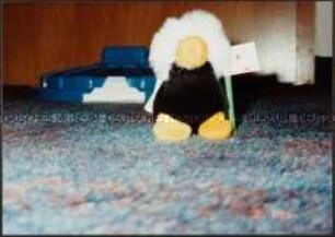
Plüschtier mit Fahne, im Hintergrund blauer Deckel eines Mülleimers (Sonderthema: Außerirdische)
Remarques sur le rapport des quatre périodes lunaires des Brames, avec les élémens des Tables de la Lune de Mayer
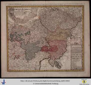
Circulus Austriacus

Junge in seinem Kinderzimmer (Altersgruppe 14-17)

Dvcatvs Silesiae Tabula geographica generalis : statui hodierno, ei nempe qui post pacem Dresdensem locum obtinet, adaptata, iustaque Graducatione rectificata

La Comte De Glatz : avec le Principaute de Munsterberg
Blauer Deckel eines Mülleimers liegt auf dem Teppich (Sonderthema: Außerirdische)
Herabhängende rote Stiefel vor einem Etagenbett mit darauf sitzender Person, einem Waschbecken und Bierdosen (Altersgruppe 14-17)
Karte von Polen und Litauen, 1:2 900 000, Kupferstich, 1773. - Aus: Atlas mapparum geographicarum generalium & specialium Centum Foliis compositum et quotidianis usibus accommodatum - Norimbergae, 1791 : Mappa Geographica Regni Poloniae : C. P. S. C. M. = Carte des Etats de la Couronne de Pologne / ex novissimis quotquot sunt mappis specialibus composita et ad LL. stereographica proiectionis revocata a Tob. Mayero, S. C. S. Luci publicae tradita per Homannianos Heredes. - [Ca. 1:2.900.000]. - Norimb.//Nürnberg, 1773. - 1 Kt : Kupferst ; 50 x 43 cm. - Maßstab in graph. Form (Milliaria Germanica, Leucae Gallicae). - Nullmeridian: Ferro
Karte von Polen und Litauen, 1:2 900 000, Kupferstich, 1773. - Aus: Atlas mapparum geographicarum generalium & specialium Centum Foliis compositum et quotidianis usibus accommodatum - Norimbergae, 1791 : Mappa Geographica Regni Poloniae : C. P. S. C. M. = Carte des Etats de la Couronne de Pologne / ex novissimis quotquot sunt mappis specialibus composita et ad LL. stereographica proiectionis revocata a Tob. Mayero, S. C. S. Luci publicae tradita per Homannianos Heredes. - [Ca. 1:2.900.000]. - Norimb.//Nürnberg, 1773. - 1 Kt : Kupferst ; 50 x 43 cm. - Maßstab in graph. Form (Milliaria Germanica, Leucae Gallicae). - Nullmeridian: Ferro
Karte von Polen und Litauen, 1:2 900 000, Kupferstich, 1773. - Aus: Atlas mapparum geographicarum generalium & specialium Centum Foliis compositum et quotidianis usibus accommodatum - Norimbergae, 1791 : Mappa Geographica Regni Poloniae : C. P. S. C. M. = Carte des Etats de la Couronne de Pologne / ex novissimis quotquot sunt mappis specialibus composita et ad LL. stereographica proiectionis revocata a Tob. Mayero, S. C. S. Luci publicae tradita per Homannianos Heredes. - [Ca. 1:2.900.000]. - Norimb.//Nürnberg, 1773. - 1 Kt : Kupferst ; 50 x 43 cm. - Maßstab in graph. Form (Milliaria Germanica, Leucae Gallicae). - Nullmeridian: Ferro
Blauer Deckel eines Mülleimers mit weißer Markierung liegt auf einem Teppich (Sonderthema: Außerirdische)
Plüschtier mit Fahne, im Hintergrund blauer Deckel eines Mülleimers (Sonderthema: Außerirdische)
Remarques sur le rapport des quatre périodes lunaires des Brames, avec les élémens des Tables de la Lune de Mayer
Circulus Austriacus
Junge in seinem Kinderzimmer (Altersgruppe 14-17)
Dvcatvs Silesiae Tabula geographica generalis : statui hodierno, ei nempe qui post pacem Dresdensem locum obtinet, adaptata, iustaque Graducatione rectificata
La Comte De Glatz : avec le Principaute de Munsterberg