
- Alternative title
-
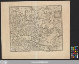
Comitatus Mansfeldiae descriptio
- Location
-
Universitäts- und Landesbibliothek Sachsen-Anhalt -- Altkt D II 7 [1] 3
- Extent
-
1 Karte; 36 x 46 cm, Kupferstich
- Language
-
Latein
- Notes
-
Maßstab in grafischer Form (Miliaria Germanica)
Titelkartusche oben rechts. - Verleger unten links. - Maßstab unten Mitte
Mit Bergzeichnung
Oben rechts: "XX"
Erschienen in: Nicolson, William: The English atlas. - Oxford : Pitt, 1681 ; vol. 2 : Containing the description of part of the empire of Germany ... ; Karte XX
Auctore Tilemanno Stella Sig.
Altkarte
- Contributor
- Published
-
[Oxford] : Apud Janssonio-Waesbergios, Mosem Pitt et Staphanum Swart , 1681
- Sponsorship
-
Die Digitalisierung wurde gefördert durch die Deutsche Digitale Bibliothek aus Mitteln des Programms „Neustart Kultur“ der Beauftragten der Bundesregierung für Kultur und Medien.
- DOI
-
doi:10.25673/39103
- URN
-
urn:nbn:de:gbv:3:3-1192015415-236520075-12
- Last update
-
03.06.2025, 7:51 AM CEST
Data provider
This object is provided by:
Martin-Luther-Universität Halle-Wittenberg, Universitäts- und Landesbibliothek Sachsen-Anhalt. If you have any questions about the object, please contact the data provider.
Martin-Luther-Universität Halle-Wittenberg, Universitäts- und Landesbibliothek Sachsen-Anhalt. If you have any questions about the object, please contact the data provider.
Object type
- Monografie
Associated
Time of origin
- [Oxford] : Apud Janssonio-Waesbergios, Mosem Pitt et Staphanum Swart , 1681
Other Objects (12)
Mansfeldiae Comitatvs Descriptio
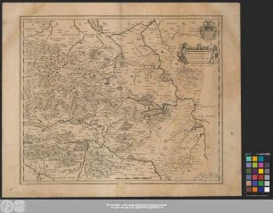
Mansfeldia Comitatvs
Comitatvs Mansfeldiæ Descripto

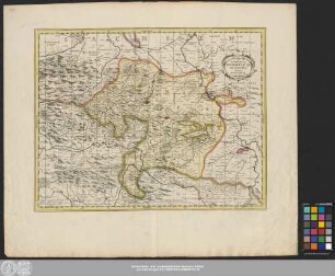
COMITATVS WERTHEIMICI FINITIMARVMOVE REGIONVM NOVA ET EXACTA DESCRIPTIO. Joannes Janssonius excudit

Hennenbergensis Comitatvs Origo.
COMITATVS WERTHEIMICI FINITIMARVMOVE REGIONVM NOVA ET EXACTA DESCRIPTIO. Joannes Janssonius excudit (Kupferstich)
COMITATVS WERTHEIMICI FINITIMARUMQUE REGIONVM NOVA ET EXACTA DESCRIPTIO. Joannes Jansson excudit (Kupferstich)

Comitatvs Marchia Et Ravensberg
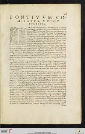
Pontivvm comitatvs, vvlgo Ponthiev

Kupferstich: Insigne Comitatvs Lapponiae

Kupferstich: Insigne Comitatvs Daaliae

Kupferstich: Insigne Comitatvs Nericiae
Mansfeldiae Comitatvs Descriptio
Mansfeldia Comitatvs
Comitatvs Mansfeldiæ Descripto
COMITATVS WERTHEIMICI FINITIMARVMOVE REGIONVM NOVA ET EXACTA DESCRIPTIO. Joannes Janssonius excudit
Hennenbergensis Comitatvs Origo.
COMITATVS WERTHEIMICI FINITIMARVMOVE REGIONVM NOVA ET EXACTA DESCRIPTIO. Joannes Janssonius excudit (Kupferstich)
COMITATVS WERTHEIMICI FINITIMARUMQUE REGIONVM NOVA ET EXACTA DESCRIPTIO. Joannes Jansson excudit (Kupferstich)
Comitatvs Marchia Et Ravensberg
Pontivvm comitatvs, vvlgo Ponthiev
Kupferstich: Insigne Comitatvs Lapponiae
Kupferstich: Insigne Comitatvs Daaliae