- Reference number
-
D 73, 5/1640
- Dimensions
-
Höhe: 97, Breite: 97, Maßstab: ca. 1:2.895
- Context
-
Allgemeine Kartensammlung (bisherige Kartei) >> 23. Tit. 5 (noch nicht klassifiziert) >> 23.9. Nr. 1601 - 1800
- Holding
-
D 73 Allgemeine Kartensammlung (bisherige Kartei)
- Date of creation
-
(19. Jh.)
- Other object pages
- Provenance
-
Behörden, Institutionen, Einzelpersonen (Sammlungen)
- Delivered via
- Last update
-
05.11.2025, 4:06 PM CET
Data provider
This object is provided by:
Landesarchiv Nordrhein-Westfalen. Abteilung Ostwestfalen-Lippe. If you have any questions about the object, please contact the data provider.
Landesarchiv Nordrhein-Westfalen. Abteilung Ostwestfalen-Lippe. If you have any questions about the object, please contact the data provider.
Object type
- Karten / Pläne
Time of origin
- (19. Jh.)
Other Objects (12)

Vermessungskarte der Pans-Heide (Amt Oerlinghausen);. Inselkarte
Brouillonkarte der kleinen Kachtenhauser Heide (Amt Oerlinghausen),. Inselkarte
Flurkarte der kleinen Kachtenhauser Heide (Amt Oerlinghausen);. Inselkarte

Vermessungskarte
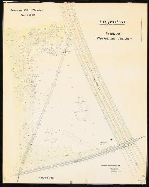
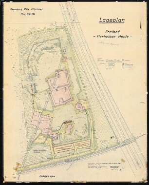
Freibad Merheimer Heide, Köln: Lageplan Vermessungskarte 1:500
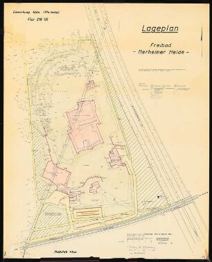
Freibad Merheimer Heide, Köln: Lageplan Vermessungskarte 1:500
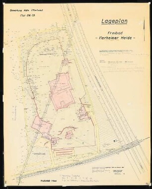
Freibad Merheimer Heide, Köln: Lageplan Vermessungskarte 1:500
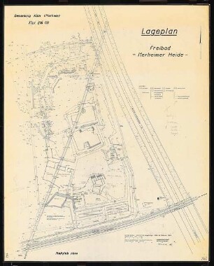
Freibad Merheimer Heide, Köln: Lageplan Vermessungskarte 1:500
Freibad Merheimer Heide, Köln: Lageplan Vermessungskarte 1:500
Postvereins-Vermessungskarte
Brouillonkarte vom Gut Dahlhausen (Amt Oerlinghausen);. Inselkarte
Karte der Menkhauser Berge (Amt Oerlinghausen),. Inselkarte
Vermessungskarte der Pans-Heide (Amt Oerlinghausen);. Inselkarte
Brouillonkarte der kleinen Kachtenhauser Heide (Amt Oerlinghausen),. Inselkarte
Flurkarte der kleinen Kachtenhauser Heide (Amt Oerlinghausen);. Inselkarte
Vermessungskarte
Freibad Merheimer Heide, Köln: Lageplan Vermessungskarte 1:500
Freibad Merheimer Heide, Köln: Lageplan Vermessungskarte 1:500
Freibad Merheimer Heide, Köln: Lageplan Vermessungskarte 1:500
Freibad Merheimer Heide, Köln: Lageplan Vermessungskarte 1:500
Freibad Merheimer Heide, Köln: Lageplan Vermessungskarte 1:500
Postvereins-Vermessungskarte
Brouillonkarte vom Gut Dahlhausen (Amt Oerlinghausen);. Inselkarte