Archivale
Liebenwalde. Topographische Karte mit Hammer, Zerpenschleuse, Kreuzbruch
- Archivaliensignatur
-
P.01.07_03.02.02-I-0008
- Sonstige Erschließungsangaben
-
Format in mm: 600 x 600
- Kontext
-
Karten und Pläne >> 03 Katasterkarte/ Topographische Karte >> 03.02 Niederbarnim >> 03.02.02 Messtischblatt
- Bestand
-
P.01.07 Karten und Pläne
- Laufzeit
-
(1883) 1942
- Weitere Objektseiten
- Letzte Aktualisierung
-
16.10.2025, 11:21 MESZ
Datenpartner
Dieses Objekt wird bereitgestellt von:
Kreisarchiv des Landkreises Barnim. Bei Fragen zum Objekt wenden Sie sich bitte an den Datenpartner.
Kreisarchiv des Landkreises Barnim. Bei Fragen zum Objekt wenden Sie sich bitte an den Datenpartner.
Objekttyp
- Archivale
Entstanden
- (1883) 1942
Ähnliche Objekte (12)

Statische Berechnung der Brücken: Kreuzbruch - Zerpenschleuse und Zehlendorf - Liebenwalde
Liebenwalde Krs. Niederbarnim: Kreuzbruch
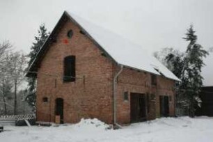
Kreuzbruch, Liebenwalde, Klosterfelder Chaussee 21
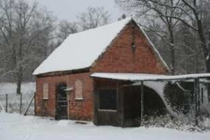
Kreuzbruch, Liebenwalde, Klosterfelder Chaussee 21
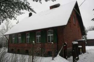
Kreuzbruch, Liebenwalde, Klosterfelder Chaussee 21
Kreuzbruch, Liebenwalde, Klosterfelder Chaussee 21
Kreuzbruch, Liebenwalde, Klosterfelder Chaussee 21
Planfeststellung für die Strecke Kreuzbruch - Zerpenschleuse
Kreuzbruch, Liebenwalde, Kreuzbrucher Straße 22 a
Liebenwalde Krs. Niederbarnim: Zinswiesen im Kreuzbruch
Liebenwalde Krs. Niederbarnim: Amtszinswiesen am Kreuzbruch
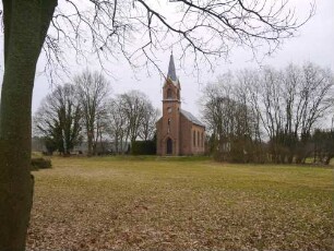
Reparatur der Kirchen zu Zerpenschleuse und Hammer, Amt Liebenwalde
Statische Berechnung der Brücken: Kreuzbruch - Zerpenschleuse und Zehlendorf - Liebenwalde
Liebenwalde Krs. Niederbarnim: Kreuzbruch
Kreuzbruch, Liebenwalde, Klosterfelder Chaussee 21
Kreuzbruch, Liebenwalde, Klosterfelder Chaussee 21
Kreuzbruch, Liebenwalde, Klosterfelder Chaussee 21
Kreuzbruch, Liebenwalde, Klosterfelder Chaussee 21
Kreuzbruch, Liebenwalde, Klosterfelder Chaussee 21
Planfeststellung für die Strecke Kreuzbruch - Zerpenschleuse
Kreuzbruch, Liebenwalde, Kreuzbrucher Straße 22 a
Liebenwalde Krs. Niederbarnim: Zinswiesen im Kreuzbruch
Liebenwalde Krs. Niederbarnim: Amtszinswiesen am Kreuzbruch