Karte / Plan
Fußwegausbau entlang der Hofer Straße in der Flur Oberlungwitz
Enthält: Fluchtlinien- und Lagepläne, Teil I (Bl. 1), Teil III (Bl. 1, Bl. 2).
- Reference number
-
30045 Amtshauptmannschaft Glauchau, Nr. K 2/2 (Zu benutzen im Staatsarchiv Chemnitz)
- Context
-
30045 Amtshauptmannschaft Glauchau >> 20. Bausachen >> 20.04. Straßenbau/-planung >> 20.04.05. Landstraßen
- Holding
-
30045 Amtshauptmannschaft Glauchau
- Date of creation
-
1929 - 1930
- Other object pages
- Last update
-
10.12.2025, 3:09 PM CET
Data provider
This object is provided by:
Sächsisches Staatsarchiv. If you have any questions about the object, please contact the data provider.
Sächsisches Staatsarchiv. If you have any questions about the object, please contact the data provider.
Object type
- Karten und Pläne
Time of origin
- 1929 - 1930
Other Objects (12)

Fußwegausbau entlang der Hofer Straße in der Flur Oberlungwitz
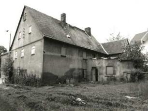
Oberlungwitz, Hofer Straße 157. Ehemalige Postschmiede
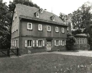
Oberlungwitz, Hofer Straße 62. Wohnhaus mit Werkstattanbau (ab 1800)
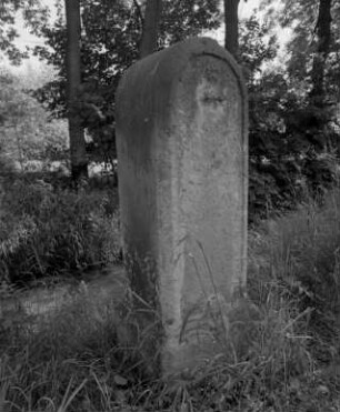
Ganzmeilensäule : Oberlungwitz (Kreis Chemnitzer Land), Hofer Straße. Ganzmeilensäule, Sandstein
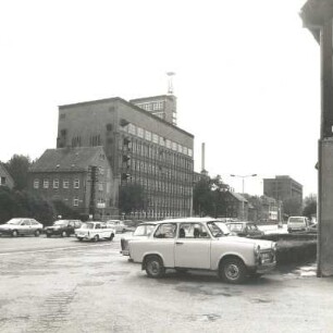
Oberlungwitz, Hofer Straße 32. Feinstrumpfwerke GmbH (FSO). Fabrikationsgebäude. Straßenansicht
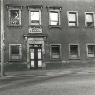
Oberlungwitz, Hofer Straße 197. Städtisches Pflegeheim (2. H. 19. Jh.). Haupteingang
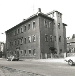
Oberlungwitz, Hofer Straße 197. Städtisches Pflegeheim (2. H. 19. Jh.). Straßenansicht
Grenzfestsetzungen der Hofer Straße B, der Lerchenstraße und der Straße Wüstenbrand - Glauchau in den Fluren Hohenstein, Ernstthal und Oberlungwitz
Hofer Straße
Hofer Straße
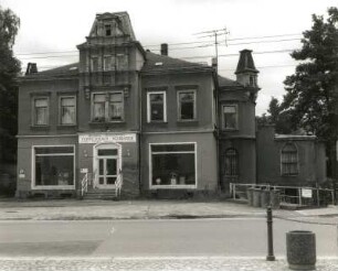
Oberlungwitz, Hofer Straße 64. Wohnhaus mit Ladeneinbaus (ehemals Gasthof "Lamm") (um 1890)
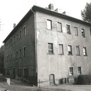
Oberlungwitz, Hofer Straße 197. Städtisches Pflegeheim (2. H. 19. Jh.). Hofansicht (Teilansicht)
Fußwegausbau entlang der Hofer Straße in der Flur Oberlungwitz
Oberlungwitz, Hofer Straße 157. Ehemalige Postschmiede
Oberlungwitz, Hofer Straße 62. Wohnhaus mit Werkstattanbau (ab 1800)
Ganzmeilensäule : Oberlungwitz (Kreis Chemnitzer Land), Hofer Straße. Ganzmeilensäule, Sandstein
Oberlungwitz, Hofer Straße 32. Feinstrumpfwerke GmbH (FSO). Fabrikationsgebäude. Straßenansicht
Oberlungwitz, Hofer Straße 197. Städtisches Pflegeheim (2. H. 19. Jh.). Haupteingang
Oberlungwitz, Hofer Straße 197. Städtisches Pflegeheim (2. H. 19. Jh.). Straßenansicht
Grenzfestsetzungen der Hofer Straße B, der Lerchenstraße und der Straße Wüstenbrand - Glauchau in den Fluren Hohenstein, Ernstthal und Oberlungwitz
Hofer Straße
Hofer Straße
Oberlungwitz, Hofer Straße 64. Wohnhaus mit Ladeneinbaus (ehemals Gasthof "Lamm") (um 1890)