- Reference number
-
AKS 1567 A/ÜF
- Context
-
Allgemeine Kartensammlung >> Gewässer und Wasserbau >> Provinz Brandenburg (1815 - 1945) >> Einzelne Gewässer
- Holding
-
AKS (112517) Allgemeine Kartensammlung
- Date of creation
-
1855-1863
- Other object pages
- View digital item at providers-website
- Last update
-
07.04.2025, 11:30 AM CEST
Data provider
This object is provided by:
Brandenburgisches Landeshauptarchiv. If you have any questions about the object, please contact the data provider.
Brandenburgisches Landeshauptarchiv. If you have any questions about the object, please contact the data provider.
Object type
- Archivale
Time of origin
- 1855-1863
Other Objects (12)

Grundprojekt Umlegung des Oberen Landgrabens
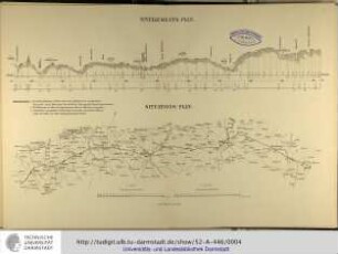
Nivellements-Plan / Situations-Plan
Situations- & Nivellementsplan über die projektierte Anlage einer Wasserleitung aus der oberen Hitschelsbach nach Siegen
Schauordnung des oberen Landgrabens und der Sornoer Elster
Regulierung des oberen Landgrabens und der Sornoer Elster
Situations- und Nivellementsplan der Müllroser Bahnhofschaussee
Situations- und Nivellementsplan der Dorflage Meinsdorf
Situations- und Nivellementsplan des Dorfes Niesen
Leipzig - Dresdner Eisenbahn. Situations- und Nivellementsplan
Situations- und Nivellementsplan des Havelländischen Hauptkanals
![[Situations- und Nivellementsplan eines unbekannten Wasserlaufs].](https://iiif.deutsche-digitale-bibliothek.de/image/2/93322303-2708-4f5a-bd99-8326b1e0f4d3/full/!306,450/0/default.jpg)
[Situations- und Nivellementsplan eines unbekannten Wasserlaufs].
Revision und die Regulierung des oberen Landgrabens im Kreise
Grundprojekt Umlegung des Oberen Landgrabens
Nivellements-Plan / Situations-Plan
Situations- & Nivellementsplan über die projektierte Anlage einer Wasserleitung aus der oberen Hitschelsbach nach Siegen
Schauordnung des oberen Landgrabens und der Sornoer Elster
Regulierung des oberen Landgrabens und der Sornoer Elster
Situations- und Nivellementsplan der Müllroser Bahnhofschaussee
Situations- und Nivellementsplan der Dorflage Meinsdorf
Situations- und Nivellementsplan des Dorfes Niesen
Leipzig - Dresdner Eisenbahn. Situations- und Nivellementsplan
Situations- und Nivellementsplan des Havelländischen Hauptkanals
[Situations- und Nivellementsplan eines unbekannten Wasserlaufs].