- Alternative title
-
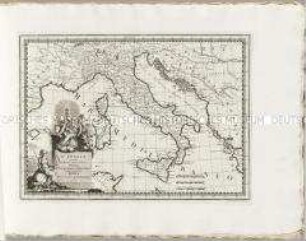
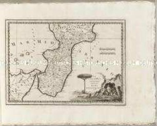
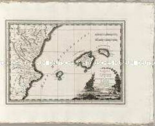
LA CAMPAGNA / DI ROMA / IL PATRIMONIO / DI S. PIETRO
- Location
-
Deutsches Historisches Museum, Berlin
- Inventory number
-
Do 2006/579.17
- Measurements
-
Höhe x Breite: 47 x 68 cm (Blatt)
Höhe x Breite: 30,5 x 43,5 cm (Karte)
Höhe x Breite: 35,3 x 48,5 cm (Platte)
- Material/Technique
-
Papier, Kupferstich
- Classification
-
Kartografie (Gattung)
- Subject (what)
-
Italien
Latium
Sabina
Kirchenstaat
- Event
-
Herstellung
- (who)
-
Stecher: Giovanni Maria Cassini
Verlag: Calcografia Camerale
- (where)
-
Rom, Italien
- (when)
-
1790
- Rights
-
Deutsches Historisches Museum
- Last update
-
24.03.2023, 9:29 AM CET
Data provider
This object is provided by:
Stiftung Deutsches Historisches Museum. If you have any questions about the object, please contact the data provider.
Stiftung Deutsches Historisches Museum. If you have any questions about the object, please contact the data provider.
Object type
- Regionalkarte
Associated
- Stecher: Giovanni Maria Cassini
- Verlag: Calcografia Camerale
Time of origin
- 1790
Other Objects (12)
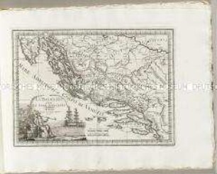
Nuovo Atlante Geografico Universale: La Dalmazia
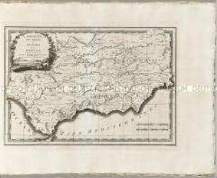
Nuovo Atlante Geografico Universale: L'Andalusia
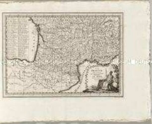
Nuovo Atlante Geografico Universale: La Francia
Nuovo Atlante Geografico Universale: L'Italia
Nuovo Atlante Geografico Universale: La Calabria ulteriore
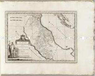
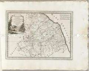
Nuovo Atlante Geografico Universale: Lo Stato Ecclesiastico
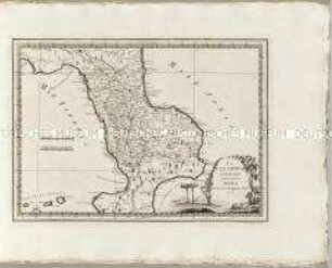
Nuovo Atlante Geografico Universale: La Calabria citeriore
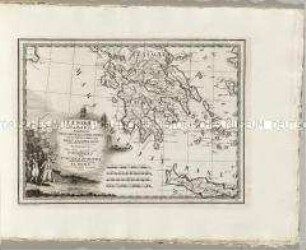
Nuovo Atlante Geografico Universale: La Morea La Livadia
Nuovo Atlante Geografico Universale: Il Regno di Valenza

Nuovo Atlante Geografico Universale: Parte dell'Asia Minore
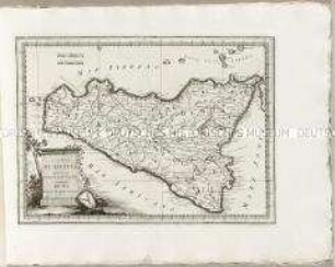
Nuovo Atlante Geografico Universale: L'Isola di Sicilia
Nuovo Atlante Geografico Universale: La Legazione D'Urbino
Nuovo Atlante Geografico Universale: La Dalmazia
Nuovo Atlante Geografico Universale: L'Andalusia
Nuovo Atlante Geografico Universale: La Francia
Nuovo Atlante Geografico Universale: L'Italia
Nuovo Atlante Geografico Universale: La Calabria ulteriore
Nuovo Atlante Geografico Universale: Lo Stato Ecclesiastico
Nuovo Atlante Geografico Universale: La Calabria citeriore
Nuovo Atlante Geografico Universale: La Morea La Livadia
Nuovo Atlante Geografico Universale: Il Regno di Valenza
Nuovo Atlante Geografico Universale: Parte dell'Asia Minore
Nuovo Atlante Geografico Universale: L'Isola di Sicilia