Karte / Plan
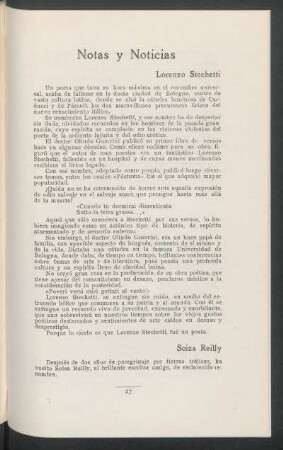
Walachei (Fürstentum) Übersichtskarte 1791 15 dt. Meilen = 8,85 cm 22 x 32,5 Druck F. J. J. Reilly Landsberg-Velen Nr. 721
- Former reference number
-
Landsberg-Velen 721
- Further information
-
Ort: Fürstentum Walachei
- Context
-
Karten A (Allgemein) >> 1. Topographische Karte, Übersichtskarten >> 1.2. Übersichtskarten >> 1.2.2. einzelne Orte
- Holding
-
W 051 Karten A (Allgemein)
- Indexentry place
-
Fürstentum Walachei
Walachei, Fürstentum, Übersicht, 1791
- Date of creation
-
1791
- Other object pages
- Provenance
-
Sammlungsregistraturbildner
- Delivered via
- Last update
-
05.11.20252025, 12:04 AM CET
Data provider
This object is provided by:
Landesarchiv Nordrhein-Westfalen. Abteilung Westfalen. If you have any questions about the object, please contact the data provider.
Landesarchiv Nordrhein-Westfalen. Abteilung Westfalen. If you have any questions about the object, please contact the data provider.
Object type
- Karten / Pläne
Time of origin
- 1791
Other Objects (12)

Bessarabien Übersichtskarte 1791 13 dt. Meilen = 9,5 cm 22 x 29,5 Druck F. J. J. Reilly Landsberg-Velen Nr. 721

Serbien (Königreich) Übersichtskarte 1791 15 dt. Meilen = 7,6 cm 29 x 23 Druck F. J. J. Reilly Landsberg-Velen Nr. 721

Slawonien (Königreich) Syrmien Übersichtskarte 1791 15 dt. Meilen = 10,4 cm 20 x 30 Druck F. J. J. Reilly Landsberg-Velen Nr. 721

Flandern (Grafschaft) Übersichtskarte 1791 4 dt. Meilen = 6,8 cm 24,5 x 33 Druck F. J. J. Reilly Landsberg-Velen Nr. 721

Ungarn (Königreich) Übersichtskarte 1791 15 dt. Meilen = 4 cm 23,5 x 31,5 Druck F. J. J. Reilly Landsberg-Velen Nr. 721

Siebenbürgen (Großfürstentum) Übersichtskarte 1791 15 dt. Meilen = 7,9 cm 22,5 x 30 Druck F. J. J. Reilly Landsberg-Velen Nr. 721

Bukowina Übersichtskarte Nr. 8 1791 12 dt. Meilen = 9 cm 22,5 x 30 Druck F. J. J. Reilly Landsberg-Velen Nr. 721

Zweibrücken (Herzogtum) Übersichtskarte 1791 4 dt. Meilen = 6,5 cm 26 x 30,5 Druck F. J. J. Reilly Landsberg-Velen Nr. 721

Waldeck (Grafschaft) Übersichtskarte 1791 3 dt. Meilen = 8,5 cm 23 x 26,5 Druck F. J. J. Reilly Landsberg-Velen Nr. 721
Soiza Reilly

Mamie Reilly

Banat Temeschwar Übersichtskarte Nr. 6 1791 10 dt. Meilen = 9,3 cm 22 x 29,5 Druck F. J. J. Reilly Landsberg-Velen Nr. 721
Bessarabien Übersichtskarte 1791 13 dt. Meilen = 9,5 cm 22 x 29,5 Druck F. J. J. Reilly Landsberg-Velen Nr. 721
Serbien (Königreich) Übersichtskarte 1791 15 dt. Meilen = 7,6 cm 29 x 23 Druck F. J. J. Reilly Landsberg-Velen Nr. 721
Slawonien (Königreich) Syrmien Übersichtskarte 1791 15 dt. Meilen = 10,4 cm 20 x 30 Druck F. J. J. Reilly Landsberg-Velen Nr. 721
Flandern (Grafschaft) Übersichtskarte 1791 4 dt. Meilen = 6,8 cm 24,5 x 33 Druck F. J. J. Reilly Landsberg-Velen Nr. 721
Ungarn (Königreich) Übersichtskarte 1791 15 dt. Meilen = 4 cm 23,5 x 31,5 Druck F. J. J. Reilly Landsberg-Velen Nr. 721
Siebenbürgen (Großfürstentum) Übersichtskarte 1791 15 dt. Meilen = 7,9 cm 22,5 x 30 Druck F. J. J. Reilly Landsberg-Velen Nr. 721
Bukowina Übersichtskarte Nr. 8 1791 12 dt. Meilen = 9 cm 22,5 x 30 Druck F. J. J. Reilly Landsberg-Velen Nr. 721
Zweibrücken (Herzogtum) Übersichtskarte 1791 4 dt. Meilen = 6,5 cm 26 x 30,5 Druck F. J. J. Reilly Landsberg-Velen Nr. 721
Waldeck (Grafschaft) Übersichtskarte 1791 3 dt. Meilen = 8,5 cm 23 x 26,5 Druck F. J. J. Reilly Landsberg-Velen Nr. 721
Soiza Reilly
Mamie Reilly