- Reference number
-
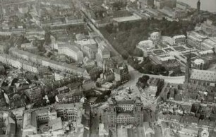
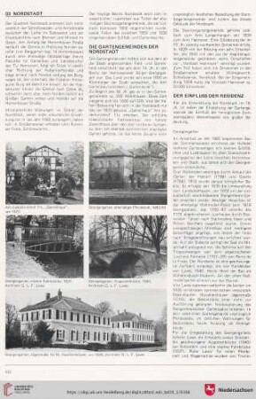
D 30/KE 48
- Former reference number
-
prefix: D 30/KE
- Dimensions
-
83 x 120 cm
- Formal description
-
N: Schönbuch / S: Neckar / W: Aischbach/Sindelfinger Straße / O: Adlerkreuzung Lustnau
- Material
-
Fotopapier
- Notes
-
Brugger-Luftbild Nr. 2/62758; 1997 erhalten vom Stadtplanungsamt/Inv. Verz. 750.
- Further information
-
Ausführung: Fotografie
Druck / Verlag: Brugger, Albrecht (Fotograf)
- Context
-
D 30 Karten- und Plansammlung >> Luftaufnahmen
- Holding
-
D 30 Karten- und Plansammlung
- Indexbegriff subject
-
Altstadt, Luftbild
Luftbild, Altstadt und Nordstadt
Nordstadt, Luftbild
- Date of creation
-
ca. 1985
- Other object pages
- Last update
-
29.04.2025, 8:34 AM CEST
Data provider
This object is provided by:
Stadtarchiv Tübingen. If you have any questions about the object, please contact the data provider.
Stadtarchiv Tübingen. If you have any questions about the object, please contact the data provider.
Object type
- Karte und Plan
Time of origin
- ca. 1985
Other Objects (12)

Luftbild mit Klinikviertel, nördlicher Altstadt und Nordstadt
Dresden-Altstadt. Postplatz und Zwinger. Luftbild-Schrägaufnahme von Südsüdost
Sebnitz. Stadtansicht. Luftbild-Schrägaufnahme von Südsüdost
Nordstadt
Dresden: Altstadt mit Zwinger, Neu- und Altmarkt. Luftbild-Schrägaufnahme von Süd-Südost
Dresden: Friedrichstadt und Altstadt mit Bahnhof Wettiner Straße. Luftbild-Schrägaufnahme von Süd-Südost

Lindener Nordstadt
Bürgerversammlungen Nordstadt
03 Nordstadt
Ortsbeirat Nordstadt
Wärmenetz Nordstadt
Gasrohrnetz Nordstadt
Luftbild mit Klinikviertel, nördlicher Altstadt und Nordstadt
Dresden-Altstadt. Postplatz und Zwinger. Luftbild-Schrägaufnahme von Südsüdost
Sebnitz. Stadtansicht. Luftbild-Schrägaufnahme von Südsüdost
Nordstadt
Dresden: Altstadt mit Zwinger, Neu- und Altmarkt. Luftbild-Schrägaufnahme von Süd-Südost
Dresden: Friedrichstadt und Altstadt mit Bahnhof Wettiner Straße. Luftbild-Schrägaufnahme von Süd-Südost
Lindener Nordstadt
Bürgerversammlungen Nordstadt
03 Nordstadt
Ortsbeirat Nordstadt
Wärmenetz Nordstadt