Karte
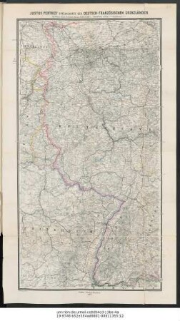
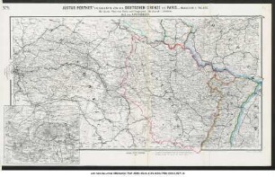
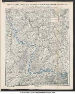
Justus Perthes' Specialkarte der deutsch-französischen Grenzländer von Mainz bis zur Nordsee (Aus Stielers 25-Blatt-Karte)

- Alternative title
-
Specialkarte der deutsch-französischen Grenzländer von Mainz bis zur Nordsee
- Location
-
Forschungsbibliothek Gotha -- SPA 4° 00415 (24)
- Extent
-
1 Kt, 35 x 61 cm
- Language
-
Deutsch
- Notes
-
Nullmeridian: Ferro. - Maßstab in graph. Form (Deutsche Meilen). - Mit Bergstrichen mutmaßl. Teil eines Gesamtwerkes, enthält Zählung: Nr. 5 Druck v. C. Hellfarth in Gotha Auch in: Stielers 25-Blatt-Karte Sammlung Perthes
- Contributor
- Published
-
Gotha : Justus Perthes ; Hellfarth , 1870
- URN
-
urn:nbn:de:urmel-2611acc2-43d2-4130-ac84-f25d519313406-00011418-17
- PURL
- Last update
-
14.04.2025, 12:54 PM CEST
Data provider
This object is provided by:
Forschungsbibliothek Gotha der Universität Erfurt. If you have any questions about the object, please contact the data provider.
Forschungsbibliothek Gotha der Universität Erfurt. If you have any questions about the object, please contact the data provider.
Object type
- Karte
Associated
Time of origin
- Gotha : Justus Perthes ; Hellfarth , 1870
Other Objects (12)
Justus Perthes' Specialkarte der deutsch-französischen Grenzländer bis Wesel, Basel, Bodensee, Hanau, Lüttich, Metz

Justus Perthes' Specialkarte der norddeutschen Küstenländer von der I. Rügen bis Königsberg (Aus Stielers 25-Blatt-Karte)

Justus Perthes' Specialkarte der norddeutschen Küstenländer von Emden & Borkum bis zur Insel Rügen (Aus Stielers 25-Blatt-Karte)
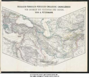
Russisch-Turkisch-Persisch-Englische Grenzländer von Bosnien bis Kaschgar und Indien
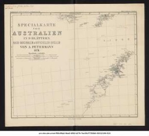
Specialkarte von Australien in 9 Blättern : nach originalen & officiellen Quellen
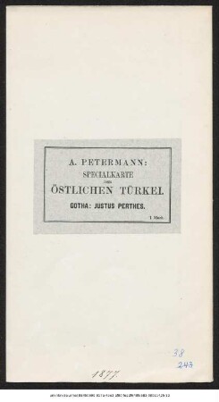
Specialkarte der östlichen Türkei
Justus Perthes' Übersichtskarte der westdeutschen Grenzlande von Kopenhagen bis Basel und von Chalons bis München
Justus Perthes' Specialkarte der deutschen Grenze bis Paris : mit einem Plan von Paris und Umgegend
Justus Perthes' Specialkarte der deutsch-französischen Grenzländer von Mainz bis Bern (Aus Stielers 25-Blatt-Karte)
Justus Perthes' Karte der deutsch-französischen Grenzländer von Köln bis Bern und von Metz bis Ulm : mit Special-Cartons der Festungen Mainz, Saarlouis, Landau, Germersheim, Rastatt, Ulm
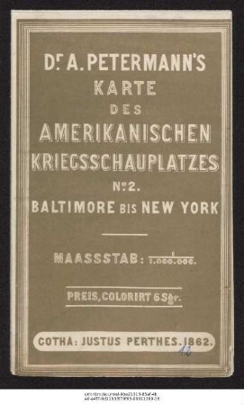
Der amerikanische Kriegsschauplatz zwischen Baltimore & New York
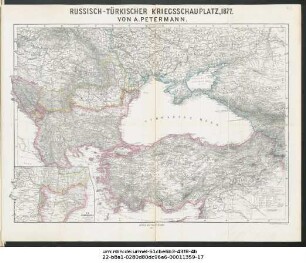
Russisch-Türkischer Kriegsschauplatz 1877
Justus Perthes' Specialkarte der deutsch-französischen Grenzländer bis Wesel, Basel, Bodensee, Hanau, Lüttich, Metz
Justus Perthes' Specialkarte der norddeutschen Küstenländer von der I. Rügen bis Königsberg (Aus Stielers 25-Blatt-Karte)
Justus Perthes' Specialkarte der norddeutschen Küstenländer von Emden & Borkum bis zur Insel Rügen (Aus Stielers 25-Blatt-Karte)
Russisch-Turkisch-Persisch-Englische Grenzländer von Bosnien bis Kaschgar und Indien
Specialkarte von Australien in 9 Blättern : nach originalen & officiellen Quellen
Specialkarte der östlichen Türkei
Justus Perthes' Übersichtskarte der westdeutschen Grenzlande von Kopenhagen bis Basel und von Chalons bis München
Justus Perthes' Specialkarte der deutschen Grenze bis Paris : mit einem Plan von Paris und Umgegend
Justus Perthes' Specialkarte der deutsch-französischen Grenzländer von Mainz bis Bern (Aus Stielers 25-Blatt-Karte)
Justus Perthes' Karte der deutsch-französischen Grenzländer von Köln bis Bern und von Metz bis Ulm : mit Special-Cartons der Festungen Mainz, Saarlouis, Landau, Germersheim, Rastatt, Ulm
Der amerikanische Kriegsschauplatz zwischen Baltimore & New York