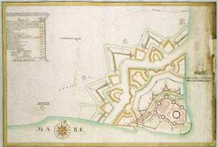
Karte/Plan
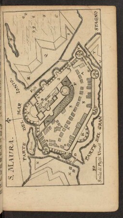
WHK 6 Ungarisch-Türkischer Krieg von 1683-1699 bis zum Frieden von Carlow: Festung Santa Maura, 1684
- Archivaliensignatur
-
WHK 6/8
- Maße
-
800x380 mm
- Sonstige Erschließungsangaben
-
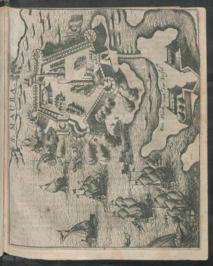
Identifikation (Karte/Plan): Originaltitel: Planta di Sta. Maura
Identifikation (Karte/Plan): Inhaltliche Beschreibung: Legende in italienischer Sprache
Weitere Angaben (Karte/Plan): Maßstab: 150 venetianische Schritte = 9,7 cm [1:20.000]
Weitere Angaben (Karte/Plan): Ausführung: Handzeichnung, koloriert
Weitere Angaben (Karte/Plan): Blattzahl: 1
- Kontext
-
Wilhelmshöher Kriegskarten >> Einzelne Kriege und Schlachtordnungen >> WHK 6 Ungarisch-Türkischer Krieg von 1683-1699 bis zum Frieden von Carlow
- Bestand
-
WHK Wilhelmshöher Kriegskarten
- Urheber
-
Sebas. Alberti
- Laufzeit
-
1685
- Weitere Objektseiten
- Letzte Aktualisierung
-
10.06.2025, 09:13 MESZ
Datenpartner
Dieses Objekt wird bereitgestellt von:
Hessisches Staatsarchiv Marburg. Bei Fragen zum Objekt wenden Sie sich bitte an den Datenpartner.
Hessisches Staatsarchiv Marburg. Bei Fragen zum Objekt wenden Sie sich bitte an den Datenpartner.
Objekttyp
- Karte/Plan
Beteiligte
- Sebas. Alberti
Entstanden
- 1685
Ähnliche Objekte (12)
WHK 6 Ungarisch-Türkischer Krieg von 1683-1699 bis zum Frieden von Carlow: Festung Prevesa, erobert durch die Venetianer, 1684
WHK 6 Ungarisch-Türkischer Krieg von 1683-1699 bis zum Frieden von Carlow: Index zu "Ungarisch-Türkischer Krieg von 1683-1699 bis zum Frieden von Carlow"
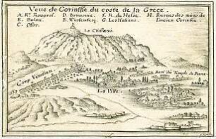
WHK 6 Ungarisch-Türkischer Krieg von 1683-1699 bis zum Frieden von Carlow: Belagerung von Korinth, 1688
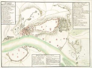
WHK 6 Ungarisch-Türkischer Krieg von 1683-1699 bis zum Frieden von Carlow: Festung von Buda, 1686
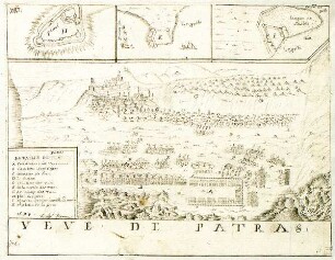
WHK 6 Ungarisch-Türkischer Krieg von 1683-1699 bis zum Frieden von Carlow: Ansicht von Patras, 1687
S. Maura
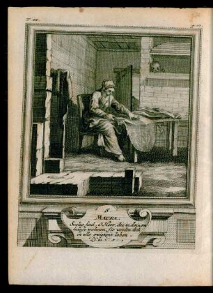
Á Maura
S. Maura
S. Maura.
St. Maura.
Santa Maura

Maura, Miguel
WHK 6 Ungarisch-Türkischer Krieg von 1683-1699 bis zum Frieden von Carlow: Festung Prevesa, erobert durch die Venetianer, 1684
WHK 6 Ungarisch-Türkischer Krieg von 1683-1699 bis zum Frieden von Carlow: Index zu "Ungarisch-Türkischer Krieg von 1683-1699 bis zum Frieden von Carlow"
WHK 6 Ungarisch-Türkischer Krieg von 1683-1699 bis zum Frieden von Carlow: Belagerung von Korinth, 1688
WHK 6 Ungarisch-Türkischer Krieg von 1683-1699 bis zum Frieden von Carlow: Festung von Buda, 1686
WHK 6 Ungarisch-Türkischer Krieg von 1683-1699 bis zum Frieden von Carlow: Ansicht von Patras, 1687
S. Maura
Á Maura
S. Maura
S. Maura.
St. Maura.
Santa Maura