Karte / Plan
Lippe: Darstellung der Lippe mit Schleusen und Staustufen von den Daperhöfen bis zum Büdericher Rheinkanal bei Wesel (Flusskilometer 175 bis 182)
- Former reference number
-
Lippe-Verband (Dep.)
- Dimensions
-
Höhe: 61 cm, Breite: 217 cm
- Further information
-
Ort: Lippe
- Context
-
Karten A (Allgemein) >> 3. Gewässer >> 3.1. Gewässer / Wasserbau >> 3.1.3. Lippe
- Holding
-
W 051 Karten A (Allgemein)
- Indexentry place
-
Lippe
- Date of creation
-
o. D.
- Other object pages
- Provenance
-
Sammlungsregistraturbildner
- Delivered via
- Last update
-
05.11.2025, 3:33 PM CET
Data provider
This object is provided by:
Landesarchiv Nordrhein-Westfalen. Abteilung Westfalen. If you have any questions about the object, please contact the data provider.
Landesarchiv Nordrhein-Westfalen. Abteilung Westfalen. If you have any questions about the object, please contact the data provider.
Object type
- Karten / Pläne
Time of origin
- o. D.
Other Objects (12)

Lippe: Darstellung der Lippe mit Schleusen und Staustufen (Flusskilometer 167 bis 174)

Staustufen
Staustufen

Lippe: geplante Durchstiche bei Wesel zwischen Drewenack Schwarzenstein und dem Büdericher Kanal
Büdericher Schützenfest
Büdericher Buschordnung
Büdericher Adventsmarkt
Büdericher Adventsmarkt
Büdericher Heimatblätter
Büdericher Buschordnung

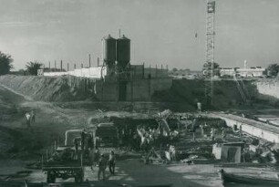
Staustufen, 1960-1961
Staustufen, 1960-1961
Lippe: Darstellung der Lippe mit Schleusen und Staustufen (Flusskilometer 167 bis 174)
Staustufen
Staustufen
Lippe: geplante Durchstiche bei Wesel zwischen Drewenack Schwarzenstein und dem Büdericher Kanal
Büdericher Schützenfest
Büdericher Buschordnung
Büdericher Adventsmarkt
Büdericher Adventsmarkt
Büdericher Heimatblätter
Büdericher Buschordnung
Staustufen, 1960-1961
Staustufen, 1960-1961
Lippe: Darstellung der Lippe mit Schleusen und Staustufen (Flusskilometer 167 bis 174)
Staustufen
Staustufen
Lippe: geplante Durchstiche bei Wesel zwischen Drewenack Schwarzenstein und dem Büdericher Kanal
Büdericher Schützenfest
Büdericher Buschordnung
Büdericher Adventsmarkt
Büdericher Adventsmarkt
Büdericher Heimatblätter
Büdericher Buschordnung
Staustufen, 1960-1961