Politisch-geografische Karte | Zeitung
Karte von Deutschland und den angrenzenden Staaten aus der "Deutschen Allgemeinen Zeitung"
- Alternativer Titel
-
Karte von 13 (Grad) bis 23 (Grad) östlicher Länge
- Standort
-
Deutsches Historisches Museum, Berlin
- Inventarnummer
-
Do 87/533II
- Maße
-
Höhe x Breite: 53 x 37,4 cm
- Material/Technik
-
Papier, gedruckt
- Klassifikation
-
Kartografie (Gattung)
- Bezug (was)
-
Geographie
Weltkrieg, 2.
- Ereignis
-
Herstellung
- (wer)
-
Verlag: Deutscher Verlag
- (wo)
-
Berlin, Deutschland [historisch: Deutsches Reich]
- (wann)
-
02.09.1939
- Rechteinformation
-
Deutsches Historisches Museum
- Letzte Aktualisierung
-
24.03.2023, 09:27 MEZ
Datenpartner
Dieses Objekt wird bereitgestellt von:
Stiftung Deutsches Historisches Museum. Bei Fragen zum Objekt wenden Sie sich bitte an den Datenpartner.
Stiftung Deutsches Historisches Museum. Bei Fragen zum Objekt wenden Sie sich bitte an den Datenpartner.
Objekttyp
- Politisch-geografische Karte; Zeitung
Beteiligte
- Verlag: Deutscher Verlag
Entstanden
- 02.09.1939
Ähnliche Objekte (12)
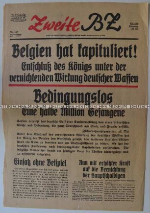
Titelseite der Tageszeitung "Zweite BZ" mit Leitartikel zur Kapitulation Belgiens

Titelblatt der "Deutschen Allgemeinen Zeitung" überwiegend zu internationalen Themen
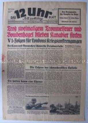
Berliner Tageszeitung "Das 12 Uhr Blatt" zu den Kämpfen in Nordfrankreich und zum Einsatz der V 1 gegen England
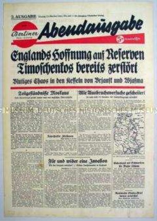
Titelblatt der Abendausgabe der "Berliner Volks-Zeitung" zum Krieg gegen die Sowjetunion
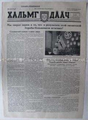
Kriegszeitung für kalmückische Kollaborateure in der Wehrmacht "Der kalmückische Kämpfer"
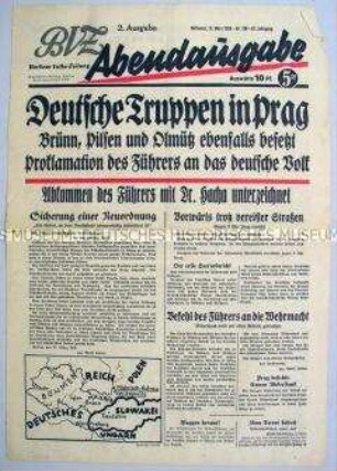
Titelblatt der Abendausgabe der "Berliner Volks-Zeitung" zur Annexion des tschechischen Teils der Tschechoslowakei
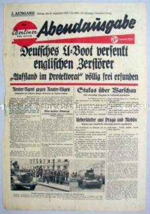
Titelblatt der Abendausgabe der "Berliner Volks-Zeitung" zum Seekrieg gegen England

Abendausgabe der "Berliner Volks-Zeitung" zu den Kämpfen an der Ostfront

Titelblatt der Abendausgabe der "Berliner Volks-Zeitung" zum Vordringen deutscher Truppen in Polen
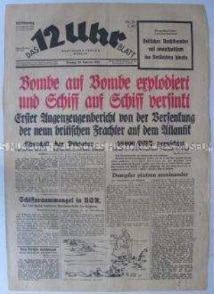
Titelblatt der Berliner Tageszeitung "Das 12 Uhr Blatt" zum Luft- und Seekrieg gegen Großbritannien
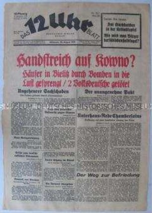
Titelblatt der Berliner Tageszeitung "Das 12 Uhr Blatt" zur Lage in Polen am Vorabend des Überfalls der Wehrmacht
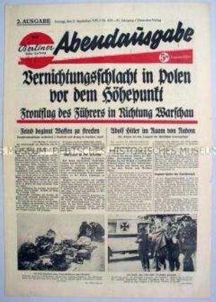
Abendausgabe der "Berliner Volks-Zeitung" zum Vordringen deutscher Truppen in Polen
Titelseite der Tageszeitung "Zweite BZ" mit Leitartikel zur Kapitulation Belgiens
Titelblatt der "Deutschen Allgemeinen Zeitung" überwiegend zu internationalen Themen
Berliner Tageszeitung "Das 12 Uhr Blatt" zu den Kämpfen in Nordfrankreich und zum Einsatz der V 1 gegen England
Titelblatt der Abendausgabe der "Berliner Volks-Zeitung" zum Krieg gegen die Sowjetunion
Kriegszeitung für kalmückische Kollaborateure in der Wehrmacht "Der kalmückische Kämpfer"
Titelblatt der Abendausgabe der "Berliner Volks-Zeitung" zur Annexion des tschechischen Teils der Tschechoslowakei
Titelblatt der Abendausgabe der "Berliner Volks-Zeitung" zum Seekrieg gegen England
Abendausgabe der "Berliner Volks-Zeitung" zu den Kämpfen an der Ostfront
Titelblatt der Abendausgabe der "Berliner Volks-Zeitung" zum Vordringen deutscher Truppen in Polen
Titelblatt der Berliner Tageszeitung "Das 12 Uhr Blatt" zum Luft- und Seekrieg gegen Großbritannien
Titelblatt der Berliner Tageszeitung "Das 12 Uhr Blatt" zur Lage in Polen am Vorabend des Überfalls der Wehrmacht