Karte / Plan
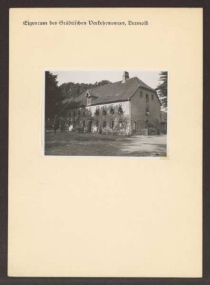
Querschnitt, Grundriss von der Bock- und Bohrmühle bei der Mittelmühle in Detmold
- Reference number
-
D 73, 4/6304
- Dimensions
-
Höhe: 37, Breite: 32, Maßstab: ca. 1:85
- Context
-
Allgemeine Kartensammlung (bisherige Kartei) >> 22. Tit. 4 (noch nicht klassifiziert) >> 22.16. Nr. 6201 - 6400
- Holding
-
D 73 Allgemeine Kartensammlung (bisherige Kartei)
- Date of creation
-
(ca. 19. Jh.)
- Other object pages
- Provenance
-
Behörden, Institutionen, Einzelpersonen (Sammlungen)
- Delivered via
- Last update
-
05.11.2025, 3:09 PM CET
Data provider
This object is provided by:
Landesarchiv Nordrhein-Westfalen. Abteilung Ostwestfalen-Lippe. If you have any questions about the object, please contact the data provider.
Landesarchiv Nordrhein-Westfalen. Abteilung Ostwestfalen-Lippe. If you have any questions about the object, please contact the data provider.
Object type
- Karten / Pläne
Time of origin
- (ca. 19. Jh.)
Other Objects (12)

Ansicht, Querschnitt, Grundrisse von der Mittelmühle in Detmold
Ansicht, Querschnitt, Grundrisse von der Mittelmühle in Detmold
Ansicht, Querschnitt, Grundrisse von der Mittelmühle bei Detmold
Längsschnitt, Querschnitt, Grundriss und Ansicht einer Reinigungsmaschine in der Mittelmühle in Detmold
Mittelmühle zu Detmold

Mittelmühle. Detmold. Ameide
Mittelmühle. Detmold. Ameide
Ansicht, Querschnitt und Grundrisse von der Mittelmühle in Detmold
Karte zum Dachlukenausbau für die Mittelmühle in Detmold, Ansicht, Querschnitt, Grundriss auf Transparent
Mittelmühle, Burggraben, Detmold; farbig
Mittelmühle, Detmold; farbig (Rotstich)
Mittelmühle, Detmold; farbig (Rotstich)
Ansicht, Querschnitt, Grundrisse von der Mittelmühle in Detmold
Ansicht, Querschnitt, Grundrisse von der Mittelmühle in Detmold
Ansicht, Querschnitt, Grundrisse von der Mittelmühle bei Detmold
Längsschnitt, Querschnitt, Grundriss und Ansicht einer Reinigungsmaschine in der Mittelmühle in Detmold
Mittelmühle zu Detmold
Mittelmühle. Detmold. Ameide
Mittelmühle. Detmold. Ameide
Ansicht, Querschnitt und Grundrisse von der Mittelmühle in Detmold
Karte zum Dachlukenausbau für die Mittelmühle in Detmold, Ansicht, Querschnitt, Grundriss auf Transparent
Mittelmühle, Burggraben, Detmold; farbig
Mittelmühle, Detmold; farbig (Rotstich)