- Alternative title
-
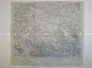
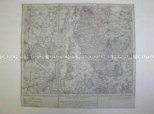
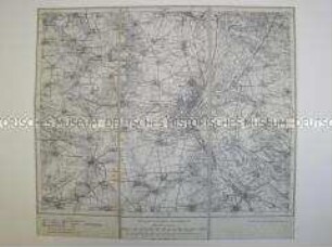
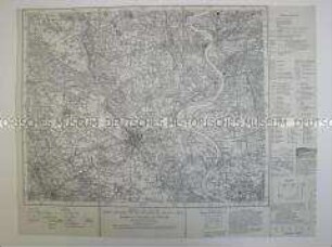
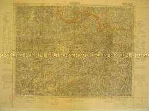
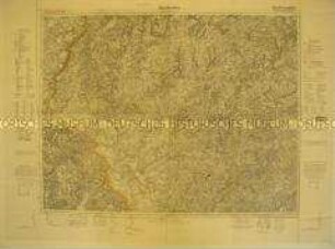
Stettin-Kreckow
- Location
-
Deutsches Historisches Museum, Berlin
- Inventory number
-
Do2 93/459
- Measurements
-
Höhe x Breite: 28 x 21,8 cm
- Material/Technique
-
Druckfarbe (schwarz), Tinte (schwarz), Papier, gedruckt
- Classification
-
Kartografie (Gattung)
- Event
-
Herstellung
- (who)
-
Herausgeber: Reichsamt für Landesaufnahme (Berlin)
- (where)
-
Berlin, Deutschland [historisch: Deutsches Reich]
- (when)
-
1934
- Rights
-
Deutsches Historisches Museum
- Last update
-
24.03.2023, 9:31 AM CET
Data provider
This object is provided by:
Stiftung Deutsches Historisches Museum. If you have any questions about the object, please contact the data provider.
Stiftung Deutsches Historisches Museum. If you have any questions about the object, please contact the data provider.
Object type
- Topographische Karte
Associated
- Herausgeber: Reichsamt für Landesaufnahme (Berlin)
Time of origin
- 1934
Other Objects (12)
Topografische Karte von Oebisfelde und Umgebung

Topografische Karte von Zossen und Umgebung
Topografische Karte von Naumburg und Umgebung
Topografische Karte von Gotha und Umgebung
Topografische Karte der Umgebung von Schwerin
Topografische Karte von Stendal und Umgebung

Topografische Karte von Berlin und Umgebung
Topografische Karte von Magdeburg und Umgebung
Topografische Karte von Krefeld und Umgebung
Topografische Karte des Amtsbezirkes Stockach
Topografische Karte des Raumes Saarbrücken
Topografische Karte des Raumes Saarlautern
Topografische Karte von Oebisfelde und Umgebung
Topografische Karte von Zossen und Umgebung
Topografische Karte von Naumburg und Umgebung
Topografische Karte von Gotha und Umgebung
Topografische Karte der Umgebung von Schwerin
Topografische Karte von Stendal und Umgebung
Topografische Karte von Berlin und Umgebung
Topografische Karte von Magdeburg und Umgebung
Topografische Karte von Krefeld und Umgebung
Topografische Karte des Amtsbezirkes Stockach
Topografische Karte des Raumes Saarbrücken