Grafik | Landkarte
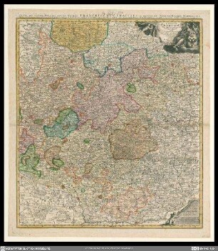
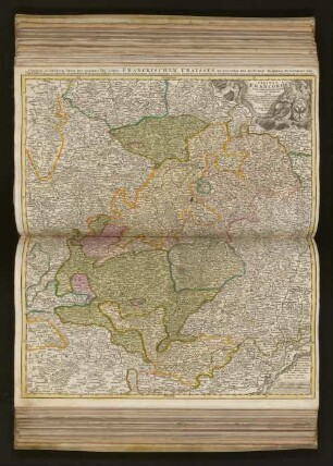
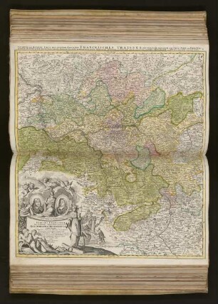
Circuli Franconiae pars occidentalis
Historische kolorierte Karte von Franken mit Titelkartusche unten links
- Weitere Titel
-
Unterer und mindere Theil des gantzen hochlöblichen Fränckischen Craisses: exhibens simul integrum fere electoratum Moguntinum ...
- Sammlung
-
Pictothek
- Identifier
-
36/A 1.19
- Quelle
-
Universitätsbibliothek Würzburg
- Umfang
-
465 mm x 535 mm
- Sprache
-
Latein
Deutsch
- Thema
-
Lothar Franz
Johann Philipp Franz, Würzburg, Bischof
Altkarte
- Bezug (wo)
-
Franken
Rheinfranken
- URN
-
urn:nbn:de:bvb:20-36a119term73322490-4
- Letzte Aktualisierung
-
06.03.2025, 15:26 MEZ
Datenpartner
Dieses Objekt wird bereitgestellt von:
Universitätsbibliothek Würzburg. Bei Fragen zum Objekt wenden Sie sich bitte an den Datenpartner.
Universitätsbibliothek Würzburg. Bei Fragen zum Objekt wenden Sie sich bitte an den Datenpartner.
Objekttyp
- Grafik
- Landkarte
Beteiligte
Entstanden
- Ca. 1720
Ähnliche Objekte (12)

Circuli Franconiae pars occidentalis
Circuli Franconiae pars orientalis et potior novissime delineata

Circuli Franconiae pars orientalis et potior novissime delineate
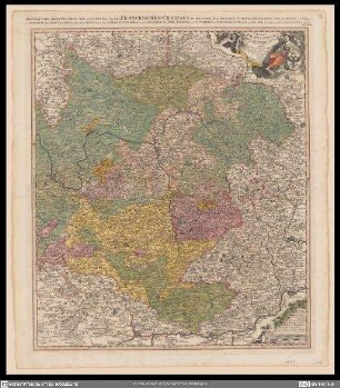
Circuli Franconiae pars orientalis et potior novißime delineata
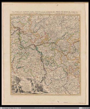
Altera et minor pars totius illustrissimi Franconiae circuli
Circuli Franconiae pars occidentalis, exhibens simul integrum fere Electoratum Moguntinum
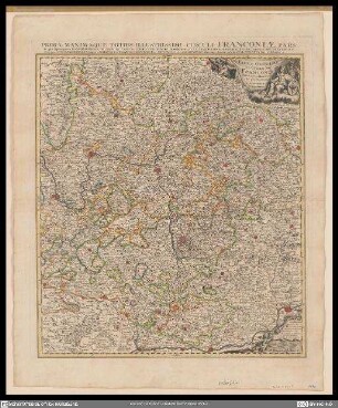
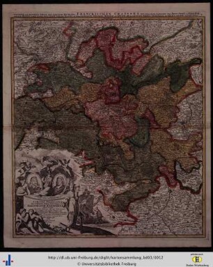
Prima maximaque totius illustrissimi circuli Franconiae para ...
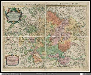
Le cercle de Franconie = Nova circuli Franconiae Tabula
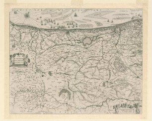
Pars Flandriae Teutonicae occidentalis.
Circuli Franconiæ Pars Orientalis Et Potior
Circuli Franconiæ Pars Occidentalis, exhibens simul integrum fere Electoratum Moguntinum Quem unacum Tractu Totius Moeni Fluminis
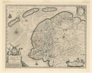
Frisia occidentalis
Circuli Franconiae pars occidentalis
Circuli Franconiae pars orientalis et potior novissime delineata
Circuli Franconiae pars orientalis et potior novissime delineate
Circuli Franconiae pars orientalis et potior novißime delineata
Altera et minor pars totius illustrissimi Franconiae circuli
Circuli Franconiae pars occidentalis, exhibens simul integrum fere Electoratum Moguntinum
Prima maximaque totius illustrissimi circuli Franconiae para ...
Le cercle de Franconie = Nova circuli Franconiae Tabula
Pars Flandriae Teutonicae occidentalis.
Circuli Franconiæ Pars Orientalis Et Potior
Circuli Franconiæ Pars Occidentalis, exhibens simul integrum fere Electoratum Moguntinum Quem unacum Tractu Totius Moeni Fluminis