Schlachtenkarte
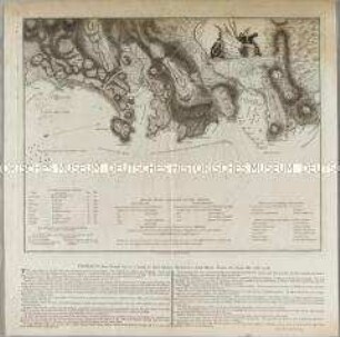
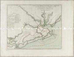
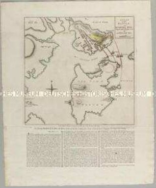
The operations of his Majesty's Squadron in the bay of Honduras / The attack and escalade on the 20th of October 1779 of San Fernando de Omoa. Mit einer Nebenkarte: Plan of the Fort
- Alternative title
-
THE OPERATIONS OF HIS MAJESTY'S SQUADRON IN THE BAY OF HONDURAS, / under the Command of the HON JOHN LUTTRELL / from the 15th. of September to the 24th. of October 1779
- Location
-
Deutsches Historisches Museum, Berlin
- Inventory number
-
Do 2006/777
- Measurements
-
Höhe x Breite: 61,5 x 49,7 cm (Blatt)
Höhe x Breite: 47,5 x 32,3 cm (Karte)
Höhe x Breite: 50 x 34,5 cm (Platte)
- Material/Technique
-
Papier, Kupferstich, koloriert
- Classification
-
Kartografie (Gattung)
- Subject (what)
-
Belize
Honduras
Mittelamerika
- Event
-
Herstellung
- (who)
-
Verleger: Robert Sayer
Verleger: John Bennett
Verlag: Sayer and Bennett
- (where)
-
London, Großbritannien und Nordirland
- (when)
-
01.01.1780
- Rights
-
Deutsches Historisches Museum
- Last update
-
24.03.2023, 9:27 AM CET
Data provider
This object is provided by:
Stiftung Deutsches Historisches Museum. If you have any questions about the object, please contact the data provider.
Stiftung Deutsches Historisches Museum. If you have any questions about the object, please contact the data provider.
Object type
- Schlachtenkarte
Associated
- Verleger: Robert Sayer
- Verleger: John Bennett
- Verlag: Sayer and Bennett
Time of origin
- 01.01.1780
Other Objects (12)
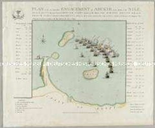
Plan of the ever memorable Engagement of Abukir at the Mouth of the Nile
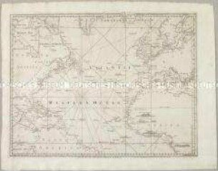
A Chart of the Atlantic Ocean I. Sheet. Mit vier Ansichten
Sketch of Part of the Island of Ste. Lucie
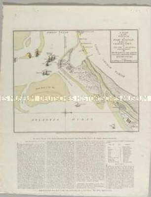
A Plan of the Attack, of Fort Sulivan
A plan of the military operations against Charlestown
A Plan of the Battle, on Bunkers Hill
A plan of the attack, made Novber. 27th. 1781 by a detachment commanded by Brigadier-General Ross, from the Garrison of Gibraltar, on the enemy's works erected before that Fortress

Jamaica. Mit zwei Nebenkarten: The Harbour of Bluefields; The Harbours of Kingston and Port Royal
A Chart of the British Channel
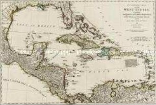
A compleat map of the West Indies

An Index Map to the following Sixteen Sheets, being A Compleat Chart of the West Indies : With Letters in the Margin, to direct the placing the different Sheets in their proper Places

South America with Its Several Divisions, according to the Possessions Of The European Powers
Plan of the ever memorable Engagement of Abukir at the Mouth of the Nile
A Chart of the Atlantic Ocean I. Sheet. Mit vier Ansichten
Sketch of Part of the Island of Ste. Lucie
A Plan of the Attack, of Fort Sulivan
A plan of the military operations against Charlestown
A Plan of the Battle, on Bunkers Hill
A plan of the attack, made Novber. 27th. 1781 by a detachment commanded by Brigadier-General Ross, from the Garrison of Gibraltar, on the enemy's works erected before that Fortress
Jamaica. Mit zwei Nebenkarten: The Harbour of Bluefields; The Harbours of Kingston and Port Royal
A Chart of the British Channel
A compleat map of the West Indies
An Index Map to the following Sixteen Sheets, being A Compleat Chart of the West Indies : With Letters in the Margin, to direct the placing the different Sheets in their proper Places