Karte / Plan
Münster (Münster) Stadtplan aus der Vogelschau (1636) o.M. 115 x 98 Nachdruck E. Alerdinck B Nr. 1268m
- Former reference number
-
B 1268m
- Further information
-
Ort: Münster, Münster
- Context
-
Karten A (Allgemein) >> 1. Topographische Karte, Übersichtskarten >> 1.5. Stadt-/ Ortspläne
- Holding
-
W 051 Karten A (Allgemein)
- Indexentry place
-
Münster, Münster
Münster, Stadtplan, 1636
- Date of creation
-
1636
- Other object pages
- Provenance
-
Sammlungsregistraturbildner
- Delivered via
- Last update
-
05.11.2025, 4:00 PM CET
Data provider
This object is provided by:
Landesarchiv Nordrhein-Westfalen. Abteilung Westfalen. If you have any questions about the object, please contact the data provider.
Landesarchiv Nordrhein-Westfalen. Abteilung Westfalen. If you have any questions about the object, please contact the data provider.
Object type
- Karten / Pläne
Time of origin
- 1636
Other Objects (12)

Münster (Münster) Ludgeritor und St. Ludgerikirche aus der Vogelschau Teilkopie nach einer Radierung von Everhard Alerding 1636 (1636) 1937 o.M. 19 x 22 Lichtpause Herding Kopie: E. Brüggemann Bestellsignatur: Regierung Münster, Personalakten A, B Nr. 45

Münster (Münster) Grüner Grund Ansicht aus der Vogelschau (1928) o.M. 46 x 54 Zeichnung Wohnungsgesellschaft Münsterland
Plan von Münster aus der Vogelschau

Münster (Münster) Staatsarchiv Erweiterungsbau Blatt 6 Ansicht von Südwesten aus der Vogelschau 1935 o.M. 50 x 45 Pause (Staatshochbauamt)

Münster (Münster) Strafanstalt Ansicht aus der Vogelschau des Zustandes von 1857 20.Jh. o.M. Geisberg, Dipl.-Ing. KSM Nr. 1078c

Mecklenbeck (Münster) Bebauungsplan Ansicht aus der Vogelschau (1950) o.M. 46 x 49 Zeichnung Wohnungsgesellschaft Münsterland
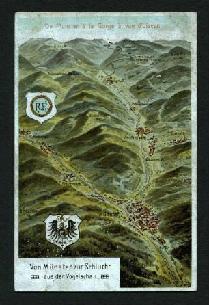
Von Münster zur Schlucht aus der Vogelschau

Amsterdam Stadtplan aus der Vogelschau Amsteldamum nobile Inferioris Germaniae oppidum.. 17.Jh. o.M. 32 x 46 farb. Nachdruck

Münster (Münster) verkleinerter Nachdruck des Alerdinckschen Stadtplans (1600) 1860/1870 o.M. 42 x 51,5 Lithographie v. Chr. Espagne, Münster Landsberg-Velen Nr. 677

Münster (Münster) Vogelschau der Belagerung von 1657 nach 1657 o.M. 59 x 71 Zeichnung (Baron Claris?) Bem.: s. Geisberg 1, S.20 KSM Nr. 753s
Der Ornamentrahmen der Gigas-Karte (Münster 1616) und des Alerdinck-Planes (Münster 1636)

Die Aufstellung zur Wittstocker Schlacht am 24. 9. 1636 aus der Vogelschau
Münster (Münster) Ludgeritor und St. Ludgerikirche aus der Vogelschau Teilkopie nach einer Radierung von Everhard Alerding 1636 (1636) 1937 o.M. 19 x 22 Lichtpause Herding Kopie: E. Brüggemann Bestellsignatur: Regierung Münster, Personalakten A, B Nr. 45
Münster (Münster) Grüner Grund Ansicht aus der Vogelschau (1928) o.M. 46 x 54 Zeichnung Wohnungsgesellschaft Münsterland
Plan von Münster aus der Vogelschau
Münster (Münster) Staatsarchiv Erweiterungsbau Blatt 6 Ansicht von Südwesten aus der Vogelschau 1935 o.M. 50 x 45 Pause (Staatshochbauamt)
Münster (Münster) Strafanstalt Ansicht aus der Vogelschau des Zustandes von 1857 20.Jh. o.M. Geisberg, Dipl.-Ing. KSM Nr. 1078c
Mecklenbeck (Münster) Bebauungsplan Ansicht aus der Vogelschau (1950) o.M. 46 x 49 Zeichnung Wohnungsgesellschaft Münsterland
Von Münster zur Schlucht aus der Vogelschau
Amsterdam Stadtplan aus der Vogelschau Amsteldamum nobile Inferioris Germaniae oppidum.. 17.Jh. o.M. 32 x 46 farb. Nachdruck
Münster (Münster) verkleinerter Nachdruck des Alerdinckschen Stadtplans (1600) 1860/1870 o.M. 42 x 51,5 Lithographie v. Chr. Espagne, Münster Landsberg-Velen Nr. 677
Münster (Münster) Vogelschau der Belagerung von 1657 nach 1657 o.M. 59 x 71 Zeichnung (Baron Claris?) Bem.: s. Geisberg 1, S.20 KSM Nr. 753s
Der Ornamentrahmen der Gigas-Karte (Münster 1616) und des Alerdinck-Planes (Münster 1636)