- Reference number
-
S 07 Kartensammlung, 511
- Former reference number
-
4013
- Dimensions
-
37,5 x 41,5 cm
- Material
-
Transparentpapier
- Notes
-
Lageplan Brinkstraße/Andreasstraße/Josefstraße Vorl.Nr.: 512
- Further information
-
Ort: Warendorf
Ausführung: Tusche, Original
Maßstab: 1 : 625
Druck / Verlag: Stadtbaumeister
- Context
-
Kartensammlung >> Karten und Pläne >> Andere Karten und Pläne
- Holding
-
S 07 Kartensammlung Kartensammlung
- Date of creation
-
1938 Januar 8
- Other object pages
- Provenance
-
Stadt Warendorf
- Delivered via
- Last update
-
05.11.2025, 4:07 PM CET
Data provider
This object is provided by:
Kreis Warendorf. Kreisarchiv, Kreisverwaltung. If you have any questions about the object, please contact the data provider.
Kreis Warendorf. Kreisarchiv, Kreisverwaltung. If you have any questions about the object, please contact the data provider.
Object type
- Karten und Pläne
Time of origin
- 1938 Januar 8
Other Objects (12)

Lageplan zu Straßenverbreiterungen im Bereich Münsterweg/Brinkstraße, Entwurf
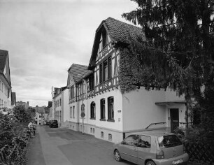
Bestandszeichnung | Warendorf, Brinkstraße 5
Straßenbau- und Unterhaltung: Andreasstraße ( früher Teilstück: Josefstraße; Str. - Schl.: 0440)
Ansicht Wappenlöwe im Hof Andreasstraße
Limburg, Josefstraße 7, Josefstraße 9
Josefstraße
Josefstraße
Josefstraße
Josefstraße
Luftaufnahme der Firma Wiemann & Bispinck mit der Andreasstraße (unten) und der Brinkstraße (senkrecht)
Stadt Nettetal, Stadtteil Breyell. Bebauungsplan Br-103d "Sanierungsgebiet Stadtteilzentrum Breyell - Östlich Josefstraße"
Stadt Nettetal, Stadtteil Breyell. Bebauungsplan Br-103a "Sanierungsgebiet Stadtteilzentrum Breyell - Westlich Josefstraße"
Lageplan zu Straßenverbreiterungen im Bereich Münsterweg/Brinkstraße, Entwurf
Bestandszeichnung | Warendorf, Brinkstraße 5
Straßenbau- und Unterhaltung: Andreasstraße ( früher Teilstück: Josefstraße; Str. - Schl.: 0440)
Ansicht Wappenlöwe im Hof Andreasstraße
Limburg, Josefstraße 7, Josefstraße 9
Josefstraße
Josefstraße
Josefstraße
Josefstraße
Luftaufnahme der Firma Wiemann & Bispinck mit der Andreasstraße (unten) und der Brinkstraße (senkrecht)
Stadt Nettetal, Stadtteil Breyell. Bebauungsplan Br-103d "Sanierungsgebiet Stadtteilzentrum Breyell - Östlich Josefstraße"