- Alternativer Titel
-
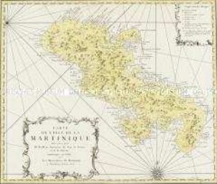
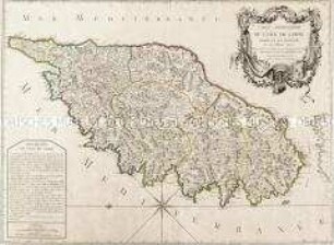
CARTE / DE L'ISLE DE LA / MARTINIQUE / L'une des Antilles de l'Amerique
- Standort
-
Deutsches Historisches Museum, Berlin
- Inventarnummer
-
Do 2006/45
- Maße
-
Höhe x Breite: 45 x 60,5 cm (Blatt)
Höhe x Breite: 31,7 x 34,7 cm (Karte)
Höhe x Breite: 35 x 45,5 cm (Platte)
- Material/Technik
-
Druckfarbe, Papier, Kupferstich, koloriert
- Klassifikation
-
Kartografie (Gattung)
- Bezug (was)
-
Kleine Antillen
Martinique
Westindische Inseln
- Ereignis
-
Herstellung
- (wer)
-
Geograph: ? Longchamps
Stecher, Verleger: Nicolas Chalmandrier
- (wo)
-
Paris, Frankreich
- (wann)
-
1780
- Rechteinformation
-
Deutsches Historisches Museum
- Letzte Aktualisierung
-
24.03.2023, 09:27 MEZ
Datenpartner
Dieses Objekt wird bereitgestellt von:
Stiftung Deutsches Historisches Museum. Bei Fragen zum Objekt wenden Sie sich bitte an den Datenpartner.
Stiftung Deutsches Historisches Museum. Bei Fragen zum Objekt wenden Sie sich bitte an den Datenpartner.
Objekttyp
- Küstenkarte
Beteiligte
- Geograph: ? Longchamps
- Stecher, Verleger: Nicolas Chalmandrier
Entstanden
- 1780
Ähnliche Objekte (12)
Carte de l'Isle de la Martinique
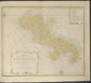
Carte De L'Isle De La Martinique

Carte De L'Isle De La Martinique : Colonie Françoise dans les Isles Antilles
Carte De L'Isle De Sumatra
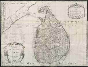
Carte de l'isle de Ceylan
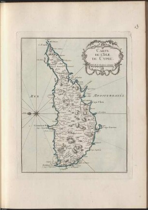
Carte De L'Isle De Cypre

"Carte Topographique de l'Isle Minorque"
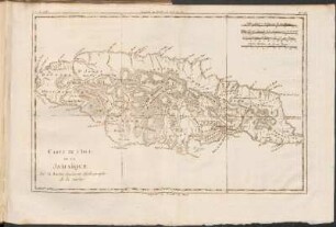
Carte De L'Isle De La Jamaique
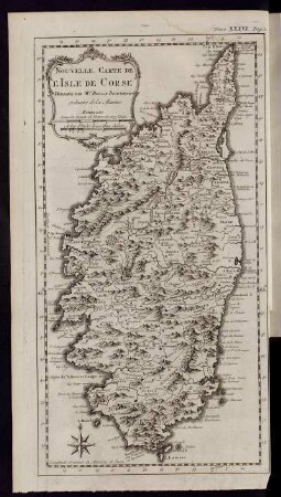
Nouvelle Carte de L´Isle de Corse...
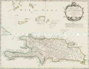
Carte de l'Isle de Saint-Domingue
![Nouvelle Carte de L´Isle de Java[...]](https://iiif.deutsche-digitale-bibliothek.de/image/2/f3f55136-7b7d-49e6-bb25-1eb1167ba04f/full/!306,450/0/default.jpg)
Nouvelle Carte de L´Isle de Java[...]
Carte particuliere de l'Isle de Corse
Carte de l'Isle de la Martinique
Carte De L'Isle De La Martinique
Carte De L'Isle De La Martinique : Colonie Françoise dans les Isles Antilles
Carte De L'Isle De Sumatra
Carte de l'isle de Ceylan
Carte De L'Isle De Cypre
"Carte Topographique de l'Isle Minorque"
Carte De L'Isle De La Jamaique
Nouvelle Carte de L´Isle de Corse...
Carte de l'Isle de Saint-Domingue
Nouvelle Carte de L´Isle de Java[...]